On Towpath / Eagle Marsh Trail, on the right when traveling north.
In colonial times, a portage from the St. Marys River in Fort Wayne to the Wabash River in Huntington enabled a major French and Indian trade route to exist from Quebec on the St. Lawrence River to New Orleans on the Mississippi River. Later, the . . . — — Map (db m225163) HM
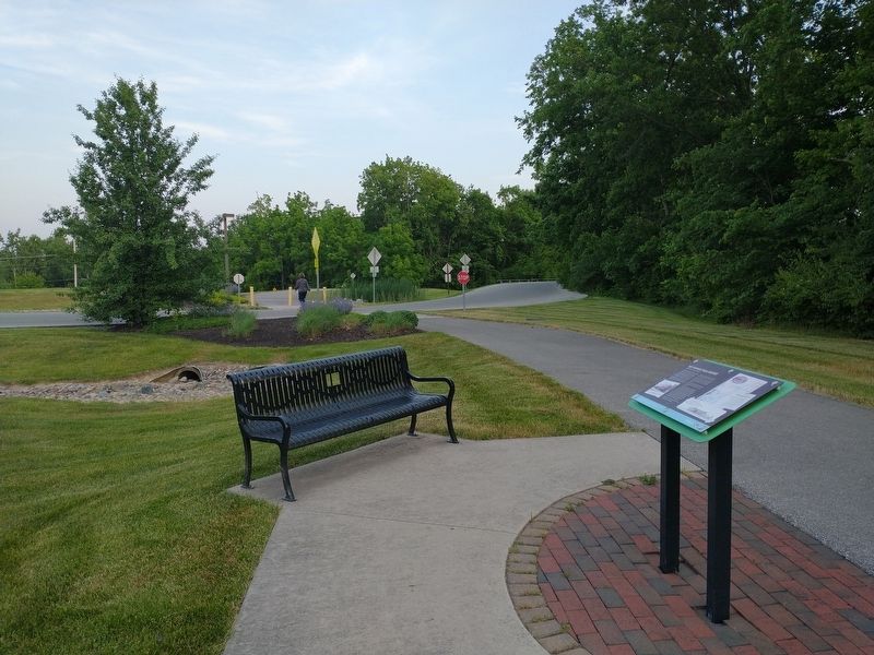
On S. Barr Street, on the left when traveling south.
Past this point flowed the Wabash and
Erie Canal begun at Fort Wayne in 1832
rad dedicated at Fort Wayne July 4, 1843.
m its final phase the canal ran from
Maumee Bay on Lake Erie, through
Fort Wayne and southwestward to
Lafayette and thence . . . — — Map (db m197327) HM
On West Main Street at Growth Avenue, on the right when traveling west on West Main Street.
On February 22, 1832, ground was broken two blocks north for the canal, which would link Lake Erie at Toledo with the Ohio River at Evansville. Jordan Vigus, Canal Commissioner, Charles W. Ewing, Samuel Hanna, Elias Murray participated in the . . . — — Map (db m21045) HM
Anchoring the southern edge of the Headwaters Park “Thumb” until circa 1874, the Wabash & Erie Canal’s importance to transportation to the western part of the United States and to the growth of Fort Wayne was substantial. Headwaters Park . . . — — Map (db m16985) HM
On W. Columbia Street, on the left when traveling west.
For nearly a century, the principal
business street of Fort Wayne, named for
Dana Columbia, hotel and canal boat operator.
Here was the terminal for passengers
and freight arriving and departing via
stagecoach and canal. Ground broken
for . . . — — Map (db m197141) HM
On West Main Street at Rockhill Street, on the left when traveling west on West Main Street.
The Aqueduct
Carrying the Wabash and Erie Canal across the St. Marys River was located just north of the bridge about where the Nickle Plate Railroad crosses the river and was the playground and swimminghole for the West End Boys. Completed . . . — — Map (db m99093) HM
On U.S. 24 at Harper Road, on the right when traveling east on U.S. 24.
Wabash and Erie Canal lock was discovered here June 1991 during excavation for highway construction. It was built 1838–1840 by Henry Lotz and named for lock keeper Joseph Gronauer. The rare, well-preserved timber-frame design lock measured . . . — — Map (db m2498) HM
On Broadway Street, on the right when traveling north.
Past this point flowed
the Wabash and Erie Canal
begun in 1832 and
dedicated July 4. 1843 at Fort Wayne.
In its final phase the canal
extended 459 miles
from Maumee Bay to Toledo,
through New Havens southwestward
to Layette and then to . . . — — Map (db m197133) HM
Near West North Washington Street at North Charles Street, on the right when traveling east.
Marie Harris, Ellen Hostetler and Nancy Farrier, in memory of their parents John David and Ruth Marie Hilderandt Rhine
John and Ruth were both lifetime residents of Carroll County. They loved this part of Indiana and its history. In 1961 they . . . — — Map (db m163347) HM
Near West North Washington Street at North Charles Street, on the right when traveling east.
Before You Is a Kaleidoscope of Flavors and Scents
Early settlers maintained an herb garden for four reasons:
Medicine, flavor for food, to provide scents for soap and for
fresh flowers as well as dried flowers for year-long . . . — — Map (db m163307) HM
Near West North Washington Street just east of Charles Street, on the right when traveling east.
The Bicentennial Garden was created in 2016 as a way for the Carroll
County Wabash & Erie Canal Association to celebrate the two
hundredth anniversary of the founding of the state of Indiana. With
a strong focus on blues and yellows, the . . . — — Map (db m163258) HM
Near West North Washington Street at North Charles Street, on the right when traveling east.
Blacksmith Shop
A Blacksmith is one who works with iron at a furnace or forge where
"black” metal, heated and wrought is formed by beating and hammering
into a desired shape. A "whitesmith” worked with light metals. . . . — — Map (db m163333) HM
Near West North Washington Street at North Charles Street, on the right when traveling east.
Broomcorn The Unique Plant
Broomcorn consists of a tall stately stalk (14-
18 feet) with a brush at the top and no ears.
Broomcorn is a member of the sorghum
family. The only part of the broomcorn that
is used is the brush. The process of . . . — — Map (db m163330) HM
On West North Washington Street at North Charles Street, on the right when traveling east on West North Washington Street.
Building A Home
Felhng 40 or so logs in the forest 15-26 inches in diameter for the sides and ends
the settler had only to add three or four shorter ones for the gables. Each end was
notched to both secure one log with the next and to . . . — — Map (db m163318) HM
Near West North Washington Street just east of Charles Street, on the right when traveling east.
A Canal Boat That Will Not Float?
The Playground Boat is most like the freight boat in the
above illustration. But this one has been changed to make it
fun for young people's imagination. It won't float in the Canal
but it will carry . . . — — Map (db m163259) HM
Near West North Washington Street at North Charles Street, on the right when traveling east.
A Variety of Bridges Solve Many Problems
When the Wabash & Erie Canal cut through an Indiana
wilderness, its 40 feet wide channel of water created
challenges for those who wished to cross from one side to
the other. Pedestrians, . . . — — Map (db m163312) HM
Near West North Washington Street at North Charles Street, on the right when traveling east.
Animals For Towing Canal Boats
During a time before motorized power, canal boats were
towed by horses or mules using heavy ropes of 100 feet or
more. On the Wabash & Erie Canal towpath, one animal or
more hitched in tandem, were led by a . . . — — Map (db m163350) HM
Near West North Washington Street just east of North Charles Street, on the right when traveling east.
Creating a Life in the Wilderness
The Canal Village is comprised of buildings constructed
during the canal era. The water in back of you is the only
remaining accessible and recreational watered segment of
the Wabash & Erie Canal in . . . — — Map (db m163315) HM
On County Road N 700 W north of County Road W 675 N, on the right when traveling north.
90 lots platted in 1836 on both sides of Wabash - Erie Canal lock.
A Post office in 1838 - 39. The lock passed canal boats into the river on the pool of the Great Dam at Pittsburg five miles below. The mules carried the towline across the . . . — — Map (db m35413) HM
Near West North Washington Street at North Charles Street, on the right when traveling east.
Surveying: A Canal could not proceed along the upper Wabash until title to Miami and Potawatomi lands were transferred to the State. At the 1826 Treaty of Paradise
Springs the title was conveyed.
A corps of U. S. engineers was sent to Fort . . . — — Map (db m163309) HM
Named and platted in 1828 by Gen. Samuel Milroy, on 100 acres donated by Wm. Wilson for the seat of Carroll Co., named for Charles Carroll, last surviving signer of the Declaration of Independence. Henry Robinson was the first settler. . . . — — Map (db m1154) HM
On W. North Washington Street, on the right when traveling east.
How Would You Like To Sit On A Log Bench All Day?
The structure before you depicts a one room log school house of 1834. If you
were between the ages of 5 and 21 in rural Indiana in the 1830s you would have
attended a one room school very . . . — — Map (db m163328) HM
On West North Washington Street at North Charles Street, on the right when traveling east on West North Washington Street.
Kitchen Vegetable Garden
As European settlers arrived via the canal and by wagon this region was still
a wilderness in the 1830s. It was essential for their survival to bring seeds and
root cuttings to start their gardens in this forest . . . — — Map (db m163319) HM
Near West North Washington Street just east of Charles Street, on the right when traveling east.
The Wabash & Erie Canal conference
and interpretive center before you
combines historic facades from 1850s
downtown Delphi.
J. H. Stewart Drugs, Callahan Boots and Lathrope
Bakery fill the middle of the block in this 1850s . . . — — Map (db m163275) HM
Near West North Washington Street at North Charles Street, on the right when traveling east.
Logs were part of the railroad trestle at Pittsburgh removed in the 1930s. They became a lakeside cottage on Freeman Lake known as "The Oaks". Logs were donated by the families of: Grantham, Israel and Goyer in 2019 — — Map (db m163338) HM
Near West North Washington Street at North Charles Street, on the right when traveling east.
Lewis T. Jones, a blacksmith, and his
wife Manerva arrived in Carroll County
in 1850, They disembarked from the Wabash
& Erie Canal at Lockport and two years later
settled in Jefferson Township. One of their
eight children who came with them . . . — — Map (db m163260) HM
Near West North Washington Street at North Charles Street, on the right when traveling east.
A New Spiritual Anchor at Canal Park
During the 1830s and 40s the Canal
transformed this region into a new cultural
and economic entity. This new era propelled
a now confident Delphi into the mid and late
19th century. It was now ready . . . — — Map (db m163314) HM
Near West North Washington Street at North Charles Street, on the right when traveling east.
Weaving for the Canal Homestead
If the woodsman's axe and the long rifle were first
in importance to the pioneer, the spinning wheel
and the loom would rank second. In colonial
America many families wove cloth for clothing.
bedding, . . . — — Map (db m163324) HM
On Road N 700 W north of Road W 675 N, on the right when traveling north.
Carrollton on the Wabash
The Mentzer Tavern was built in 1840 at the north end of the Carrollton Towing Path Bridge that crossed the Wabash River. Erected by Ignatius Mentzer and George Friday, it opened as a cooper shop where barrels were made . . . — — Map (db m35438) HM
Near West North Washington Street at North Charles Street, on the right when traveling east.
Carroll County Wabash & Erie Canal Inc.
wishes to convey its appreciation for the
contribution and vision of our friend and
neighbor, Duke Energy Foundation. The
completion of the Mule Barn creates a
major historic site for Canal Park and . . . — — Map (db m163351) HM
Near West North Washington Street just east of Charles Street, on the right when traveling east.
Prairie plants like those featured here grew along the canal's towpath.
Look for the featured plants as you walk the towpath.
Can You Picture It?
The canal landscape has changed over time.
The Canal Width. The canal . . . — — Map (db m163261) HM
Near Bicycle Bridge Road, 0.1 miles west of West Monroe Street (Route 16), on the left when traveling west.
Surrounded By Immense Water Power
Delphi Paper Mill: George Robertson came from Scotland and established a
small paper mill here in 1845. It was powered by Canal water leased by the
State and parallel to the Wabash River. Enoch Rinehart . . . — — Map (db m163361) HM
Near West North Washington Street just east of North Charles Street, on the right when traveling east.
Before Canals
The Wabash River illustrates how wilderness streams
served as highways beginning with the early French
explorers. Before the canal, rivers brought settlers
to new adventures and opportunities cutting through
unknown . . . — — Map (db m163279) HM
On County Road N 700 W north of County Road W 675 N, on the right when traveling north.
Front
The Wabash & Erie Canal meets the Wabash River
Carroll County Wabash & Erie Canal
Delphi, Indiana
See Photo #2:
1844 Timber Truss Bridge
The Wabash and Erie Canal authorities built the first bridge here in . . . — — Map (db m35445) HM
Near West North Washington Street at North Charles Street, on the right when traveling east.
Cooper Shop: An Ancient Craft
The Cooper trade is an old one which came to America in
the 1600s and was a leader in developing and introducing
machines to replace the handmade methods. Before modern
plastics and cardboard materials were . . . — — Map (db m163326) HM
Near West North Washington Street at North Charles Street, on the right when traveling east.
A New Home For The Depot
This restored train depot was
originally used by the Erie Line
in Leiters Ford, Indiana. Built
in the 1880s it symbolized a
new mode of competition for
canal travel. By the 1860s the
Canal fell into decline . . . — — Map (db m163345) HM
Near West North Washington Street at North Charles Street, on the right when traveling east.
Guard Lock Gates Keep The Canal Safe
Before you is a replica of a guard lock constructed of large cut
limestone blocks. Guard locks often had only one set of gates as
opposed to lift locks which always had two sets of lock gates.
The . . . — — Map (db m163339) HM
Near West North Washington Street at North Charles Street, on the right when traveling east.
A Small Construction Camp Shanty
This Canal worker's shanty is constructed of actual canal-era
timbers. Plain and simple, these temporary structures provided
for the workers - offering a place to sleep, argue, joke, gamble,
mediate and . . . — — Map (db m163337) HM
Near West North Washington Street at North Charles Street, on the right when traveling east.
Papermaking developed in China around 100 AD. The process is based on using any plant
fiber or cellulose based material which has been processed (beaten) and mixed with water.
Cotton, hemp and linen are commonly used. The hand dipping process . . . — — Map (db m163316) HM
Near West North Washington Street at North Charles Street, on the right when traveling east.
Along the Monon Tracks
This building originally served as the post
office in Sleeth, a rural community in
Carroll County about nine miles northwest
of Delphi. Sleeth was also known as
McCoy's Station on the Louisville, New
Albany, & . . . — — Map (db m163341) HM
On Road N 700 W north of Road W 675 N, on the left when traveling north.
Front
The Longest Canal in North America
Carroll County Wabash & Erie Canal
Delphi, Indiana
The Wabash & Erie Canal extended 468 miles
from Toledo, Ohio to Evansville, Indiana
On March 2, 1827, a Congressional land grant made . . . — — Map (db m35449) HM
On Bicycle Bridge Road, 0.1 miles west of West Monroe Street (Indiana Route 18), on the right when traveling east.
Great Place to Visit
Enjoy yourself, take your time, bring your camera and
your fishing tackle, watch the clouds reflected on the
Wabash, experience the spirit of a nineteenth century
downtown square, walk a tree lined trail along the . . . — — Map (db m163356) HM
Near West North Washington Street at North Charles Street, on the right when traveling east.
The Wabash & Erie Canal ran 468 miles from Toledo, Ohio to Evansville, Indiana, thus providing
access to New York and the East Coast via the Erie Canal and access to New Orleans and the Gulf of
Mexico via the Ohio and Mississippi . . . — — Map (db m163281) HM
On Bicycle Bridge Road just west of West Monroe Street (Indiana Route 18), on the left when traveling west.
Constructed 1832-1853, canal was
nation's longest, connecting Lake
Erie at Toledo with Ohio River at
Evansville. Key portion in Carroll
County included Deer Creek Lake
Dam, constructed 1838-1840 (1 mile
west). Various canal structures . . . — — Map (db m163353) HM
Constructed 1832-1853, canal was nation's longest, connecting Lake Erie at Toledo with Ohio River at Evansville. Key portion in Carroll County included Deer Creek Lake Dam, constructed 1838-1840 (1 mile west). Various canal structures are still in . . . — — Map (db m7540) HM
Near West North Washington Street just east of North Charles Street, on the right when traveling east.
Carroll County Wabash & Erie Canal, Inc.
Founded in 1974, in Delphi, Indiana, Carroll County Wabash & Erie Canal, Inc. is dedicated to the
preservation of the stretch of the Wabash & Erie Canal located in Delphi, Indiana. Approximately . . . — — Map (db m163280) HM
Near West North Washington Street at North Charles Street, on the right when traveling east.
Great Place to Visit
Enjoy yourself, take your time, bring your camera and
your fishing tackle, watch the clouds reflected on the
Wabash, experience the spirit of a nineteenth century
downtown square, walk a tree lined trail along the . . . — — Map (db m163306) HM
On North 5th Street at North Street, on the left when traveling north on North 5th Street.
Trade and emigration route from Lake Erie to Evansville. Completed through Logansport 1840. Followed Erie Avenue and 5th Street, crossing Eel River by wooden aqueduct. Abandoned about 1876. — — Map (db m35409) HM
On State Road 58 west of State Road 57, on the right when traveling east.
A canal from Terre Haute to Evansville authorized 1846. Maysville Division along White River was over 23 miles long from Newberry through Owl Prairie (now Elnora) to Maysville; part of it paralleled what is now S.R. 57. Contracts were let June . . . — — Map (db m23203) HM
On West Washington Street, on the right when traveling west. Reported permanently removed.
In fall 1846, residents of Covington and Attica skirmished at Lock 35 over lack of water to Covington. Heavy rains eventually resolved the problem. Competition among canal towns over water control was often intense. First boat reached Attica 1846 . . . — — Map (db m3284) HM
On North Portland Arch Road west of County Road W400N, on the left when traveling west.
Shawnee Township
Wabash - Erie Canal
1846 - 1875
The Canal extended from Toledo, Ohio to Evansville, Indiana. Construction on the 376 mile section in Indiana began in 1832 and completed through Fountain County in 1846.
One to six horses in . . . — — Map (db m20364) HM
On U.S. 52, 1 mile east of McGuire Ridge Road, on the left when traveling west.
The Whitewater Canal was one of several projects begun by the Indiana Improvement Act of 1836, which was designed to improve transportation and develop commerce state-wide. Constructed to link southeastern and central Indiana, the canal was . . . — — Map (db m163363) HM
On County Road 550E at County Road 175S, on the left when traveling south on County Road 550E.
( At Top - - Canal Map & Points of Interest )
Here is a section of the Wabash & Erie Canal still visible in Gibson County. Construction of the approx. 460 mi. canal. The longest in North America. Began in 1832 & was completed in 1853. One . . . — — Map (db m47806) HM
On East Park Drive (U.S. 224) at Warren on East Park Drive.
The canal boat "Indiana" docked here on the evening of July 3, 1835, opening the Wabash and Erie canal to traffic from Fort Wayne to Huntington. This was the first section of the canal opened in Indiana. John Burk, for whom the lock was named, was a . . . — — Map (db m7546) HM
On North Jefferson Street at East Washington on North Jefferson Street.
(Side 1)
Canal Landing on Washington Street. The Huntington Landing started 120 feet west on Washington St and continued to the lock at Cherry St. The Wabash & Erie canal was 4 feet deep and 100 feet wide as this point. Other locks . . . — — Map (db m65223) HM
On East Park Drive (U.S. 224) at Warren on East Park Drive.
The first permanent hotel of Huntington was built of stone on this site by General John Tipton in 1835. Standing on the bank of the Wabash and Erie Canal, it was a commercial, political and social center. From 1862 to 1872 it housed one of the first . . . — — Map (db m7547) HM
The Wabash & Erie Canal fulfilled George Washington's dream
of connecting the St. Lawrence Seaway with the Gulf of Mexico
by creating a waterway across the only land barrier that lay
between the St. Marys River in Fort Wayne and this site on
the . . . — — Map (db m161453) HM
First lock west of summit level of Wabash and Erie Canal (connected Lake Erie with Ohio River in 1853). Known as Dickey Lock. Built as Lock 1, 1834-1835, of wood construction; renumbered Lock 4 as result of canal completion to Ohio line (1840). . . . — — Map (db m61119) HM
Near North Blackford Street north of Indianapolis Cultural Trail, on the right when traveling north.
Three Native Americans pilot canoes, circumnavigating three currents. The Wabash and Salamonie rivers made this area a popular center for Native Americans, and in 1831, Chief Richardville moved the Miami capital to the Forks of the Wabash in . . . — — Map (db m238845) HM
Near North Blackford Street north of Indianapolis Cultural Trail, on the right when traveling north.
Parke County has preserved the majority of its covered bridges, many of them dating back to the 1800s, and boasts more than any other county in the nation. Life in the early communities centered around the mills established along Sugar Creek, Big . . . — — Map (db m238843) HM
Authorized by Indiana's 1836 Internal Improvement Act, Central Canal conceived as link in transportation system connecting Wabash and Erie Canal with Ohio River. State's bankruptcy in 1839 prevented completion of Central Canal. Canal has since . . . — — Map (db m95231) HM
On U.S. 36 near Water Street, on the right when traveling west.
The Wabash & Erie was the longest canal built in North America, running from Toledo to Evansville. Montezuma was the main port of Parke County. This portion was abandoned about 1865. — — Map (db m3679) HM
On State Road 57 north of County Road 150N, on the left when traveling north.
The approximately 460 mile canal from Toledo, Ohio, to Evansville, Indiana, was the longest canal built in the United States. Here a section constructed above the natural land surface to prevent flooding and erosion, remains intact. — — Map (db m47811) HM
On Main Street west of South 2nd Street, on the right when traveling west.
Site of depot for canal which passed through town at foot of Main Street. Operations through Petersburg ceased 1860. Constructed 1832-1853, canal was nation's longest, connecting Lake Erie at Toledo with Ohio River at Evansville, through Fort Wayne, . . . — — Map (db m23215) HM
On North 2nd Street south of Columbia Street, on the right when traveling south.
Erected on this site in 1845 by John Purdue (October 31, 1802 - September 12, 1876) The John Purdue Block was a collection of 12 stores, each 22 feet wide, occupying the complete block between Columbia and South streets. At the time, it was the . . . — — Map (db m34826) HM
On Main Street west of North 4th Street, on the left when traveling west.
Between Toledo, Ohio, and Evansville, Indiana.
And which, through Lafayette
paralleled the Wabash River,
crossing Main Street at
the East end of the bridge. — — Map (db m34215) HM
On County Road S 700 W at County Road W 75 S, on the right when traveling north on County Road S 700 W.
Founded in 1834 by Thomas W. Treckett and Thomas Concannon, with later additions in 1836. Granville boasted 153 lots and a public square. In 1850 its name was changed to Weaton, after the Wea Indian town which once stood to the east. Later the name . . . — — Map (db m34827) HM
On NW 4th Street at Vine Street, on the right when traveling north on NW 4th Street.
On March 2, 1827, Congress provided a land grant to encourage Indiana to build the Wabash & Erie Canal. The original plan was to link the navigable water of the Maumee with the Wabash through the seven mile portage at Fort Wayne. Work began five . . . — — Map (db m48241) HM
On NW 5th Street at Vine Street, on the left when traveling north on NW 5th Street.
Completed from Lake Erie to Evansville, 1853. Used till 1865. Passing from 5th St. to 1st Ave., canal widened into basin for docks covering part of this square. — — Map (db m47817) HM
On Chestnut Street at North 2nd Street, on the right when traveling west on Chestnut Street.
This marker denotes the site of one of the canal’s dry dock areas as depicted on 1854 City of Terra Haute map.
Dry dock areas along the canal were used to construct and/or repair canal barges and boats.
Constructed mostly of wood . . . — — Map (db m175901) HM
On Washington Street at Canal Street, on the right when traveling east on Washington Street.
Important Business Center
on the old Wabash Erie canal
this site presented to the
town of Lagro
by Charles Nottingham
to be Presented as a
Historical Monument — — Map (db m68098) HM
On Ohio Route 424 at Independence Road, on the left when traveling west on State Route 424.
This marker is on the trunk line of both the Miami & Erie Canal and the Wabash & Erie Canal. The Miami & Erie Canal, built by Ohio, was begun on July 21, 1825 and completed in 1845. It connected the Ohio River at Cincinnati with Lake Erie at . . . — — Map (db m19438) HM
The Wabash & Erie Canal opened between Toledo and Lafayette, Indiana, May 8, 1843. The Miami Extension Canal was completed to Junction, Ohio, on July 4, 1845, linking the Wabash & Erie Canal with Cincinnati and resulting in changing the canal’s . . . — — Map (db m19574) HM
Near West River Road, 0.5 miles south of Ford Street. Reported permanently removed.
The Side Cut section of the Miami and Erie Canal was completed in 1842 to provide a water connection from the canal down to the river at Maumee. It was two miles long with six limestone locks.
Canal locks acted like elevators to raise and . . . — — Map (db m173273) HM
On Summit Street at Marina Road, on the right when traveling north on Summit Street. Reported missing.
Canal Terminus
The original northernmost lock in a canal system which linked Lake Erie with the Ohio River was located near the foot of LaSalle Street. Indiana’s Wabash & Erie Canal (1843 – 1874) joined Ohio’s Miami & Erie . . . — — Map (db m19439) HM
On Michigan Street at Jackson Street, on the left when traveling south on Michigan Street.
[Marker Front]:
The first canal boat arrived in Toledo from Indiana in 1843 via the Wabash & Erie Canal. The Miami & Erie Canal from Cincinnati was completed in 1845. It joined the W&E Canal near Defiance and they shared the same course . . . — — Map (db m19474) HM
On North 4th Street at Farnsworth Road (Ohio Route 64), on the right when traveling north on North 4th Street.
East Side of Marker:
"John Pray - Founder of Waterville, Ohio"
Born in Rhode Island, John Pray (1783-1872) moved to the Maumee River Valley from New York shortly after serving in the War of 1812 and completing a . . . — — Map (db m30795) HM
On County Road 111 at County Road 163, on the left when traveling west on County Road 111.
On this site, the Miami and Erie Canal, that came north from Cincinnati and the Ohio River, intersected with the Wabash and Erie Canal that came from Fort Wayne and Evansville, Indiana. From this point, which became the town of Junction, the canals . . . — — Map (db m27250) HM