On this 20-acre square stood the first Georgia State Penitentiary. Completed in 1816, the walled compound occupied 2-1/2 acres in the center of the square. The penitentiary housed approximately 245 prisoners in a brick and granite main cell . . . — — Map (db m127158) HM
This 20-acre square as the center of Georgia's state government and location of its capitol building from 1807 until 1868. The "State House," imposing Gothic edifice that dominates the square contained the offices of the governor and the chambers of . . . — — Map (db m103227) HM
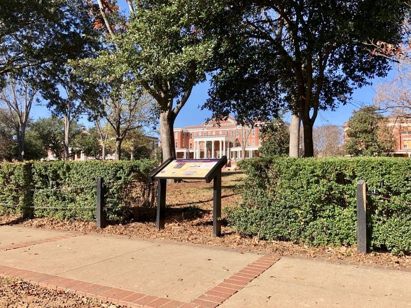
Construction of this Executive Mansion was authorized in 1835 and completed in 1839. The governor's earlier residence, Government House, just to the south on the corner of Clarke and Greene Streets, had fallen into disrepair. The Mansion is . . . — — Map (db m103230) HM
The Western & Atlantic Railroad, running from
Chattanooga to Atlanta, “winds Southeasterly among
the hills, and...penetrates a minor ridge and emerges
from a cut” recalled a Federal officer. The ruggedness of
Allatoona Pass . . . — — Map (db m142914) HM
After the Battle of Shiloh, Tennessee, on April 6 & 7, 1862, the Confederate government selected Macon as a Federal prisoner-of-war camp site. The Macon Fair and Parade Grounds was used to incarcerate 900 prisoners-of-war later that spring. Named . . . — — Map (db m110167) HM
This impressive home was already more than a quarter century old when Union Major General James Harrison Wilson occupied it in 1865. It is a masterpiece of one of Macon's most notable early master-builders, Alexander Elam who designed this house for . . . — — Map (db m103212) HM
During the early 1800s, Georgia grew through a series of treaties with the Creek Indians. After the Louisiana Purchase, President Thomas Jefferson authorized Benjamin Hawkins, Agent for Indian Affairs, to negotiate the 1805 treaty to expand Georgia . . . — — Map (db m103214) HM
The building that houses Macon’s City Hall was constructed in 1837 as headquarters for the Monroe Railroad and Banking Company. In 1845, the Greek Revival temple-style building was converted into Macon’s first “fire-proof” cotton warehouse. It was . . . — — Map (db m99439) HM
Military earthworks, also variously called redoubts, lunettes, entrenchments and breastworks, have been used for centuries as points of lookout and defense. Early in the Civil War, soldiers learned to dig a simple trench behind an earthen parapet . . . — — Map (db m103297) HM
The Lanier House, for decades Macon's premiere hotel, opened on June 12, 1850 at this location. Macon native and poet Sidney Lanier was a member of the inn-keeping family. With additions the hotel stretched 135 feet on Mulberry Street with a cast . . . — — Map (db m130961) HM WM
On Monday, November 28, 1864, while elements of the Federal 20th Corps were destroying sections of the Central Railroad of Georgia at Bartow (aka Speir's Turnout), Major General William T. Sherman was traveling with his army's 17th Corps led by . . . — — Map (db m127163) HM
Built about 1858 in the Georgian Cottage style as a home for J. D. Roberts, the house was designed by noted architect John Trowbridge. Subsequent occupants have included a doctor's office, millinery shop and county museum. In late 1864 the house . . . — — Map (db m103299) HM
As the “Right Wing” of Union Major General William T. Sherman's army marched from Atlanta to Savannah they encountered three major physical barriers: the Ocmulgee, Oconee and Ogeechee Rivers. The Ocmulgee River, about six miles east of Indian . . . — — Map (db m227259) HM
Jackson, seat of Butts County, "was a beautiful little place and evidently occupied by the most prosperous people of that region. Those descriptive words were penned by Union Major Thomas W Osborn, Chief of Artillery of Major General Oliver O. . . . — — Map (db m103197) HM
In 1864, Sylvan Grove Plantation was located just outside Jackson. Its owner, Asa Buttrill, built an impressive 14-room plantation house in the 1830s for his bride, Lucy Manley. The house stood slightly south of the large stone covering a wellspring . . . — — Map (db m103196) HM
This sandstone depot, located on the Civil War-era Western and Atlantic Railroad, was built around 1849. The first train steamed into the new station on May 9, 1850. The depot witnessed a variety of activity throughout the War. On April 12, 1862, . . . — — Map (db m142950) HM
In 1776 a small earthwork called Mud Fort was built at this site, known as Salter's Island, on the east side of Savannah. Unhealthy conditions soon forced the abandonment of Mud Fort. In the early 1800s, United States President Thomas Jefferson . . . — — Map (db m200206) HM
Located near the center of fighting on the second day of the Battle Jonesborough (Jonesboro), the final major battle of the Atlanta Campaign, this cemetery contains the graves of up to 1,000 Confederate soldiers killed while fighting here on . . . — — Map (db m103182) HM
Also known as the “Fletcher House,” this building was originally built in 1845 as a cotton warehouse by Marietta’s first mayor, John H. Glover. Dix Fletcher purchased it in 1855, and after remodeling he opened it as a hotel. Located next . . . — — Map (db m70102) HM
This cemetery was
established on property once
owned by the First Baptist
Church of Marietta.
Following the church's move,
John H. Glover, Marietta's
first mayor, bought this
parcel. His wife, Jane Porter
Glover, permitted this quiet
corner . . . — — Map (db m142953) HM
In early September 1863, a major Federal army entered Georgia for the first time since the outbreak of war. A division of Union Major General William S. Rosecrans' Army of the Cumberland arrived here on September 4th, the first of at least 25,000 . . . — — Map (db m82779) HM
Five DeKalb County courthouses have been
erected here in the center of Decatur since 1823.
The third courthouse structure, between 1847
and 1898, was where DeKalb County's two
anti-secession delegates were selected to attend
Georgia's secession . . . — — Map (db m142543) HM
The Hardman Family Cemetery is one of the oldest landmarks in DeKalb County and among the last vestiges of its early settlement. Both white settlers and enslaved African Americans were buried here. Nearby ran the Shallowford Indian Trail, a trade . . . — — Map (db m142533) HM
This Native American trail crossing at Georgia Highway 56 (itself a 19th century road) was a major route in colonial times. It is named the "Old Savannah Road." Starting in Savannah, it crossed the Ogeechee River, running west and south of it, then . . . — — Map (db m103274) HM
Located on the south side of Broad Street at First Avenue on the banks of the Etowah River in downtown Rome was the Noble Brothers and Company foundry, one of the most iron manufacturing businesses in the South. English-born James Noble, Sr. and his . . . — — Map (db m171078) HM
At 4:30 p.m. on July 20, 1864, 2,700 Confederate soldiers in two brigades of Major General William W Loring's division attacked the Federal '20th Corps, aligned north of Collier Road. "The enemy was in plain view about 700 yards distant occupying . . . — — Map (db m142521) HM
The new commander of the Army of Tennessee, Confederate General John B. Hood, hoped to destroy one of Union General William T. Sherman's three armies as it crossed Peach Tree Creek. Hood's target was Major General George Thomas's Army of the . . . — — Map (db m142534) HM
By late July 1864 three major battles...Peach
Tree Creek, Atlanta and Ezra Church...had
weakened but not defeated the Confederate army
defending Atlanta. By that time Union Major
General William T. Sherman had begun inching
his troops southwest . . . — — Map (db m185975) HM
This area contains some of the few Civil War entrenchments still visible in
Atlanta. Confederate soldiers and African-American slaves dug them during the summer of 1864 as part of an approximate eight-mile fortified line running generally southwest . . . — — Map (db m185982) HM
This earthen fortification is one of the few remaining traces, of a ring of entrenchments that encircled Atlanta during the summer of 1864. The Atlanta City Council voted on May 22, 1863 to ask Confederate engineers to construct fortifications at . . . — — Map (db m142500) HM
After General John Bell Hood took command of the the army defending Atlanta he directed three Confederate failed attacks against Union Major General William T. Sherman's armies. On July 28, 1864, Union Major General Oliver O. Howard's "Army of the . . . — — Map (db m142514) HM
This building, completed in 1869 and renovated in
1981, stands on the site of the first Georgia Railroad
Freight Depot, one of the major railroad structures in
downtown Atlanta during the Civil War. In 1860
Atlanta was Georgia's 4th largest . . . — — Map (db m142540) HM
The present depot at Calhoun, Georgia, originally
called Oothcalooga Station, opened about 1853 and
served passengers and commerce for over a century.
During the 1840's, Irish immigrants had constructed the Western & Atlantic
Railroad tying . . . — — Map (db m142934) HM
The original Western & Atlantic Railroad
bridge over the Oostanaula River at Resaca
dates from 1847. By 1862, two bridges spanned
the river, one for the railroad, the other for a
wagon road to Calhoun six miles south. When
Federal agents led . . . — — Map (db m142921) HM
Leaving McDonough on Thursday, November 17, 1864, the Federal 15th and 17th Corps separated and marched generally southeast using multiple roads. They comprised the “Right Wing” of Major General William T. Sherman's army, led by Major General Oliver . . . — — Map (db m186577) HM
By Wednesday evening, November 16, 1864, after marching that day from the vicinity of Stockbridge, two Federal infantry corps camped at locations around McDonough, the seat of Henry County. The 17th Corps, more than 11,000 strong and commanded by . . . — — Map (db m186572) HM
Confederate President Jefferson Davis, his family and entourage, guarded by the 4th Michigan Cavalry Regiment led by Union Lieutenant Benjamin D. Pritchard, passed through this area on Saturday, May 13, 1865. The area was then a small farming . . . — — Map (db m197994) HM
Hillsboro (originally spelled Hillsborough), named for pioneer settler Isaac Hill, is one of the oldest communities in central Georgia. It is the birthplace of Benjamin
Harvey Hill, a United States and later Confederate States Senator. The . . . — — Map (db m103202) HM
The land where you now stand was originally settled by Revolutionary War hero and statesman General Solomon Wood. To protect against Indian attacks Wood built a fort approximately one mile to the east for protection of his family and neighbors. . . . — — Map (db m103273) HM
When an army crosses a large stream it is vulnerable to attack. Commanders often reduce this hazard by crossing at multiple locations, decreasing congestion and expediting the movement. When possible each crossing occurs within close supporting . . . — — Map (db m103309) HM
On Monday, November 28, 1864, Union Major General William T. Sherman's "Left Wing" commanded by Major General Henry W. Slocum reached the Ogeechee River and Rocky Comfort Creek just west of Louisville. The bridges had been destroyed by portions of . . . — — Map (db m103307) HM
Millen Junction was founded in 1835 as an inn owned by Robert
Hendricks Gray. Originally named Brisonville, it is located
approximately 80 miles from Savannah on the Central Railroad of
Georgia. Thus the town was also called "The 80 Mile Depot" . . . — — Map (db m169088) HM
Big Buckhead Baptist Church was initially established in 1774 but was disrupted by the Revolutionary War. It was reconstituted in 1787. Delegates to the annual convention of Georgia Baptists meeting here in 1831, "Resolved, that as soon as the . . . — — Map (db m103278) HM
Founded in 1808 Clinton was a commercial and educational center and the early seat of Jones County. It was planned with streets in a New England styled gridiron pattern and a central square. In 1820 Clinton was the fourth -largest town in Georgia. . . . — — Map (db m103208) HM
Griswoldville is among the most severe examples of destruction during the March to the Sea. Nothing remains today of the industrial town that once occupied this crossroads. Named for Samuel Griswold (1790-1867), a Connecticut industrialist, . . . — — Map (db m127156) HM
As part of a two-pronged Cavalry raid, on Wednesday, July 27 1864, Union Major General George Stoneman with over 2,100 troopers left the main Federal army then located near Atlanta. Stoneman's orders from Major General William T. Sherman, were to . . . — — Map (db m103205) HM
On Wednesday, May
25, 1864, a fierce battle
was fought between
Union Major General
Joseph Hooker's 20th
Corps and Confederate
Major General Alexander
P. Stewart's division. It
occurred around a church
located at this crossroads,
known as . . . — — Map (db m142916) HM
The cemetery and former sanctuary for New
Hope Church became parts of a battlefield on
Wednesday, May 25, 1864. The Federal 20th
Corps, commanded by Major General Joseph
Hooker, attacked Confederate Major General
Alexander P. Stewart's . . . — — Map (db m142917) HM
After capturing Confederate President Jefferson Davis, his family, staff and escort just north of Irwinville, Georgia near dawn on Wednesday, May 10, 1865, Union Lieutenant Colonel Benjamin D. Pritchard and his 135-man detachment of the 4th Michigan . . . — — Map (db m174535) HM
Pulaski County was created in 1808 and named for Count Casimir Pulaski. He was a Polish born Brigadier General and hero during the American Revolution who was mortally wounded at Savannah, Georgia in 1779. Hawkinsville became the county seat in . . . — — Map (db m174537) HM
Eatonton's “Liberty Pole,” erected after Georgia's secession in 1861, towered 102 feet above the Putnam County Court House grounds holding an oversized flag. Approximately 10,000 Putnam County residents produced six infantry companies for . . . — — Map (db m197750) HM
On January 24, 1861 five days after
Georgia's secession from the Union,
Governor Joseph E. Brown accepted
the surrender of the United States Arsenal at
Augusta from Captain Arnold Elzey. {Picture
included} Brown rejected Elzey's . . . — — Map (db m36086) HM
When the conflict began in April 1861,
leaders on both sides were unprepared
to wage a long war. The Confederacy's
industrial capacity was especially lacking,
and munitions of all types were scarce.
Initial stores of gunpowder . . . — — Map (db m32882) HM
Little Ogeechee Baptist Church is the oldest congregation in Screven County. Organized in 1790, its first two structures were composed of logs. During the Civil War members met in a white clapboard building with a high-pitched roof and an impressive . . . — — Map (db m128287) HM
Jacksonborough became the seat of government for Screven County in 1797. For fifty years it was a thriving community, but by 1847 it had declined and the county seat moved to Sylvania. According to legend an itinerant preacher named Lorenzo Dow . . . — — Map (db m128288) HM
Crawfish Spring was the first name given to the modern community Chickamauga, Georgia. Cherokees lived in this area before their forced removal in 1838, with their Chickamauga District courthouse located near the spring. In the 1840s an early white . . . — — Map (db m12314) HM
Lee & Gordon's Mills became a familiar landmark
for Federal and Confederate soldiers before and during
the Battle of Chickamauga in
September 1863. It is located
along West Chickamauga Creek
on the vital “State Road" between
Chattanooga . . . — — Map (db m142897) HM
As Union Major General William S. Rosecrans' “Army of the Cumberland” entered Georgia in early September 1863, its three infantry corps were dangerously divided over a fifty mile radius. Most endangered was Major General George H. Thomas' 14th . . . — — Map (db m208720) HM
Named for John Brown
Gordon, a Confederate
general, Georgia governor
and U.S. Senator, this
school stands, as a silent
monument to the citizens
whose legacies made
La Fayette a historically rich
community. Originally
named “Chattooga . . . — — Map (db m142951) HM
By nightfall on Sunday, September 20, 1863, more
than two-thirds of the surviving Federal “Army of the
Cumberland” had retreated from the Chickamauga
battlefield through this narrow gap in Missionary
Ridge. One of the Federal army's . . . — — Map (db m142875) HM
By early May 1864, after wintering around
Dalton, Georgia, Confederate General Joseph E.
Johnston's approximately 50,000-man “Army of
Tennessee” was prepared for
battle on Rocky Face Ridge.
One of Johnston's defensive
necessities . . . — — Map (db m142898) HM
New Hope is the oldest Methodist Church still in existence in Washington County. Its early written church records are lost, but oral history relates that New Hope's original structure was built in the late 1700s. It was a one-room building with a . . . — — Map (db m103249) HM
The Brown House was built about 1850 by Nathan Haynes. It was purchased by merchant and planter William Gainer Brown about 1851. During the 1850s portraits of William and Miriah Brown were painted by an itinerant artist for $75 plus room and board. . . . — — Map (db m103238) HM
On Thursday, November 24, 1864, the 14th and 20th Corps of Union Major General William T. Sherman's army began entering Washington County. By November
26th the 28,000 soldiers of the two corps arrived in Sandersville, marching on separate roads . . . — — Map (db m103235) HM
Tennille was founded in 1837 as Franklinville for Sam O. Franklin who gave land for the railroad's right-of-way and the town's creation. Its name was changed in 1842 after a prominent local citizen, Francis Tennille. The following year Tennille also . . . — — Map (db m103239) HM
In early May 1864 the main advance of Union
Major General William T. Sherman's armies
near Dalton was made toward Snake Creek Gap
to the southwest. To draw
attention away from this
effort other Federal troops
attempted to cross Rocky
Face . . . — — Map (db m142900) HM
The opening actions of the Atlanta Campaign occurred around Dalton during early May 1864. Union Major General William T. Sherman's strategy, as two of his three armies approached from the north and northwest, involved a series of demonstrations by . . . — — Map (db m85914) HM
This cemetery was
established during the
Civil War on about
four and one-half acres
of Dalton's original
ten-acre cemetery
donated to the city by
Duff Green on
February 15, 1855.
Today this much larger
cemetery is known as
West Hill. Over . . . — — Map (db m142905) HM
The Confederate "Army of Tennessee" that defended Dalton from November 1863 to May 1864 briefly returned here the following October. It was much depleted in both size and spirit. Their unsuccessful defense of Atlanta ended with its fall on September . . . — — Map (db m86563) HM
Hamilton House is the oldest surviving house
in Dalton, pre-dating the city's founding. The
brick home and spring house were built about
1840 by John Hamilton and his wife Rachel.
John was a civil engineer with the Western and
Atlantic . . . — — Map (db m142903) HM
After their defeat at Missionary Ridge near
Chattanooga in November 1863, the Confederate
“Army of Tennessee” spent the winter of
1863-64 around Dalton, fortifying its defense.
As the weather warmed and dirt roads dried,
heavy . . . — — Map (db m142913) HM
The city of Tunnel Hill was incorporated in 1848.
The next year the state of Georgia began
construction of a depot in anticipation of the
completion of the Western and Atlantic Railroad.
This rail line linked Atlanta to Chattanooga. Yet
before . . . — — Map (db m142946) HM
Secession sentiment was strong on Thursday, December 15, 1860, when a rally in Washington, Georgia raised a new flag over the cupola of the Wilkes County Courthouse located in the center of the town's square. It was a blue banner with a large . . . — — Map (db m200043) HM
Station Number 17 on the Central Railroad of Georgia, Gordon was named for. William W. Gordon, first president of the Central Railroad (and grandfather of Juliette Gordon Low, founder of the Girl Scouts of the USA). It was a strategic point . . . — — Map (db m103218) HM
Ball's Ferry, named for John Ball, a Revolutionary War soldier, operated on the Oconee River from about 1806 until 1939. The quiet ferry crossing became a battleground in November 1864.
Henry C. Wayne, Georgia's Inspector and Adjutant General, . . . — — Map (db m127161) HM