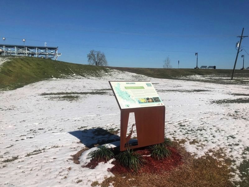
Once a course of the Mississippi River, Bayou Lafourche helped shape Louisiana's coastline by carrying fresh water, sediment and nutrients south to the Gulf of Mexico.Bayou LaFourche is a 106-mile waterway that stretches from Donaldsonville to . . . — — Map (db m111250) HM
The community of Pierre Part in nearly surrounded by water and was inaccessible by land until the Mid-20th century, thus isolated from much of the world. Bayous lace this portion of south Louisiana. The highest land in the area is located along . . . — — Map (db m111809) HM
Bayou Des Glaises' French name likely refers to the kind of loamy, clay soil that settlers found along its banks.Bayous are typically found in flat, low-lying areas and can be slow-moving streams, rivers, marshes or wetlands. They are sometimes . . . — — Map (db m116249) HM
Located on Red River 11 miles upstream from Marksville, Lock & Dam #1 is the first of five locks used to manage transportation from Shreveport to the Mississippi and Atchafalaya Rivers.The Red River is 1,360 miles long and originates in the . . . — — Map (db m116089) HM
Spring Bayou in located within the Spring Bayou Wildlife Management Area, which spans more than 12,000 acres in the low-lying , poorly drained Red River backwater system.Spring Bayou is located within Spring Bayou Wildlife Management Area, . . . — — Map (db m117592) HM
The Three Rivers Confluence is where the Red River, Old River and the Atchafalaya River meet and combine the distributary outflow of the Mississippi River with the Atchafalaya Basin. This complex intersection is the origin of the Atchafalaya River . . . — — Map (db m116158) HM
The Mississippi River's watershed measures 1.85 million square miles, or 41 percent of the U.S., from the crest of the Appalachian Mountains to the crest of the Rocky Mountains.One of the longest rivers in North America, the Mississippi flows . . . — — Map (db m119848) HM
After logjams in the Red and Atchafalaya Rivers were removed, the Mississippi threatened to change course by sending increasing mounts of water to the Atchafalaya via Old River.The connection between the Mississippi, Red and Atchafalaya rivers . . . — — Map (db m116156) HM
The idea to create lakes from the old Perkins Swamp originated in a Chamber of Commerce meeting in 1933, when thousands of men needed work and the relocation of the LSU campus had created momentum for growth of the city southward.The Baton . . . — — Map (db m111270) HM
The Mississippi River - One of the longest rivers in North America - is divided into three sections: Upper, Middle and Lower Mississippi. At certain points on the southernmost section, the river is one mile wide.The Mississippi River is one of . . . — — Map (db m111611) HM
Bayou Fountain was once connected to the Mississippi River when springtime flooding flowed over the natural levees just below downtown Baton Rouge, entering the swamps to the east of the river. Bayou is a word used frequently to describe . . . — — Map (db m111819) HM
Interconnectedness is an integral part of life for Bluebonnet Swamp, which helps to alleviate floods and serve as a filter for sediment and pollutants from the surrounding areas. Bluebonnet Swamp is a combination cypress-tupelo swamp and . . . — — Map (db m111780) HM
Parent soil material along the Comite includes quartz and sand crystals, which differ significantly from the alluvial mud that characterizes the Mississippi River Basin.The Comite River begins in East and West Feliciana parishes and joins the . . . — — Map (db m111589) HM
Avery Island is a 2,200 acre salt dome located in coastal Iberia Parish. The dome's elevation supports habitats not found in the surrounding marshes, swamps and parishes.Avery Island stands out from the surrounding wetlands, rising at its . . . — — Map (db m118435) HM
Because movement here in the late 1800s was easier by water than by land, many daily activities occurred on or along Bayou Teche, including transportation, trade, and mail delivery.Bayou Teche is an ancient channel of the Mississippi River, . . . — — Map (db m116057) HM
A lone chimney rises above the surface of Lake Peigneur as a reminder of the unusual disaster that occurred here in 1980.
More than 140 years ago, Lake Peigneur was described as the most beautiful lake in the South. The present-day lake and . . . — — Map (db m118837) HM
The Gulf Intracoastal Waterway was designed primarily for commercial traffic but is also used by recreational boaters. It allows vessels and goods to travel more than 1,300 miles through safer waters inland from the Gulf of Mexico.Completed in . . . — — Map (db m111259) HM
Upon completion in 1909, The Plaquemine Lock was an engineering marvel thanks to the unique gravity of water flow system that operated the highest fresh water lock in the world.As a distributary of the Mississippi River and an inland route to . . . — — Map (db m111247) HM
Bayou Plaquemine was an important Mississippi River distributary that allowed for boat navigation throughout the Atchafalaya Basin. Travelers left the Mississippi via Bayou Plaquemine, moved west to the Atchafalaya, and then headed further inland . . . — — Map (db m111443) HM
This otherwise flat region, sloping, hill-like formations are visible and represent the Mississippi River escarpment (bluff-like shelf) that divides this area into floodplain and prairie. The Vermilion River flows at the base of this . . . — — Map (db m114785) HM
The Vermilion is a tidal river formed from the bottom up by Vermilion Bay tides and other natural actions that slowly eroded inland from the marshes and cheniers and through the Louisiana prairie. The Vermilion River, also known as Bayou . . . — — Map (db m114505) HM
During early settlement and into the Antebellum Period, the Vermilion was an important secondary waterway for steamboats carrying agricultural products to New Orleans, the east coast and, eventually the world.The Vermilion River, also known as . . . — — Map (db m114649) HM
The upper part of Turnbull's Bend filled in and separated from the Mississippi River, but the lower channel grew. It was named Old River and became the point at which the Red, Old and Atchafalaya Rivers meet.The connection between the . . . — — Map (db m116236) HM
Mississippi River levee breeches in the Morganza area between 1780 and 1890 resulted in 15 major floods affecting Pointe Coupée Parish and all those to the south as far as the Gulf of Mexico.Mississippi River levee breeches in the Morganza area . . . — — Map (db m114158) HM
Originally the main channel of the Mississippi River, today False River is an oxbow lake—a horseshoe-shaped bend the Mississippi left behind when it changed course between 1713 and 1722. Originally the main channel of the Mississippi . . . — — Map (db m110715) HM
Significant prehistoric flooding in this area of the Mississippi River occurred through the breaches in the river's natural levees along the Pointe Coupée coast, which was vulnerable to erosion and overtopping by floodwaters.The “Old . . . — — Map (db m114329) HM
The Atchafalaya Basin is made up of three floodways - The West Atchafalaya Floodway, The Morganza Floodway and the Lower Atchafalaya Basin Floodway - which together are designed to move floodwaters south to the Gulf of Mexico. Prior to the . . . — — Map (db m117196) HM
The Flood Control Act of 1966 authorized the Teche-Vermilion Fresh Water Project, which provided funding for the construction of the system that now transfers water from the Atchafalaya River into Bayou Teche and the Vermilion River. Efforts to . . . — — Map (db m114155) HM
Steamboat travel was frequently affected by low water, immovable rafts of debris, underwater snags and shifting sandbars, including one at the junction of Bayou Courtableau and the Atchafalaya River called Le Petit Diable ("The Little . . . — — Map (db m114305) HM
The width of Bayou Courtableau at the Town of Washington was too narrow to maintain steamboat operations until a turning basin was completed in 1848, allowing steamboats to reverse course and head back downstream. Originally called the . . . — — Map (db m114285) HM
The levee that surround this section of the lower Atchafalaya Floodway are about 15 miles apart and were built in the 1930s. Their construction- and the straightening of the Atchafalaya River in this area- forever changed the Atchafalaya . . . — — Map (db m114176) HM
The Atchafalaya River is North America’s fifth-largest river according to discharge and, together with the Mississippi, accounts for about 90 percent of the freshwater discharge into the Gulf of Mexico.The Atchafalaya River is North America’s . . . — — Map (db m114219) HM
Lake Dauterive is home to one of the oldest documented cypress trees in Louisiana. The approximately 1,000-year-old tree has a circumference of 17 feet and a diameter of 5.4 feet.Though named as two separate lakes, Lake Dauterive and Lake . . . — — Map (db m120925) HM
Annual flooding in the Acthafalaya Basin provides an ideal crawfish habitat. Today, most of Louisiana's crawfish production comes from farms,
but the Basin still leads in the production of wild-caught crawfish.The Atchafalaya Basin is one of . . . — — Map (db m114220) HM
Numerous towns, villages and cities border Bayou Teche and serve as reminders of the waterway's importance as an early transportation corridor.Central to the ecology, economy and spirit of Louisiana is the network of waterways—rivers, . . . — — Map (db m115683) HM
Once connected to the Atchafalaya River, Lake Fausse Pointe was cut off from the river's flow and sediment deposits once the Atchafalaya Basin levees were completed in the 1930s. The lake's shape has remained the same ever since. Though named . . . — — Map (db m115555) HM
In the early 1950s, a five mile levee was built around a naturally occurring open body of water within a cypress-tupelo swamp to hold water throughout the year. This created Lake Martin as it is known today.Located in the heart of Acadian . . . — — Map (db m114538) HM
While deltas east of here are adding land, East Cote Blanche has been retreating due to erosion, subsidence and land loss-issues that are affecting mot of coastal Louisiana.East Cote Blanche Bay is part of a remnant delta complex that was once . . . — — Map (db m117217) HM
According to Chitimacha legend, the imprint of a giant dying snake was left in the soil, and later became the twisty Bayou Teche as it filled in with water.No one knows exactly how the 125-mile Bayou Teche got its name, but according to one . . . — — Map (db m115150) HM
Between Grand Isle and Cameron, Cypremort Point is the only locality near the Gulf of Mexico that can be reached by car.Cypremort is derived from the French words cyprés (cypress) and mort (dead). This point of land at . . . — — Map (db m117214) HM
The diverse land along the Bayou Teche provides critical habitat for numerous native species, including the elusive Louisiana black bear. Bayou Teche is one of the most important bayous in south Louisiana. A former channel of the Mississippi . . . — — Map (db m115184) HM
At its peak, Franklin was the largest steamboat port on Bayou Teche, a major early transportation route that directly influenced early English settlers here.Throughout the 1800s, the 125-mile Bayou Teche was the main transportation route . . . — — Map (db m115262) HM
Because the lower Atchafalaya River is near the Gulf, this area is a popular shipping departure point. But challenges such as combating sedimentation and the close proximity of the three bridges sometimes cause difficulties for river traffic. . . . — — Map (db m111892) HM
The first Atchafalaya levee or wall constructed in 1946 was 13 feet tall on both sides of the river. Subsequent floods resulted in its redesign and expansion to the current 21-foot-wall, built after the flood on 1973. The Atchafalaya River, the . . . — — Map (db m111896) HM
Lake Palourde covers 11,520 acres and is one of a number of large lakes that once existed within the historic Atchafalaya River Basin's 3-million-acre landscape. Lake Palourde is just east of Morgan City. The word palourde is French for . . . — — Map (db m111812) HM
Like redwoods, cypress trees can live a long time and grow to fantastic sizes. Prior to largescale logging, south Louisiana and the Atchafalaya Basin were full of large stands of giant cypress. Bald cypress (Taxodium distichum) trees and swamps . . . — — Map (db m111970) HM
Bald cypress swamps and freshwater marshes once thrived here, but natural and man-made changes to the hydrology eventually allowed salt water to begin encroaching into these delicate coastal bayous. Today they are tidal arms of the Gulf of . . . — — Map (db m115136) HM
The southern part of the Terrebonne Basin faces many challenges, including substantial subsidence, coastal erosion, marsh loss from sediment and saltwater intrusion. The Terrebonne Basin is part of the Lafourche Delta that formed between 800 to . . . — — Map (db m115138) HM
The Port of Delcambre is an important hub for seafood processing and shipping. It is situated within a rich system of coastal wetlands and web of waterways that connect to the Intracoastal Waterway and the Gulf of Mexico. Delcambre is a small . . . — — Map (db m118635) HM
The Port Allen Lock connects the Gulf Intracoastal Waterway and the Gulf of Mexico to the Port of Greater Baton Rouge and other points north along the Mississippi River, shortening the distance for boat traffic about 120 miles. The Intracoastal . . . — — Map (db m111836) HM
At one time, all east-west traffic now traveling U.S. Route 190 crossed the Mississippi River via ferry to this site. The ferry was first used by horses and wagons, later by cars and trucks, and always by pedestrians. The Mississippi River is . . . — — Map (db m111781) HM