The oldest trees in this forest probably began growing around 1865. Before that time, most of the trees along Arlington's Palisades were cut down to establish a clear line of sight for the Civil War fortifications surrounding Washington. The most . . . — — Map (db m186870) HM
Historical Site Defenses of Washington 1861-1865 Fort Corcoran During the Civil War, the Union built a series of forts to defend Washington, D.C. By 1865 there were 33 earthen fortifications in the Arlington Line. Fort Corcoran (1861) was part . . . — — Map (db m5106) HM
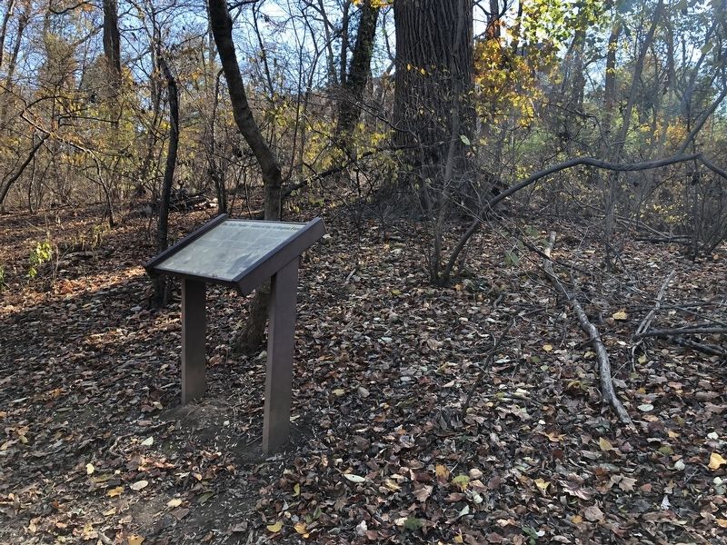
Historical Site Defenses of Washington 1861-1865 Fort Haggerty Here beside the Georgetown-Alexandria road stood Fort Haggerty, a small outwork of Fort Corcoran, constructed in May 1861. With a perimeter of 128 yards and emplacements for 4 guns, . . . — — Map (db m5111) HM
Fort Ethan Allen's star-shaped design enabled soldiers to defend all sides of the fort.
Constructed primarily from earth and wood, Fort Ethan Allen was a bastion-style fort. Bastions are angular structures that jut out from the enclosing . . . — — Map (db m129227) HM WM
Fort Ethan Allen had emplacements for 36 guns.
The forts that formed the Defenses of Washington were placed at half-mile intervals, supplemented with artillery batteries and rifle pits, making a nearly continuous connection between . . . — — Map (db m129236) HM
Fort Ethan Allen was a repeating station, transmitting messages back and forth to other nearby stations.
A series of signal stations linked the forts of the Defenses of Washington. The soldiers who relayed secret messages from station to . . . — — Map (db m129238) HM
Fort Ethan Allen was constructed during the Civil War to provide one of the last lines of defense against possible Confederate attacks aimed at Washington. The fort commanded approaches to Chain Bridge (over the Potomac River) from the south of . . . — — Map (db m2318) HM
Fort Ethan Allen was constructed during the Civil War to provide one of the last lines of defense against possible Confederate attacks aimed at Washington. The fort commanded approaches to Chain Bridge (over the Potomac River) from south of . . . — — Map (db m213839) HM
Historical Site Defenses of Washington 1861-1865 Fort Ethan Allen This embankment was the south face of Fort Ethan Allen, a bastioned earthwork built in September 1861 to command all the approaches to Chain Bridge south of Pimmit Run. The fort . . . — — Map (db m2317) HM
At the peak of the Civil War, as many as 1,000 soldiers were garrisoned at Fort Ethan Allen.
The men who built and defended the fort belonged to volunteer regiments recruited from New York, Massachusetts, and other northern states. While . . . — — Map (db m129240) HM
Fort Ethan Allen Chain Bridge Gulf Branch Sanctuary for Wildlife and not so wildlife herineafter referred to as…
The Sanctuary
…Historical Site of Civil War Fort Ethan Allen which commanded all the approaches south of Pimmit Run to . . . — — Map (db m129245) HM
Company M, 2nd New York Heavy Artillery, August 1865
The war ended in April 1865, but troops continued to occupy the fort temporarily. With their guns cleaned and polished, Company M would be mustered out in Washington, D.C., on September 29. . . . — — Map (db m129232) HM
Much survives of Fort Ethan Allen, a critical part of the Defenses of Washington, D.C., during the Civil War.
Fort Ethan Allen defended the southern approaches to Chain Bridge, one of the three Potomac River crossings that Confederate . . . — — Map (db m129223) HM
Here stood Fort Craig, a lunette in the Arlington Line constructed in August 1861. It had a perimeter of 324 yards and emplacements for 11 guns. — — Map (db m5150) HM
Immediately to the northwest stood Fort Albany, a bastioned earthwork built in May 1861 to command the approach to the Long Bridge by way of the Columbia Turnpike. It had a perimeter of 429 yards and emplacements for 12 guns. Even after Forts . . . — — Map (db m5258) HM
Here the Arlington Line constructed in August, 1861, crossed the Georgetown-Falls Church road. 100 yards to the northwest stood Fort Morton, a lunette with a perimeter of 250 yards and emplacements for 17 guns; 200 yards to the southeast stood Fort . . . — — Map (db m5161) HM
Here stood Battery Garesché, constructed late in 1861 to control the higher ground dominating Fort Reynolds, 200 yards to the southeast. It had a perimeter of 166 yards and emplacements for 8 guns. — — Map (db m5164) HM
Here stood Fort Reynolds, a redoubt constructed in September, 1861, to command the approach to Alexandria by way of the valley of Four Mile Run. It had a perimeter of 360 yards and emplacements for 12 guns. — — Map (db m5155) HM
Fort C.F. Smith was constructed in early 1863 as part of the expansion and strengthening of the capital’s defenses that continued throughout the Civil War. With Forts Strong, Morton and Woodbury, Fort C.F. Smith formed the outer perimeter of the . . . — — Map (db m5099) HM
Fort C.F. Smith was constructed in 1863 on farmland appropriated from William Jewell. The fort was named in honor of Gen. Charles Ferguson Smith, who was instrumental in the Union victory at Fort Donelson, Tennessee in 1862. The fortification was . . . — — Map (db m5101) HM
The ramps in front of you, now covered with grass, led to wooden platforms on which the various cannons were placed. When built in 1863, Fort C.F. Smith had platforms for twenty-two artillery pieces and four siege mortars. However, only sixteen . . . — — Map (db m5102) HM
Fort C.F. Smith was constructed early in 1863 as part of the expansion and strengthening of the capital's defenses that continued throughout the war. With Forts Strong, Morton, and Woodbury, Fort C.F. Smith formed the outer perimeter of . . . — — Map (db m175254) HM
The ramps in front of you, now covered with grass, led to wooden platforms on which the various cannons were placed. When Fort C.F. Smith was built in 1863, it had platforms for twenty-two artillery pieces and four siege mortars. Only the mortars . . . — — Map (db m175255) HM
Fort C.F. Smith was constructed in 1863 on farmland appropriated from William Jewell. The fort was named in honor of Gen. Charles F. Smith, who was instrumental in the Union victory at Fort Donelson, Tennessee, in 1862. Fort Smith extended the . . . — — Map (db m175256) HM
Historical Site Defenses of Washington 1861-1865 Fort C.F. Smith Just to the north are the remains of Fort C.F. Smith. A lunette built early in 1863 to command the high ground north of Spout Run and protect the flank of the Arlington Line. It . . . — — Map (db m5103) HM
Fort Washington, directly across the river, is the oldest existing fortification erected for the defense of the national capital. It was begun in 1814 to replace the first fort which was destroyed during the War of 1812 with Great Britain.
. . . — — Map (db m115808) HM
An area that was part of Washington's perimeter defenses established by the Union Army after the disaster of the Battle of Manassas (First Bull Run) — — Map (db m154463) HM
After Virginia seceded from the Union on April 17, 1861 the District of Columbia was on the dangerous border between the divided states. Because of the city’s importance, the Union Army immediately occupied Northern Virginia, which allowed troops to . . . — — Map (db m47967) HM
Fort Willard Park contains significant earthworks and archaeological remains of a fort built in 1862 by the Union Army. It was one of 63 forts that were built surrounding the District of Columbia during the Civil War as part of the Defenses of . . . — — Map (db m154524) HM
In this vicinity stood Fort Lyon, the major fortification on the left flank of the Federal defenses guarding the city of Washington during the Civil War. Named in honor of Brig. Gen. Nathaniel Lyon, the fort covered an area of nine acres with its . . . — — Map (db m154523) HM
During the Civil War, the U.S. Army constructed a series of forts and artillery batteries around Washington to protect it from Confederate attack. Forts O’Rourke, Weed, Farnsworth, and Lyon stood just to the north, and Fort Willard which still . . . — — Map (db m2330) HM
In the early 19th century these 10 acres were part of Burgundy Plantation. In the 1850s, John A. Fairfax established a 150 acre plantation named Fairview on the property. He improved the existing dwelling originally constructed between 1800 and . . . — — Map (db m131551) HM
Battery between Fort O'Rourke and Fort Farnsworth
In the tree line in front of you are visible remnants of earthworks constructed by United States Army engineers in 1862 as a part of the Defenses of Washington. This earthen parapet . . . — — Map (db m131553) HM
After the Union defeat on 21 July 1861 at the First Battle of Manassas, Lincoln appointed Maj. Gen. George B. McClellan as commander of the demoralized army. A superb organizer, McClellan rebuilt the army and on 20 November 1861 staged a formal . . . — — Map (db m180) HM
Nearby once stood Fort Buffalo. This
earthwork fortification was built by the 21st New York Infantry of the Union army in 1861 and named for the troops’ hometown. During the Civil War, a concentration of forts existed in the Seven Corners section . . . — — Map (db m7399) HM
An extensive line of rifle trenches connected the advance works of Fort Ethan Allen and Fort Marcy and extended to the west bank of the Potomac River. Auxiliary batteries for the field guns, strategically placed, provided additional strength to . . . — — Map (db m3079) HM
Civil War Defenses of Washington 1861-1865 The earthworks and other visible remnants of Fort Marcy and related batteries still remain. Fort Marcy was built in 1862 to protect the Chain Bridge approach to Washington, D.C. — — Map (db m42258) HM
The Virginia approaches to the Chain Bridge were guarded by Fort Marcy on the old Leesburg Turnpike and Fort Ethan Allen on the Military Road. The sites were occupied by Union troops on September 24, 1861, and the earthworks completed in short . . . — — Map (db m70682) HM
Troops stationed here most likely slept in a Sibley Tent patented in 1856 by Federal Army Colonel Henry Hopkins Sibley. the tents were designed to be portable and comfortable and were modeled after the Comanche buffalo-hide houses called tipis . . . — — Map (db m198195) HM
Located near the edge of the Confederacy, Washington, D.C., was under constant threat by Confederate forces. To ward against that threat, Washington was ringed by earthen fortifications.
Skirmishes, guerilla raids, and major battles such as . . . — — Map (db m198197) HM
The Fairfax County Park Authority preserves cultural resources across the county, including many significant Civil War sites. Visit sites where forces clashed, like Ox Hill Battlefield Park, or sites where the Union and Confederate soldiers lived, . . . — — Map (db m198198) HM
At any one time, eight men, led by a sergeant likely from nearby Prospect Hill, were stationed in weekly rotation at Freedom Hill. A soldier's time was divided between patrol duty and maintenance of the earthen and log fortifications that . . . — — Map (db m198196) HM
Two-story building with verandahs stood on 56 acres bought in 1856 by Wm. Taylor (part of 1731 271-acre T. Harrison grant). Tavern faced Alexandria-Leesburg Pike west of Junction with Georgetown Road (Wilson Blvd.). Near here on June 24, 1861, . . . — — Map (db m2837) HM
At the beginning of the war, Union commanders were uncertain of Confederate intentions and military capabilities. On June 22, 1861, civilian balloonist Thaddeus S.C. Lowe inflated his racing balloon Enterprise at the Washington Gas Company . . . — — Map (db m41495) HM
146 entries matched your criteria. Entries 101 through 146 are listed above. ⊲ Previous 100