Markers placed or sponsored by any Chapter of The Colonial Dames of America, founded and headquartered in New York City. The Society was established in 1890 to commemorate the history of the thirteen American colonies and the men and women who founded them.
On Greensboro Avenue (24th Avenue) south of 7th Street, on the right when traveling south.
“He was the suzerain of many territories, and of a numerous people, being equally feared by his vassals and the neighboring nations.” — — Map (db m156405) HM
Training troops in desert warfare in preparation for Operation "Torch." The invasion of German held North Africa. The world's largest military installation, training 60 divisions and more than one million soldiers. — — Map (db m99284) HM
On Brookside Road just north of Old Kings Highway North, on the right when traveling north.
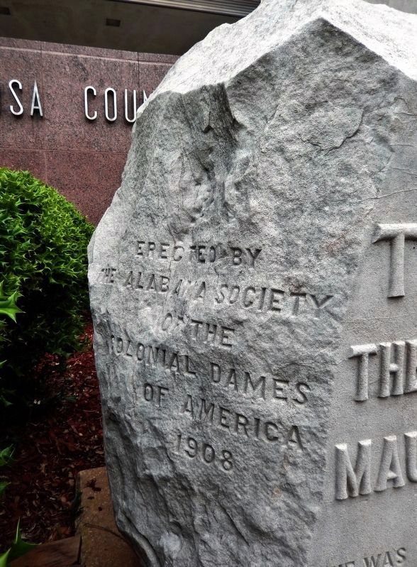
1894.
On Sunday, July 22, 1781,
while engaged in public worship
in the building then occupying this site
Rev. Dr. Moses Mather
and fifty men of this congregation were captured
by British troops and taken to New York
There . . . — — Map (db m230983) HM WM
Near Main Street near Gold Street, on the right when traveling south.
Of Copford Hall. Essex England. Third Governor of Massachusetts. A founder of this commonwealth & its first Governor. A lover of religious liberty. A man trusted and honored.
Near this place he was buried & by this tablet The Connecticut . . . — — Map (db m44068) HM
Near Main Street at Gold Street, on the right when traveling south.
Thomas Hooker
1586 – 1647
A leader of the founders in this commonwealth. A preacher of persuasive power. A statesman who based all civil authority on the free consent of the people.
This tablet is placed near the site of his burial by The . . . — — Map (db m44070) HM
On Woolfolk Street at Smith Street, on the right when traveling east on Woolfolk Street.
In Ocmulgee Fields camped Gen. James Edward Oglethorpe and his men on their way to Coweta Town for the purpose of making the treaty with the Creek Confederacy in 1739 — — Map (db m59596) HM
This Memorial to
Button Gwinnett
Born 1735 Died 1777
Georgia Signer of The Declaration of Independence
President of Georgia
Whose remains, buried in this cemetery, are believed to lie entombed hereunder. Was erected by the . . . — — Map (db m241905) HM
On Spring Street just north of East Court Avenue, on the right when traveling north.
General Lafayette was the official guest of the State of Indiana at Jeffersonville on May 12, 1825 at the house of Former Governor Posey on the West corner of Front and Fort Streets. He was welcomed by the Governor of the the State, by a . . . — — Map (db m221572) HM
On Williamsburg Pike (U.S. 35) at Richmond Avenue, on the right when traveling south on Williamsburg Pike.
A premier suffragist and advocate of women’s rights, Mary B. Thistlethwaite Birdsall was the women’s editor of the Indiana Farmer and in 1855 became editor and proprietor of the “Lily”, a nationally distributed magazine devoted to the . . . — — Map (db m138968) HM
Old State Capitol River Road & North Blvd. Baton Rouge, LouisianaErected 1847-48 Razed by fire 1862.Seat of State Government 1850-1862 1882-1932. — — Map (db m121371) HM
On State Highway 485 at Natchitoches Highway (Route 6), on the right when traveling north on State Highway 485.
Mission founded nearby in 1717 for Adaes Indians by Fra Margil, Franciscan of Zacatecas, who traversed the trail from Panama on foot. French Natchitoches served by missionaries from this easternmost Spanish post. Plaque Dedicated June 1, . . . — — Map (db m86805) HM
On Chartres Street at St. Peters, on the left when traveling north on Chartres Street.
Erected in the latter part of the 18th century, by the Spanish government and used for the assembling of the Cabildo or Governmental Council. Here, in 1803 took place the formal transfer of the Province of Louisiana from Spain to France and from . . . — — Map (db m221537) HM
Planted as a tercentenary commemoration to the manorial homes of the men and women who on this site founded Maryland
March 25, 1634 - March 25, 1934. — — Map (db m204925) HM
Near Water Street at Endecott Street. Reported missing.
One-eighth of a mile distant.
On a part of the 300 acres
granted to Governor John
Endecott, is the pear tree
planted by the Governor in
1632. This tree still bears
fruit. — — Map (db m46192) HM
On Main Street at South Church Street, on the right when traveling east on Main Street.
In Commemoration of
Hernando De Soto
and his men who spent the winter of
1540 — 1541
in North East Mississippi prior to his
discovery of the Mississippi River — — Map (db m102786) HM
On Crawford Street west of Adams Street, on the right when traveling west.
A Greek Revival Building
ca 1830
Oldest Structure in Southern Heritage Complex
Presented By
Mississippi State Society
National Society Colonial Dames
Seventeenth Century — — Map (db m109512) HM
On Grant Street just north of Forbes Avenue, on the right when traveling north.
The day after the fall of Fort Duquesne, General Forbes wrote in a letter to William Pitt:–
"I have used the freedom of giving your name to Fort Duquesne, as I hope it was in some measure the being actuated by your spirits . . . — — Map (db m156215) HM
Near East Penn Square (Pennsylvania Route 611) at Market Street, on the left when traveling north.
“And thou, Philadelphia, the virgin settlement of this province – named before thou wert born – what love, what care, what service and what travail, there have been to bring thee forth and to preserve thee from such as would abuse and defile . . . — — Map (db m107588) HM
On State Highway 21 east of Cedar Grove Road, on the left when traveling east.
Site of crossing on the Sabine River which has
been used for more than 400
years. First by the Indians,
later by the Spaniards, the
French, and other Europeans,
and more than 50,000 Anglo
Americans who came to settle
in Texas prior to . . . — — Map (db m30766) HM
Near Gaskin Road (County Route 709) at Christ Church Road (County Route 646).
Christ Church Lancaster, a singular example of colonial church architecture, was completed circa 1735. This is Robert “King” Carter’s legacy to the community. Its simplicity stands as a witness to the importance of the Christian faith to . . . — — Map (db m24280) HM
On Grosvenor Square at Brook Street on Grosvenor Square.
In this House Lived
John Adams
First American Minister to GREAT BRITAIN, May 1785 to
March 1788 afterwards Second President of the UNITED STATES
From here his Daughter ABIGAIL was married to
COLONEL WILLIAM STEPHENS SMITH, . . . — — Map (db m109295) HM