On W. Allendale Avenue at Delta Court, on the right when traveling east on W. Allendale Avenue.
John H. Van Houten came to this neighborhood in 1792 and later purchased land. His son, Paul J. Van Houten, built this farmhouse about 1869 on family acreage. In 1870 he willed it to his daughter, Margaret Ann, the wife of John L. Yeomans, a . . . — — Map (db m43788) HM
On Closter Dock Road (County Route 502) at Old Dock Road, on the right when traveling west on Closter Dock Road.
Laid out in 1761 by New York over an earlier route when that province claimed jurisdiction over this area. Used by troops during the Revolutionary War, the road led from Closter to Closter Dock on the Hudson where farm produce was shipped to New . . . — — Map (db m7208) HM
On Cedar Street, on the left when traveling north.
Francis Jackson, a freed slave, purchased 7 ¾ acres of woodland here in 1868. Later it would include the black cemetery and “a plain neat little church” built about 1873. The Pastor, Rev. Nicholas Fr. Jackson, lived nearby. The cemetery had 72 . . . — — Map (db m7509) HM
On West Church Street, on the right when traveling west.
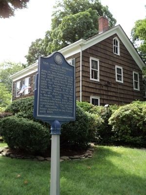
Organized in 1723 as the Schraalenburg Dutch Reformed Church. First church erected in 1728, 150 feet to the east, the present building in 1799. The True Reformed Church was founded here in 1822. The church became Presbyterian in 1913. John Henry . . . — — Map (db m7506) HM
On West Fort Lee Road at River Road, on the left when traveling west on West Fort Lee Road.
In 1642, when this area was part of New Netherland, Johannes Winckelman built near here a ninety-foot long fur trading post and farmhouse – a building which sheltered both settlers and cattle. During the 1643 Indian war it was protected by five . . . — — Map (db m7128) HM
On Durie Avenue at High Street, on the right when traveling south on Durie Avenue.
In 1899 the schoolhouse property was bought from the Bloomer family. The following year a two story, square plan, Renaissance Revival style building was completed with 3 classrooms and an assembly room for grades K-8. In 1907, 4 classrooms were . . . — — Map (db m7912) HM
On Piermont Road (Route 501), on the right when traveling north.
Built about 1786 by Daniel De Clark, the frame kitchen wing was added in the early 1800’s. De Clark operated a large cattle and dairy farm on 170 acres of land. In 1815 son William was the owner and he sold the house to his grandson, Jacob D.C. . . . — — Map (db m7916) HM
Built in 1871 for Hilderbrant Naugle on a suburban lot near the Closter R.R. depot, the frame gable-front-and wing house is notable for the ornamental scroll work of Gothic design. Naugle was a carpenter and clockmaker who made improvements to his . . . — — Map (db m7919) HM
This final resting place of early Closter settlers was established by Barent and Resolvert Nagel on their 1,030-acre tract jointly purchased in 1710. The first burial is believed to be Jan Adriansen, c. 1721. The Nagel brothers divided their land . . . — — Map (db m63546) HM
On Harvard Street, on the left when traveling east.
Built about 1745 on land purchased in 1710 by Barent and Resolvert Nagel. The frame wing was added later. Owned by Barent’s son John by 1754 and later by grandson David Naugle, a militiaman during the Revolutionary War. In about 1784 David built a . . . — — Map (db m7910) HM
On West Street at High Street (County Route 502), on the left when traveling north on West Street.
Established as the “Protestant Reformed Dutch Church of Closter City”, it was the first church erected in the Borough of Closter. Dedicated October 7, 1862, tradition says the church was the headquarters of the “Harrington Rifles”, a group of . . . — — Map (db m7917) HM
On Piermont Road (County Route 501) at High Street, on the right when traveling north on Piermont Road.
In 1795 Walter Parcells, a mason, erected this house of local stone on 34 acres of land on what was then known as Closter New Road. Built in the Federal style, it is 1½ stories high with a gambrel style roof. The frame wing was added later and . . . — — Map (db m7915) HM
On County Road (County Route 501) at Westervelt Place, on the left when traveling north on County Road.
The main wing of this house was built in 1808 by Benjamin P. Westervelt who served in the local militia during the Revolution. The site of this house has been continuously owned by the Westervelt family since early colonial times. General Erskine’s . . . — — Map (db m7207) HM
On County Road (County Route 501), on the right when traveling north.
In 1776, a 180 acre farm here was owned by Loyalist John Ackerson. It extended from the Tenakill to the Hudson, bordered on the north by the road used by British invaders that year. Seized as enemy property, it was bought in 1784 by Militia Captain . . . — — Map (db m7212) HM
On County Road (County Route 501) at Madison Ave, on the right when traveling north on County Road.
In colonial times a crude road led from here to a landing at the Hudson River. According to the reports and maps of Generals Erskine and Wayne this road was used by Cornwallis in attacking Fort Lee on November 20, 1776. On May 10, 1779 it was used . . . — — Map (db m7206) HM
On Park Street, on the right when traveling north.
Built 1872 at “Demarests Station” on the Northern Railroad of New Jersey. Designed by noted architect J. Cleveland Cady, it was considered the “handsomest on the line.” The depot was built of Palisades stone quarried on the . . . — — Map (db m7508) HM
On Washington Avenue, on the left when traveling north.
This example of Dutch Colonial architecture was built between 1780-1790 by Derick Banta, soldier in the American Revolution, after his birthplace here was burned by Tories. Owned by the Quackenbush family from 1792, it was sold to Isaac Dixon in . . . — — Map (db m7507) HM
On Washington Avenue at Madison Avenue, on the left when traveling north on Washington Avenue.
Organized in 1723 as the Schraalenburgh Reformed Dutch Church. First church was built in 1728. In 1801 the present Old North Reformed Church was built, one mile north of first site, and continues as a Reformed congregation. This sanctuary is . . . — — Map (db m7486) HM
On Binghamton Way, on the right when traveling north.
Built for the Hoboken Ferry Company and launched in 1905, it plied the Hudson River between Hoboken and Manhattan (Barclay St.) for 62 years. This double-ender steamboat was designed to carry 986 passengers and a number of vehicles. It was in . . . — — Map (db m9528) HM
On River Drive at Garden Drive, on the left when traveling south on River Drive.
Built c. 1782 by Cornelius J. Van Houten as an addition to the earlier house of his father, John C. Van Houten. Located in “Slotterdam”, the farm stretched between the Passaic and Saddle Rivers and was raided during the Revolutionary . . . — — Map (db m43782) HM
On Kinderkamack Road (County Route 503) at Linwood Avenue, on the right when traveling south on Kinderkamack Road.
An area which in colonial times included part of Emerson, Kinderkamack extended southward into part of River Edge. The name is found recorded as early as 1686. This portion became Etna in the late 19th century and Emerson in 1909. The road which . . . — — Map (db m8634) HM
On Engle Street (County Route 501), on the right when traveling north.
Built in 1860 on Palisade Avenue as “The Englewood Presbyterian Church”, it was the first church established in the city. A new, larger church was built on the original site and the old building was taken down, stone by stone, and re-erected at . . . — — Map (db m7011) HM
On Grand Avenue (County Route 501), on the right when traveling north.
Built about 1808 by Henry DeMott, this sandstone Dutch Colonial house was once attached to the pre-Revolutionary homestead of Albert Lydecker. Material from the older house used in the present frame wing built c. 1810 by Peter Westervelt. The . . . — — Map (db m7133) HM
On Tenafly Road at Pleasant Ave, on the left when traveling north on Tenafly Road.
This former school was originally built in 1818 near the Liberty Pole Tavern. In 1850 it was moved here and rebuilt with the original materials. This part of Englewood was then known as Highwood. The name Englewood School was adopted in 1897. It . . . — — Map (db m7129) HM
On East Palisades Avenue (County Route 505) near Dwight Place, on the left when traveling west.
Organized in 1860 as “The Englewood Presbyterian Church”, the first edifice was erected on this site in the same year. It was the first church building in Englewood and the first Presbyterian congregation in Bergen County. Today’s structure was . . . — — Map (db m6970) HM
On Grand Avenue (County Route 501) at Tracey Place, on the left when traveling north on Grand Avenue.
Built c. 1800 by John G. Benson, a farmer, and from 1794 to 1797, a captain in the militia. This house, an example of post-Revolutionary War Dutch Colonial architecture, was built on property confiscated by New Jersey from the Reverend Garret . . . — — Map (db m7009) HM
On West Palisade Avenue (County Route 505) at Lafayette Avenue, on the left when traveling west on West Palisade Avenue.
This area named for a Liberty Pole erected here before the Revolution. The strategic junction was the scene of many American and British troop movements, including the 1776 retreat of the Continental Army from Fort Lee, and British activity in 1776 . . . — — Map (db m7012) HM
On Engle Street (County Route 501) at Church Street, on the right when traveling north on Engle Street.
Organized in 1865, the congregation first met in homes and in the armory on Van Brunt St. The original church was built in 1866. The present chapel was erected in 1895 as a parish hall. Today’s Gothic church structure, built in 1899, has the rose . . . — — Map (db m7010) HM
On Dunkerhook Road, on the left when traveling north.
This colonial home was built in the 18th century by a Naugle. He was said to have been a paymaster in Layayette’s Light Division. The house served as a landmark on many Revolutionary War maps. It is believed that Lafayette visited here in 1824. . . . — — Map (db m63050) HM
On Fair Lawn Avenue at New Jersey Route 208, on the right when traveling south on Fair Lawn Avenue.
One of the last farmsteads in Fair Lawn stood on this site. The house built by Henry A. Hopper in 1855 was razed for road improvement in 1989. He was a Sheriff and Freeholder of Bergen County and served in the State Legislature. In 1919 William M. . . . — — Map (db m63049) HM
On Franklin Lake Road, on the left when traveling east.
Built about 1793 by James A. Ackerman on land owned by the family since 1727. The farm was then in the locality known as Ponds Neighborhood and within the old Township of Franklin. In 1841 the house was purchased by Adam Boyd who farmed the land . . . — — Map (db m43853) HM
On Franklin Avenue, on the right when traveling west.
Originated as an Indian trail across land the Redmen called “Campgaw”. It was surveyed during the Revolutionary War by Robert Erskine, George Washington’s mapmaker, and connected settlements in the Ramapo and Saddle River Valleys. Franklin Lakes . . . — — Map (db m12395) HM
On Franklin Lake Road west of Wyandotte Dr., on the left when traveling west.
Known to the Indians as “Michanagrape,” these waters were formed by the melting glacier some 10,000 years ago. In 1700 the lake was named Christian Pool when it was included in a land grant to Michael Hawden. Later called Great Pond, . . . — — Map (db m52941) HM
On Pulis Avenue at Mabel Ann Avenue, on the left when traveling north on Pulis Avenue.
Organized in 1855 as the Methodist Episcopal Church of Campgaw, the first church was built on Circle Ave, in 1856, but was destroyed by fire in 1919. William V. Pulis donated a lot ‘in a most commanding part of the village.’ and the stone church . . . — — Map (db m27048) HM
On Spotswood Road, 0.1 miles west of Delmar Avenue, on the left when traveling west.
Located on the boundary between two Hopper farms, the cemetery was shared by both families and their relatives for almost one hundred years. The earliest known burial was in 1804. — — Map (db m36966) HM
On Hillman Avenue at Ackerman Avenue, on the right when traveling south on Hillman Avenue.
North wing built 1780 by Hendrick H. Hopper in area then called “Small Lots”. Center section erected by son John, in early 1800’s. The farmhouse was sold to the Hillmann family in 1895, ending four generations and 115 years of continuous Hopper . . . — — Map (db m36967) HM
On Prospect Street at Locust Road, on the left when traveling north on Prospect Street.
Located in “Small Lots”, Henry G. Hopper began the construction of this house about 1788 on a 120 acre farm. Son Garret erected the Dutch-style main house in the early 1800’s. The north frame wing was built in the 1850’s for his son Thomas who . . . — — Map (db m36971) HM
On Rock Road at Ackerman Avenue, on the right when traveling west on Rock Road.
This former one room Schoolhouse was the original Ridgewood Grove School Number 44. Built in 1846 it was used until 1894 by Ridgewood Township. In 1894 the proposed closing of this school resulted in the incorporation of the Borough of Glen Rock. It . . . — — Map (db m36969) HM
On Washington Place at Court St., on the left when traveling east on Washington Place.
Erected about 1831 by the Washington Banking Company. The first bank in present Bergen County, it opened in the nearby Mansion House in 1825-26. After the bank failed in 1833, it housed the offices of prominent lawyers and judges. Later the home of . . . — — Map (db m6817) HM
On Court Street at Moore Street, on the right when traveling east on Court Street.
[Bergen County Court House Side]:
James Riely Gordon (1863–1937), noted architect of public buildings used the Beaux Arts style to reflect the power and dignity of American institutions of government and justice. Ground was broken . . . — — Map (db m6869) HM
On Court St. at Church St., on the left when traveling east on Court St..
Earliest records of this pioneer Dutch church, dated 1686, mark it as the second oldest in New Jersey. Old stones embedded in the east wall show the initials of founding families and first settlers.
The old burying ground contains the grave of . . . — — Map (db m6820) HM
Built in 1818, by John I. Hopper in old “Polifly”, this Federal style house stands on land purchased in 1694 by his great-grandfather Hendrick. The farm remained in the Hopper family for seven generations. Slaves lived in the kitchen . . . — — Map (db m6864) HM
On Hudson Street, on the right when traveling north.
Soldiers of the Revolution are buried in this cemetery of the True Reformed Dutch Church Deeded by Robert Campbell March 8, 1833 Erected by the Bergen County Historical Society 1937 — — Map (db m7229) HM
On Atlantic Street, on the right when traveling west.
First African American Church in Hackensack. Organized in 1864 as “Olive Branch Colored Mission Number Three of Hackensack.” First church was an old lime shed moved here in 1867. In 1917 current name was adopted in honor of the first Bishop of the . . . — — Map (db m7223) HM
On Lafayette Road, on the left when traveling north.
The house and the kitchen wing were built about 1801 by Abraham D. Blauvelt who farmed the land. It came into possession of his niece, Catherine Blauvelt, wife of Richard J. Blauvelt, and remained in the family until 1891. In 1904 Herman . . . — — Map (db m7921) HM
On Lafayette Road at Hackensack Avenue, on the right when traveling north on Lafayette Road.
Homestead of Isaac Blanch from about 1758 and site of his grist mill, both inherited in 1767 from his father, Richard Blanch, a native of England. Isaac was a Patriot official and member of the State Assembly during the Revolutionary War. He was . . . — — Map (db m7920) HM
In use for nearly two hundred years, largely by the Blauvelt family, the earliest known burial was in 1722. The cemetery contains the graves of members of other early Bergen County families, veterans of the American Revolution and slaves. Some of . . . — — Map (db m7877) HM
On Harriot Avenue at Bogerts Mill Road, on the left when traveling east on Harriot Avenue.
Abraham Myers established a grist mill at this site on the Hackensack River prior to 1765. Inherited by son John who operated the mill until his death in 1829, it was continued by his son-in-law James Bogert. Long known as “Bogert’s Mill”, it . . . — — Map (db m7940) HM
On Harriot Avenue at Lafayette Road, on the left when traveling east on Harriot Avenue.
Frederick Wortendyke owned this land in 1723. It was once part of a large grant called the Tappan Patent. His son Jacob, who owned the homestead during the Revolutionary War, was taken captive in one of many British raids made in the area. Later . . . — — Map (db m8683) HM
On Schraalenburg Road, on the left when traveling south.
An early 19th century example of Dutch Colonial architecture erected by Garret J. Durie on part of the estate of his father, John Durie. Garret J. Durie was a farmer whose 120 acre tract stretched eastward one mile to the Tenakill Brook. Located in . . . — — Map (db m7935) HM
On Schraalenburgh Road at Massachusetts Avenue, on the right when traveling south on Schraalenburgh Road.
Beginning as an Indian trail, it became a Colonial road through the village of Schraalenburgh, linking Teaneck with Tappan, N.Y. Surveyed and improved in 1775, it appeared on maps made during the Revolutionary War by Americans, French and British. . . . — — Map (db m7879) HM
On Massachusetts Avenue at Roxbury Road, on the right when traveling west on Massachusetts Avenue.
Built 1818 by Garret H. Zabriskie on land his father Henry purchased in the 18th century. Garret's farm consisted of 219 acres. It began on Schraalenburg Road and ran westward for one mile. Later owned by son John G. Zabriskie who sold it to his . . . — — Map (db m7922) HM
On Pascack Road at Wierimus Lane, on the left when traveling north on Pascack Road.
Built about 1796 by John H. Banta on a tract bought in 1755 where he had an earlier house. Banta was a carpenter and farmer who enlarged his homestead to 395 acres. At the time of the French and Indian War he served as a captain in the Bergen . . . — — Map (db m22251) HM
On Ell Road near Jan Court, on the left when traveling east.
Located in “Pascack” on land inherited from his father, Garret Durie built this house about 1767. During the Revolutionary War, the house was plundered by both American and British armies. Durie was a farmer and a blacksmith as well as . . . — — Map (db m43787) HM
On Hillsdale Avenue, on the right when traveling east.
About 1756 Peter Westervelt built a small house, enlarged in 1785, on land of his wife Catlyntje Haring. During the Revolutionary War the farm was raided. Later it was owned by son Henry and his son Aaron, a Freeholder and State Assemblyman. . . . — — Map (db m43786) HM
On Lakeview Drive, on the right when traveling west.
Located in old English Neighborhood on land purchased by Dirck Vreeland before the Revolution, the homestead stretched between the Hudson River and Overpeck Creek. The stone wing of this house was built about 1786 and later was remodeled. Son . . . — — Map (db m7131) HM
On Riverside Ave at Fern Ave, on the right when traveling north on Riverside Ave.
The first schoolhouse was built on this site in 1804. Located in what then was called New Barbadoes Neck, the land was donated by Jacob Van Winkle “for the sole purpose of erecting a School House”. In 1849 it was replaced by a two-story building. . . . — — Map (db m6733) HM
On Ramapo Valley Road (U.S. 202), on the right when traveling south.
Located in “Ramapough” near the site of an Indian trading post, this Dutch Colonial house was built about 1750 by Jacobus Laroe. The small wing was added at a later date, the porch about 1840. Some later owners were Jacobus Bogert who . . . — — Map (db m43801) HM
On Old Station Lane at Ramapo Avenue, on the left when traveling east on Old Station Lane.
Built in 1871, the building served until 1902 and was moved from original site when four tracks were laid and grade crossing closed. Bought by A.J. Winter, it was used as a storehouse for fifty years. To preserve the landmark, The Mahwah Historical . . . — — Map (db m43796) HM
On Ramapo Valley Road (U.S. 202) 0.3 miles north of Bear Swamp Road, on the right when traveling south.
First an Indian path, then an important road during the period of colonial settlement. Washington’s army used this road in July 1777, and at many other times during the revolution. This is one of America’s oldest roads. It was an important link . . . — — Map (db m43778) HM
On Goffle Road, on the right when traveling north on Goffle Road.
This old Dutch sandstone
house, shown on Erskine's
1780 map, was built by
Cornelius Lozier before
the Revolution. South of
it was the grist mill,
known as Lozier's Mill.
Later, when the property
passed to Garret Lydecker,
the area was . . . — — Map (db m51171) HM
On Chestnut Ridge Road, on the left when traveling north on Chestnut Ridge Road.
Built in the 1790’s by Jacob Eckerson near an earlier home where he had settled about 1770. The farmstead then consisted of 119 acres. The house was inherited by his son John J. Eckerson in 1810 who owned it until 1870 when purchased by James . . . — — Map (db m29882) HM
On West Grand Avenue at Railroad Avenue, on the left when traveling east on West Grand Avenue.
An example of the "Gravel Wall and Octagon Mode of Building" popularized by Orso S. Fowler in the 1850's, noted for its use of building material, plan of rooms and adaptability to light and ventilation. Built 1855-60 by John Blauvelt, Jr., an . . . — — Map (db m33647) HM
On River Edge Avenue (County Route 70), on the right when traveling west.
Built about 1840 in the Greek Revival Style of architecture by John C. Demarest. He was a farmer with an interest in river trade when schooners plied the Hackensack River. The house was purchased in 1864 by George Bloomer, a dealer in coal and . . . — — Map (db m7226) HM
The earliest part of this house, one of the oldest in the county, was built on land purchased in 1677 by David Demarest, Sr., founder of the Huguenot Colony in Bergen County. His grandson Jacobus, born 1681, lived here until his death in 1763. . . . — — Map (db m7220) HM
On Old New Bridge Road at Roosevelt Avenue, on the right when traveling east on Old New Bridge Road.
Built in 1739-40 by Peter P. Demarest. In 1766 he received a license from the local court to “keep a Tavern or Public House” here. The old inn witnessed many stirring events during the American Revolution.
In November 1776, Washington led his . . . — — Map (db m7225) HM
On River Road at Patrolman Ray Woods Lane, on the left when traveling north on River Road.
Site of the French Church and Cemetery of Kinkachemeck, New Jersey. Deeded to David Desmarest June 8, 1677 by Tapan Indians.
Erected by the Bergen County Historical Society 1935. — — Map (db m7234) HM
On Tappan Road at Broadway, on the right when traveling north on Tappan Road.
Built about 1890 in the High Victorian style of architecture when Norwood was part of old Harrington Township. Blauvelt was an undertaker and erected the building as a residence. In 1922 it became the home of Charles S. Gray who served as Mayor of . . . — — Map (db m8682) HM
On Franklin Avenue at Ramapo Valley Road (U.S. 202), on the right when traveling west on Franklin Avenue.
This Dutch Colonial house was built by Hendrick Van Allen before the Revolutionary War on a farm that consisted of over two-hundred acres. General George Washington used this house as his Headquarters on July 14-15, 1777, when he moved his troops . . . — — Map (db m12336) HM
On Dogwood Drive at Ramapo Valley Road (U.S. 202), on the right when traveling west on Dogwood Drive.
Built about 1789 by Jacobus S. Demarest, the frame wing was added later. Demarest served in the Revolutionary War. Over the years his farm grew to 180 acres. In 1835 his son, Daniel J. Demarest, inherited the farmhouse. In 1863 it passed to his . . . — — Map (db m12401) HM
On Westwood Avenue, on the right when traveling south.
Built about 1864 by Claudius with a kitchen wing, it has elements of Greek Revival and Italianate styles of architecture. He purchased a half interest in the farm and mill works owned by his brother Nicholas. Their firm was known as the Collignon . . . — — Map (db m7930) HM
This house was built about 1709 by Cosyn Haring, one of the sixteen Tappan patentees. It is an example of early Dutch Colonial architecture found in the Hackensack valley. This house has never been deeded to anyone, having been in the same family . . . — — Map (db m52943) HM
On Old Tappan Road at Leoson Pkwy, on the right when traveling west on Old Tappan Road.
Built about 1836 by John Haring, Jr., the house is an example of Greek Revival architecture and retains many original features. Haring’s homestead was on 14½ acres but he also owned adjacent lands which he farmed for decades. Daughter Sarah . . . — — Map (db m7932) HM
On Old Tappan Road at Orangeburgh Road, on the right when traveling west on Old Tappan Road.
Erected about 1810 on the site of an earlier house, the brick and sandstone center section is Dutch Colonial style, with wings added c. 1820-1875. It was the homestead of Teunis Haring, a farmer and Chosen Freeholder of Bergen County. Later owned . . . — — Map (db m43842) HM
On Westwood Avenue, on the right when traveling south.
As early as 1704 this area of the Tappan Patent was called the “steen” or “Stone” point, later Stony Point. It was commonly known by that name for over 150 years. A grist mill was built here in 1725, fifty years before the American Revolution. For . . . — — Map (db m7931) HM
On Brookside Avenue at Kindermack Road, on the left when traveling east on Brookside Avenue.
Built about 1825 by Richard Teunis Cooper, a chairmaker, on land owned by the family since 1716. This Federal style house, once on a 22 acre farm, is in the Oradell locality formerly known as New Milford. Son John R. Cooper, a master blacksmith, . . . — — Map (db m7550) HM
On Kinderkamack Road (County Route 503) at Soldier Hill Road, on the left when traveling north on Kinderkamack Road.
The Continental Army advanced to Englewood on August 23, 1780, with some units foraging as far south as Jersey City. The main body of the army moved west of the Hackensack River on September 4th, camping in two lines west of Kinderkamack Road, one . . . — — Map (db m7552) HM
On Kinderkamack Road (County Route 503), on the left when traveling north.
Small wing built by Abraham J. Van Buskirk about 1820 from earlier c. 1789 house. Federal style main wing built c. 1832-34 for Fanning T. Oakley and wife Hetty Van Buskirk. Later owned by son Abraham V. B. Oakley and wife Eliza Voorhis; their . . . — — Map (db m7551) HM
On Dunkerhook Road, on the right when traveling west.
This old colonial lane was named Dunkerhook meaning Dark Corner by the Dutch who settled the area in the early 18th century. Along this road, the Zabriskie family, who bought the land from the Indians in 1702, built houses and a school for the use . . . — — Map (db m8314) HM
On Paramus Road, on the left when traveling north.
Built c. 1826, this house combines the Federal style of architecture with that of the earlier Dutch Colonial. Erected by Jacob J. Zabriskie on the site of an earlier home, the farmhouse remained in the Zabriskie family for 132 years. — — Map (db m8334) HM
On Spring Valley Road at Viola Way, on the left when traveling south on Spring Valley Road.
The historic cemetery directly in the rear of the Behnke farm contains the graves of descendants of early settlers in this area including a least two local farmer-militiamen of the American Revolution, Jacobus Brouwer and Henry Banta, as well as . . . — — Map (db m8345) HM
On W. Midland Avenue, on the left when traveling east.
This sturdy old frame building is a landmark in the community, having served Paramus residents in various ways. Originally School No. 26 of Midland Township, it was converted into a borough hall when Paramus Borough was formed in 1922. In 1959 it . . . — — Map (db m8333) HM
On North Farview Avenue at Sweetbriar Avenue, on the right when traveling south on North Farview Avenue.
The Indian name given this community by its Dutch settlers means “fields of wild turkeys”. A fertile farming area, Paramus was familiar ground to both the British and American armies during the Revolution. Formerly a part of Midland . . . — — Map (db m16968) HM
On Paramus Road, on the left when traveling north.
Built by Jacobus Rutan, a farmer, on 32 acres of land about 1794-95. In 1800 his widow and son sold the house to Cornelius H. Zabriskie, a blacksmith and farmer. In 1856 he deeded the house to his grandson, Cornelius Zabriskie Terhune, also a . . . — — Map (db m8336) HM
On Spring Valley Road, on the left when traveling south.
In Revolutionary days this area of Paramus was known by the unusual name of Sluckup. The name was derived from a local legend. A Dutch farmer hung his shirt on a nearby fence while working in his field. When he saw the shirt disappear into the . . . — — Map (db m8313) HM
On Paramus Road at Iris Court, on the left when traveling north on Paramus Road.
Built on the farm of his grandfather, Christian J. Zabriskie, who bought the property in 1775. Tradition places a house on the site in 1792 but the present stone dwelling was probably built in the early 1800’s and occupied by Stephen T. Zabriskie. . . . — — Map (db m8335) HM
On Paramus Road at Century Road, on the right when traveling north on Paramus Road.
Pre-Revolutionary homestead of David Terhune (1713-1792), weaver and patriot official who served as Freeholder from New Barbadoes Township 1779 to 1785; and of his son, John D. Terhune, a Freeholder in 1787. Farm raided by British four times during . . . — — Map (db m18995) HM
On Paramus Road, on the left when traveling north.
Built about 1795 by Henry S. Terhune in “Old Paramus” on land owned by the Terhune family since 1707. the two-hundred acre farm extended for over a mile between the Saddle River and Sprout Brook. In 1853 the house was inherited by Terhune’s . . . — — Map (db m8332) HM
On Forest Avenue, on the left when traveling north.
Howland Avenue divided the farms of miller Cornelius Van Saun to the south and Christian Dederer to the north. Hendrick Banta lived west of Mill Creek. The Continental Army moved into Bergen County in August 1780 to forage for food and to await the . . . — — Map (db m8412) HM
On Pascack Road at Lakeview Avenue, on the left when traveling north on Pascack Road.
Built about 1800 by John Ackerson and son Garret, this stone house stands on land purchased in 1759. The property was developed during a century of family ownership. A general store was built opposite the house site in 1777 and successive . . . — — Map (db m29883) HM
On Fremont Avenue, on the left when traveling west.
The Glen is a deep ravine cut through sandstone rock by Bear Brook. Glen Road to the
south follows an old Indian path up the hill called “Spook Bergh” (Ghost Hill) by the
early Dutch. Tradition says that a cave in the sandstone rock, . . . — — Map (db m29891) HM
This building, dedicated December 8, 1873 by Rev. Henry Ward Beecher, was built through the efforts of James Leach, James Hall and Jacob, his son, for use as a Sunday school and mission chapel. In 1875 it became a Congregational Church. The first . . . — — Map (db m29893) HM
On Pascack Road at Sulak Lane, on the right when traveling north on Pascack Road.
Erected in 1813 on farmland purchased from the Campbell and Wortendyke families, the church had thirty-six original members. Dedicated in the Fall of that year by Dominie Stephen Goetschius, the first pastor, who called it a “beautiful and . . . — — Map (db m29895) HM
On Pascack Road, on the right when traveling north.
This pre-Revolutionary Dutch barn was built by the Wortendyke family. Once common in the Hudson River area, the barn is one of the few remaining in this country. Broader than deep, the structure is entirely supported by four H-frames tied with . . . — — Map (db m29886) HM
On Pascack Road at Lang Court, on the left when traveling north on Pascack Road.
Frederick Wortendyke, Jr. built the original sandstone section of this farmhouse in the 1750’s. Located at “Pascack” on land purchased by his father in 1735, the tract included nearly a third of present-day Park Ridge. The homestead was . . . — — Map (db m29885) HM
On W. Crescent Avenue, on the right when traveling west.
Built by David Van Gelder after his marriage in 1794. Located in the area once called “Brabant”, the land was purchased twice – c. 1737 and 1745 – by grandfather Abraham to insure valid title from the proprietors of East New . . . — — Map (db m43789) HM
On Edgewater Avenue W at Church Ave, on the right when traveling east on Edgewater Avenue W.
Organized in 1770 as a Dutch Reformed Church, the first building, erected in 1768, was located in Leonia. After the Revolution, it was decided to “Erect a New One in A more Proper Place”. In 1793 the present church was built on the farm of . . . — — Map (db m7153) HM
On Homestead Pl, on the left when traveling north.
Built about 1775 by John Paulison who owned 150 acres in what was then known as “Old Hackensack”. The farm was raided by the British during the Revolutionary War. In 1826 the house was inherited by his son Paul Paulison. Purchased in 1844 by David . . . — — Map (db m7154) HM
On East Ridgewood Avenue, 0.1 miles west of South Walnut Street, on the right when traveling west.
Built about 1789 by John M. Archibald on a 26 acre farm. Later owned by Peter J. Hopper who started a small store in the 1830’s, the first on the avenue. Victorian improvements were made in the 1880’s. William L. Vroom, a noted physician, purchased . . . — — Map (db m22129) HM
On Franklin Avenue at Cottage Place, on the right when traveling east on Franklin Avenue.
This building, constructed in 1894, housed all the school children of Ridgewood and vicinity. A petition by the mothers of the village altered the design from wood to brick and stone. One of New Jersey’s first kindergartens was housed here. The . . . — — Map (db m16494) HM
139 entries matched your criteria. The first 100 are listed above. The final 39 ⊳