The Yreka Trail opened up far Northern California and Southern Oregon to gold mining, ranching, farming and lumbering. The emigrants used the Yreka trail for eight to ten years.
By Douglass Halvorsen, April 4, 2015
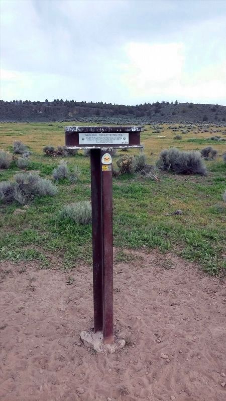
South Road - Forks Of The Yreka Trail / Yreka Trail - The Trail Forks Marker
(front plaque)
South Road - Forks Of The Yreka Trail
“All in need of provisions were supplied by a government
agent at this camp. Near this point the road forks-one
leading to Jacksonville, in Oregon, and the other to . . . — — Map (db m151605) HM
"Drove 16 miles down Shasta Valley, most of the way good roads, no hills to cross now, but in places the road is stony. Today passed one or two houses. The first I have seen for several months" - James S. Cowden, Oct 11, 1853 — — Map (db m151631) HM
"After noon we drove on until night and no water to be seen
anywhare; so we pitched camp and stayed all night without
water; in the morning we hitched up and pushed on for water"
-James Baron, Aug 9, 1855 — — Map (db m151586) HM
"At noon we came to a pine forest. Traveled in it the
rest of the day. One very steep stony hill to go up.
Road considerably stony at intervals all day."
- George McCowen, Aug 28, 1854 — — Map (db m151589) HM
"Started at 6 went on to pine woods took dinner no
water or grass then passed on to Butte Creek & followed
it three miles & campt round a little lake quite stony to
day poor country"
- Hinsdale Truman Shepard Sep 4, 1852 — — Map (db m151590) HM
"Started & went 15 miles to Shasta River & campt
verry cold nights frost last night not [feeling]
any better" - Hinsdale Truman Shepard, Sep 7, 1852 — — Map (db m151633) HM
"The first day of October we journeyed west fourteen miles to the Snelling Ranch, now called the Hurd Ranch, near Sheep Rock, Shasta Valley." - Andrew Soule, Oct 1, 1854 — — Map (db m151629) HM
"Went 15 miles came to a big meadow [grass lake] & campt we took water with us this morning found no good water here" - Phoebe S. Terwilliger, Oct 11, 1854 — — Map (db m151608) HM
"Only drove 6 miles to a good camping place. Are yet on Butte Creek. There is a large amount of timber ... The hills and mountains are nearly all covered with a heavy growth of pine timber" - James S. Cowden, Oct 9, 1853 — — Map (db m151604) HM
"We are now out of the diggers and and in the Shasta
Valley tribe (country) they are not so hostile" - Sophronia Helen Stone, Sep 20, 1852 — — Map (db m151592) HM
"The next day we followed up Butte Creek for six
miles and pitched our tents. We lost a fine horse here."
- Andrew Soule, Sep 29, 1854 — — Map (db m151595) HM
Original Marker (2008):
Yreka Trail - Splendid Pine Timber
"Passed through splendid pine timber & fur [sic] & spruce ... Passed the dividing ridge of the Shasta Mountains Verry [sic] rough & bad roads this afternoon 18 miles to day . . . — — Map (db m151902) HM
As early as 1852 wagon trains of overland emigrants crossed 600 feet to the north into Shasta Valley and Yreka; and at this point the 1857 Military Pass from Fort Crook emerged to join the westward emigrant road. — — Map (db m151607) HM
“Here we came in cite of the bute It is a splendid cite Went down the hill on to the flats Spencer & Brill shot a deer.”
– Hinsdale Truman Shepard, Sep 6, 1852 — — Map (db m151609) HM
'Left camp early. About 10 o'clock commenced down hill. Nooned at the Sheep Rock'
- George McCowen, August 30, 1854
For guidebook availability
Trails West Inc., www.EmigrantTrailsWest.org — — Map (db m195081) HM
"Stop at Sheep Rock Here is ceder [sic] and pine Large strait [sic] and tall Now this is a large rocky region where the mountain sheep abounds Deer and antelope to[sic]" - Sophronia Helen Stone, Sep 22, 1852 — — Map (db m151610) HM
"Made a drive of 20 miles and campt by what are called Sheep Rock Springs, at the head of Shasta River Valley and about 30 miles from our destination, Yreka City." - James S, Cowden, Oct 10, 1853 — — Map (db m151627) HM
“Drove into town (Yreka) and a mighty town it is... several very good brick buildings. ...nothing can be bought here for less than two bits, a loaf of bread that use to cost five cents is 25, salt 25 per lb.” George McCowen, Sep 1, 1854 — — Map (db m151576) HM
"Today we have landed to our journeys end neare Yreka, whare
we stopped to graze our teems ... we exspect to stay here some
days to rest for the man that crosses the planes will feel
like resting when he gits through" - James Bardin, Aug 11, . . . — — Map (db m151637) HM