Susquehanna and Tidewater Canal Historical Markers
Built between 1835 and 1839, the 45-mile long Susquehanna (PA) and Tidewater (MD) Canal ran from Wrightsville, Pennsylvania to Havre de Grace, Maryland.
The corporate title of the company authorized in 1783 to build one of the first inland waterways in America. The bed of this canal and some of its stone locks are still visible near this road. — — Map (db m146175) HM
A hamlet settled in the late eighteenth century by free blacks and whites. The Hosanna School, built in 1867, was Harford County's first public school for African Americans. Travelers, local farms, and industries such as milling, mining, quarrying, . . . — — Map (db m143953) HM
Lock #9 at Lapidum was one of 29 numbered locks on the 45-mile-long Susquehanna & Tidewater Canal. From 1839 until 1894, the canal was a major route for commerce between central Pennsylvania and the Chesapeake Bay. The locks were used to raise canal . . . — — Map (db m213923) HM
Instead of following the slope of the land, as rivers and streams do, a canal periodically takes a vertical step between long stretches of flat water. Locks were constructed at each vertical step to accomplish moving barges up and down between . . . — — Map (db m164934) HM
Part of “Land of Promise” tract. Original mill (1760), present grist mill (1794), first Susquehanna River Bridge (1818) and Barge Canal (1839) made through this hamlet a thriving commercial center. Surviving are Miller’s House, the Mill, Toll House . . . — — Map (db m189291) HM
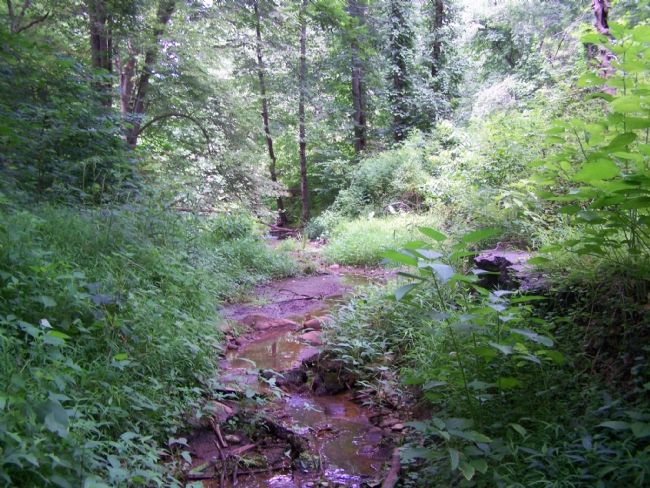
The town of Lapidum, at the head of
navigation in the Susquehanna River, traces
its history to the granting of land patents for
the tracts "Eightrupp” (1665), "Eaton” (1679),
and "Land of Promise” (1682). As the
supporting land was transformed . . . — — Map (db m188601) HM
The Lock House is located at the southern terminus of the Susquehanna and Tidewater Canal, which operated from 1840-1897. The canal was pivotal in the development of the Lower Susquehanna River Valley. It connected with the Pennsylvania Canal at . . . — — Map (db m1492) HM
The appearance of the area around the mouth of Deer Creek was changed by the construction of the Susquehanna and Tidewater Canal. A 246'-long dam, consisting of a heavy timber frame filled with rocks and covered with planking, raised the level of . . . — — Map (db m213919) HM
The 45-mile long Susquehanna (PA) and Tidewater (MD) Canal ran from Wrightsville, Pennsylvania to Havre de Grace, Maryland. The canal was built between 1835 and 1839 in order to improve commerce on the Susquehanna River. The new canal would . . . — — Map (db m164981) HM
The Toll House, constructed around 1817, provided shelter for the toll keeper and was used to store the collected tolls from bridge travelers crossing the Susquehanna River. The window in the wall on the porch was used to spot boats coming down . . . — — Map (db m189268) HM
Construction & Destruction
The Susquehanna Bridge and Banking Company began construction in 1813 and opened the bridge in 1818, connecting Harford and Cecil Counties.
The bridge was covered to protect the wooden decking and trusses from . . . — — Map (db m194866) HM
A ridge of high quality slate running from southeastern Pennsylvania into Harford County, Maryland, was quarried on a limited scale as early as 1734. Production increased in the 1840s when the opening of the Susquehanna and Tidewater Canal offered a . . . — — Map (db m169259) HM
During the mid-nineteenth century, Columbia was a bustling transportation hub. Turnpikes, ferries, bridges, canals, wharves, and railroads made Columbia a major transshipment point in the movement of lumber, coal, grains, pig iron, and people. . . . — — Map (db m161072) HM
A great variety of boats traveled the Susquehanna and Tidewater Canal. Fast-moving packet boats, which carried passengers and were pulled by horses, sometimes at a trot, always had the right of way when passing through the lock. Slower freight . . . — — Map (db m171561) HM
Small settlements grew up around the canal, many of the inhabitants either working for the canal company or providing goods and services to local boatmen and their passengers. An 1898 survey of the area listed five existing buildings at Lock 15: a . . . — — Map (db m171281) HM
A lock acts as a step in the canal, allowing boats to be raised or lowered over changes in elevation. 29 lift locks along the Susquehanna and Tidewater Canal raised boats a total of 231 feet from Havre de Grace, Maryland, to Wrightsville, . . . — — Map (db m171282) HM
North America's vast network of rivers provided Native Americans and European settlers alike with their earliest transportation routes. Early in the nineteenth century with overland routes only crudely developed and railroads not yet spanning the . . . — — Map (db m171559) HM
Chartered by Pennsylvania, 1835; run by the canal company, 1840-1872, and the Reading Railroad till 1894. Followed the river for 45 miles below Columbia. — — Map (db m5849) HM
Now housing the Tucquan Club, the nearby stone building was originally a warehouse for deposit and shipping on the canal. Masonry fragments and a portion of the canal-bed may be seen nearby. — — Map (db m5850) HM
The famous Peach Bottom roofing slate was discovered about 1734, on the ridge where Delta, Cardiff and Whiteford are now located. The discovery was made by two Welsh pioneer farmers. William and James Rees. They proceeded to roof their buildings . . . — — Map (db m171101) HM
Just north of this spot are the walls of what was once lock No. 12 of the old Susquehanna & Tidewater Canal, which paralleled the Susquehanna River 45 miles between Wrightsville, PA and Havre De Grace, MD. Built in 1836-39 and opened in 1840, the . . . — — Map (db m159956) HM
Chartered by Pennsylvania, 1835; run by the canal company, 1840-1872, and the Reading Railroad till 1894. Followed the river for 45 miles below Columbia. — — Map (db m225129) HM
Masonry visible beside the river remains from a lock of the canal which carried goods southward from Columbia, and provided an outlet for trade from Pennsylvania to Baltimore. — — Map (db m225130) HM
Chartered by Pennsylvania, 1835; run by the canal company, 1840 - 1872, and the Reading Railroad till 1894. Followed the river for 45 miles below Columbia. — — Map (db m5067) HM
Lock masonry, just below
the bridge, and part of the
old channel mark the north
end of the canal, which met
the State-owned canal at
Columbia. Until 1863, the
river-bridge had a towpath
for mules; later, tugboats
pulled canal craft across. — — Map (db m160219) HM
Before the hydroelectric companies built dams on the river in the late nineteenth and early twentieth centuries, the lower reaches of the Susquehanna were shallow, rocky, and virtually unnavigable.
In the 1830s, Baltimore merchants campaigned for . . . — — Map (db m170557) HM
Gateway to the West - Wrightsville was settled in the 1720s by Quakers, including the John Wright family. Wright established a ferry and Wrightsville became a major point of crossing the Susquehanna River by pioneers traveling west. In 1811 Jacob . . . — — Map (db m171286) HM