Both Union Soldiers training at Ft. Warren and Confederate prisoners of war were quartered along this side of the fort, often in adjoining rooms. his area also contained a schoolroom, 1900-volume library, and a chapel which was used almost daily by . . . — — Map (db m59282) HM
Settled in the year 1874 by the Jackson, Lansing & Saginaw Railroad, the new community was named for Augustine Smith Gaylord, an attorney for the railroad. Born in Jefferson, Ohio in 1831, he started the Saginaw Public School System in 1851. He . . . — — Map (db m33369) HM
On October 14, 1862, Confederate Gen. John Pemberton assumed command in Mississippi and east Louisiana. Eleven days later, Gen. Ulysses Grant became commander of Union forces in the region. Over the next 8 1/2 months, their forces fought for control . . . — — Map (db m84782) HM
The Battle of Port Gibson was one of the turning points of the War between the States, since this defeat of the Confederates led to the capture of Vicksburg. This strategic battle was fought eight miles west of Bethel Church on May 1, 1863. When . . . — — Map (db m105841) HM
The river on April 29, 1863, was at flood stage and falling. It was overflowing its banks from the bluffs on the east to high ground beyond the flood pain to the west. The river bend upstream just above the "Point of Rocks" force the current of the . . . — — Map (db m105714) HM
The town of Grand Gulf was burned by Admiral David Farragut's men in 1862 and occupied by Porter's Mississippi Squadron on May 3, 1863. The Union occupation followed Confederate Brig. Gen. John Bowen's evacuation of the town after the Battle of Port . . . — — Map (db m105718) HM
War returned in March, 1863. Fearful that Major General Grant’s army might bypass Vicksburg, Lieutenant General J. C. Pemberton ordered Brigadier General John Bowen to move his troops to Grand Gulf. During the next several weeks, Bowen’s troops . . . — — Map (db m105776) HM
After crossing the Mississippi River and fighting the battle of Port Gibson April 30 - May 1, 1863, Gen. U.S. Grant moved to capture Grand Gulf as a base of operations against Port Hudson, Louisiana. Capturing Grand Gulf on May 3, Grant learned that . . . — — Map (db m105723) HM
In April, 1863 Major General Ulysses Grant decide to alter his Vicksburg strategy by moving his troops down the Mississippi River. On April 29, 1863 the Federals launched a determined assault on Grand Gulf. The Confederates made a rigorous reply to . . . — — Map (db m103933) HM
After U.S. Grant had planned much of his campaign at Mrs. Bagnell’s, four miles west, he arrived at Rocky Springs on May 7. He remained until May 10, allowing the XV Corps to cross the Mississippi and rejoin the army. McClernand’s XIII Corps arrived . . . — — Map (db m87358) HM
Built by Samuel and Jacob, prominent Jewish businessmen, this complex forms an unusual group of consecutively constructed buildings of various architectural styles. This house, built in 1901, replaced an earlier one used by Gen. U.S. Grant as his . . . — — Map (db m103796) HM
At daybreak, the Union soldiers who camped here found themselves in the midst of a rugged landscape of ridges and ravines. As it happened, they were also at the center of what would become the battlefield. From this knoll, Generals Grant and . . . — — Map (db m143854) HM
On May 1, 1863, Confederate forces under Brig. Gen. John Bowen clashed with elements of two Union corps commanded by Maj. Gen. U.S. Grant. The battle began around midnight near the Shaifer House four miles west of town. At dawn, the Federals . . . — — Map (db m35542) HM
The Union Army under command of Maj. Gen. U.S. Grant was composed of the 13th Corps and Logan's Division of the 17th Corps. The Confederate Army, under command of Brig. Gen. John S. Bowen, was composed of Tracy's, Cockrell's, Green's, and Baldwin's . . . — — Map (db m104412) HM
When Union Gen. J. B. McPherson's XVII Corps reached Grindstone Ford, 2 miles south of here at dusk on May 2, 1863, the troops found the bridge across Big Bayou Pierre burning. Col. J. H. Wilson and a detachment put out the fire. During the night . . . — — Map (db m103855) HM
About dark on May 1, 1863, Gen. W. E. Baldwin's Confederates retreated through Port Gibson. After crossing the suspension bridge over Little Bayou Pierre, the Confederates set it afire. On the morning of the 2d. the Union army entered the beautiful . . . — — Map (db m103808) HM
Main defensive position on Yalobusha River line held by Gen. Pemberton in fall of 1862 to repel Gen. Grant, whose army of 25,000 was moving to attack Vicksburg. — — Map (db m89894) HM
Built ca. 1835, this Greek Revival house is one of the oldest in Hinds Co. U.S. Grant passed by enroute to Civil War siege of V'burg, 1863. This structure is listed on the National Register of Historic Places. — — Map (db m115290) HM
On September 4, 1875, a political rally and
debate turned violent on the grounds of the
former Moss Hill plantation, near downtown
Clinton. An exchange of gunfire between White
Democrats and Black Republicans left seven
dead and dozens . . . — — Map (db m184616) HM
By the time of the Civil War, the Natchez Trace had lost its significance as a national road. One of the sections ran from Port Gibson toward Jackson but the route veered from the original Trace to reach Raymond. In the spring of 1863, General U.S. . . . — — Map (db m87360) HM
The Treaty of Doaks Stand, 1820, opened this land to white settlement. Land was quickly claimed, and pioneer families established themselves in this wilderness. William Dean and his wife Margaret settled near here on the Old Natchez Trace in . . . — — Map (db m87359) HM
“Move your command tonight to the next cross-roads if there is water, and tomorrow with all activity into Raymond.”
Maj. Gen. Grant to Maj. Gen. McPherson, USA, May 9, 1863
“Move your brigade promptly to . . . — — Map (db m84988) HM
After the signing of the Treaty of Guadalupe Hidalgo in February, 1848, ending the Mexican War, 80,000 US Troops returned to the US for reassignment or discharge. To alleviate the crowded port conditions of New Orleans, Baton Rouge, Mobile, and St. . . . — — Map (db m102309) HM
Following their defeat in the battle of Corinth, Confederate forces, now under Lt. Gen. John C. Pemberton, established a line of defense on the Tallahatchie River in November 1862. Union Gen. U.S. Grant, moving down the Mississippi Central Railroad, . . . — — Map (db m102633) HM
On December 2, 1862, as the Confederates
fell back to the Yalobusha River, Union
Gen. U.S. Grant moved his headquarters
from Waterford to Abbeville. On the 4th,
he moved to Oxford, while his advance
crossed the Yocona River. W.T. . . . — — Map (db m102879) HM
Chartered in 1836 on Chickasaw cession land, Oxford was named for the university town in England and became home to the University of Mississippi in 1848. During the Civil War, Generals Grant and Sherman met in Oxford (1862), and the Square and many . . . — — Map (db m102878) HM
Originally built for use as magnetic observatory. Used as Confederate morgue after Battle of Shiloh in April, 1862. Also used by Gen. U.S. Grant in fall of 1862 and later by forces of Gen. Nathan B. Forrest. — — Map (db m102673) HM
The Battle of King's Creek
The campaign to take Vicksburg and control of the Mississippi River
had begun. On May 5, 1863, mounted infantry and cavalry units of the
Federal Ninth Illinois, Tenth Missouri and Seventh Kansas, under . . . — — Map (db m102851) HM
In the 1863 Campaign against Vicksburg, General Grant tried several approaches, one being to send troops on transports down the Tallahatchie and Yazoo Rivers. He cut the Mississippi River levee in February which flooded the several bayous between . . . — — Map (db m77329) HM
Airliewood, built in 1858 for William H. Coxe on a fifteen acre estate, is a gothic style villa. The massive iron gate and fence are attributed to Wood & Perot of Boston. At the invitation of Coxe, the house was used by Major General U.S. Grant as . . . — — Map (db m85131) HM
Throughout the winter of 1862-63, Union Major General Ulysses S. Grant orchestrated a series of Bayou Expeditions aimed at capturing Vicksburg. The Steele's Bayou Expedition was the most daring of these operations and was personally led by Rear . . . — — Map (db m65009) WM
Site of Lum Mansion, Hq. of Gen. U.S. Grant, family & staff, after siege of Vicksburg, 1863. The 26 room house, built about 1820, was later destroyed by order of Capt. Cyrus B. Comstock to build fortification. — — Map (db m97076) HM
Beginning on May 16, 1863, Gen. U.S. Grant held city under siege, cutting off all supplies & driving citizens to caves to escape shells. C.S.A. Gen. John C. Pemberton finally surrendered July 4. — — Map (db m39572) HM
They were all volunteers-and unmarried—those 150 Union men
called the "Forlorn Hope." Powerful cannon had pounded the
Confederates for four straight hours. Laden with planks and hastily
built ladders, they struggled up the road in front of . . . — — Map (db m109458) HM
Companies D and K were assigned to duty on gunboats by order of Major General U.S. Grant, dated February 18, 1863; Company D, under Captain Eberlee P. H. Stone served during the campaign and siege of Vicksburg on gunboat "Tyler" . . . — — Map (db m109750) HM
Direct assaults on the Confederate fortifications on May 19 and 22 ended in heavy Union losses. With Vicksburg's defenses holding strong. Grant changed tactics and ordered a formal siege. Here, at Third Louisiana Redan, all phases of siege . . . — — Map (db m109354) HM
The Union Army, under command of Maj. Gen. U.S. Grant, was composed of Osterhaus', Smith's, and Carr's Divisions of the 13th Corps, Maj. Gen. John A. McClernand commanding. The Confederate Army, under command of Brig. Gen. John S. Bowen, was . . . — — Map (db m115570) HM
The Union Army, under command of Maj. Gen. U.S. Grant, was composed of Steele's and Tuttle's Divisions, 15th Corps, Maj. Gen. Wm. T. Sherman commanding; and Logan's and Crocker’s Divisions, 17th Corps, Maj. Gen. James B. McPherson commanding. Gen. . . . — — Map (db m110224) HM
The Union Army, under command of Maj. Gen. U.S. Grant, was composed of Steele's and Tuttle's Divisions, 15th Corps, Maj. Gen. Wm. T. Sherman commanding; and Logan's and Crocker’s Divisions, 17th Corps, Maj. Gen. James B. McPherson commanding. Gen. . . . — — Map (db m115558) HM
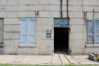
In order to guard Vicksburg from Union attack, the Confederates built a ring of forts around the city's north, east, and south sides. You are standing at the northernmost point of those defenses. From here, the tour road travels east then south . . . — — Map (db m110173) HM
Lookouts spotted Union vessels on the Mississippi River
and sounded the alarm. Within minutes, the night sky
blazed with the light of burning cotton bales and tar
barrels. In forts like the one you are in, Confederate
gunners knew just where to . . . — — Map (db m105440) HM
[Side A]
Internationally known for its firebrick industry and famed for its saddle horses, this county seat was laid out by Robert C. Mansfield and James H. Smith not long before Audrain County was organized, 1836. Named for legislator . . . — — Map (db m70508) HM
Built in the mid-1800s, this is one of the oldest buildings still standing on what was once known as “Warehouse Row.” With easy access to the Mississippi River steamboats & the railroad, the businesses located here made major contributions to the . . . — — Map (db m236099) HM
In April 1861, Ulysses Simpson Grant, a graduate of West Point and a former army officer, was out of the army and clerking in his father's store in Galena, IL. Grant's loyalties were clear: "We have a government and laws and a flag, and they . . . — — Map (db m236791) HM
The Battle at Chalk BluffDown the hill from this marker is the place where four brigades of Confederates, led by Brig. Gen. John Sappington Marmaduke, crossed the St. Francis into the safety of Arkansas on May 1-2, 1863. The clash with Union troops . . . — — Map (db m18141) HM
Erected 1886
By the Surviving Veterans of the
21st Regt. Ill. Vol. Inft.
To commemorate the spot where their Col.
Ulysses S. Grant
Received his commission as general,
1861,
And parting from his regt. entered
On his career of . . . — — Map (db m99168) HM
Settlers to what we now call Iron County arrived in the first few decades of the 19th century. Little did they know what would unfold just a few more decades later when the Civil War erupted in Missouri.
One of those first settlers was Ephraim . . . — — Map (db m99167) HM
(Front): Surrounded by the rugged splendor of the highest peaks of the Missouri Ozarks, Arcadia Valley lies in the geologic center of the Ozarks, one of the world's oldest mountain regions. The valley towns are in an area settled in the iron . . . — — Map (db m38440) HM
Stars and Bars Flag
Adopted in March 1861, the Stars and Bars was the first national flag officially used by the Confederate States of America (CSA). Seven stars represented each of the seven original states of the CSA. The flag gained stars . . . — — Map (db m91051) HM
North and west of this location, the Battle of Belmont was fought on November 7, 1861. It was the first battle in which Ulysses S. Grant commanded an army. He had recently been promoted to Brigadier General and placed in command of the federal . . . — — Map (db m17763) HM
(Front): Comprising 411 square miles of Missouri's great alluvial plain, this county, organized in 1845, is a high producer of cotton, grain, and soybeans. The Mississippi (Algonquin Indian for Great Water), flowing along some 70 miles of the . . . — — Map (db m17721) HM
At this location, and at other locations up and down stream, the Siege of New Madrid and the Island No. Ten campaigns took place during the months of March and April of 1862. Union victories here ensured Federal control of the middle Mississippi . . . — — Map (db m12342) HM
Bethel, in North River Valley, five miles from Shelbyville, was founded in 1844 as a religious communal colony by Wilhelm Keil and his German-American followers. Keil (1812-1877), an independent preacher, called his adherents "Christians." . . . — — Map (db m149765) HM
Bellefontaine Cemetery serves as the final resting place for over 86,000 souls and counting. With 314 acres and fourteen miles of roadways, Bellefontaine is home to dozens of architectural landmarks representing St. Louisans and their families since . . . — — Map (db m155782) HM
(left panel)
A Place Called Home
The Dent and Grant families spent many enjoyable years on this plantation while their children were growing up. While a few of the enslaved people lived in the house, most were housed in log . . . — — Map (db m124988) HM
Changes at White Haven (left panel)
The end of the war brought many changes to the White Haven estate. The previously enslaved African Americans were free and appear to have left the area. Labor was now provided by German and French . . . — — Map (db m122399) HM
The builder of the house, as well as its subsequent owners, were well-known and respected individuals, and the farm reflected their status in the St. Louis community. Modifications were made to the original two-story, four-room structure to . . . — — Map (db m124992) HM
(left panel)
Grant’s Departure
After the Presidency and a world tour, Ulysses and Julia Grant settled in New York to be closer to their children and grandchildren. While the romance of one day returning to White Haven remained, . . . — — Map (db m124990) HM
Colonel Dent named the property White Haven after his family home in Maryland. Paint analysis indicated the home was painted various colors in the nineteenth century, including Paris Green with a dark green trim, as seen on this wall and . . . — — Map (db m124993) HM
Mr. Busch's love of animals and the desire to share that love with people of all ages inspired him to open his home, Grant's Farm to the public in 1954. He then established the Busch Gardens family Theme Parks in Tampa, Florida and Williamsburg, . . . — — Map (db m176760) HM
Grant's plans for developing the farm resulted in many improvements, including a barn and stable built between 1869 and 1872. The stable you see today housed Grant's horses. The barn that also appears in the 1875 illustration of the farm sheltered . . . — — Map (db m124996) HM
(left panel)
Outbuildings
Operating an 850-acre slave plantation required numerous outbuildings. Col. Frederick Dent's enslaved African-Americans labored in these outbuildings and kept the farm self-sufficient prior to the Civil . . . — — Map (db m124991) HM
Settlement in St. Louis County first occurred along the three main thoroughfares out from the city: Gravois to the southwest, Manchester to the west, and Natural Bridge to the northwest. Railroad development paralleled the Mississippi River to the . . . — — Map (db m124998) HM
White Haven was the name given to both the house and the estate. Typical of many large plantations, other houses on the property were built and occupied by family members and slaves. White residents gave their houses special names. The slaves, . . . — — Map (db m124999) HM
White Haven was typical of large farms in the area during the mid-1800s. As times changed, so did its operation in terms of labor, equipment, and methods. Its two owners, Colonel Dent and Ulysses Grant, also had different interests and therefore . . . — — Map (db m125000) HM
White Haven has been designated a National
Historic Landmark
This site possesses national significance
in commemorating the history of the
United States of America. 1986 National Park Service United States Department of the . . . — — Map (db m125001) HM
Operating this 850-acre farm required numerous outbuildings. These included a spring house built over the spring to provide a cool place for crocks of butter and cheese; a barn behind the main house for livestock such as cows, pigs, and sheep; . . . — — Map (db m125002) HM
Working Plantation (left panel)
White Haven was typical of slave plantations in the area during the mid-1800s. As times changed, so did the operation of the farm in terms of labor, equipment and methods. Prior to the Civil War, . . . — — Map (db m122400) HM
In 1826, the year of Thomas Jefferson's death, Jefferson Barracks, named after him, was established ten miles south of St. Louis. Now a Missouri Air National Guard installation, it is the oldest continuously operating U.S. military post west of the . . . — — Map (db m163572) HM
Ulysses Grant's arrival at Jefferson Barracks in September, 1843, as a new officer out of West Point, commenced a long relationship with St. Louis. In 1848, he married the former Julia Dent of St. Louis County, at the Dents' city home at Fourth and . . . — — Map (db m163566) HM
Upon graduating from West Point in 1843, Ulysses S. Grant was assigned to Jefferson Barracks, near St. Louis. There he married Julia Dent, whose family estate, White Haven, was nearby. He left the Army in 1854 to work his wife's farm, which he . . . — — Map (db m124947) HM
Fort Belknap Reservation was established in 1888 when Gros Ventres, Blackfeet, and River Crows ceded to the government 17,500,000 acres of their joint reservation that had covered all of northern Montana east of the Rocky Mountains. Home for the . . . — — Map (db m142915) HM
Established as a military post August 27, 1867 by order of
President Andrew Johnson and General U.S. Grant
the post was abandoned in December 1886
Captain Wm. Clark
of the Lewis and Clark Expedition
encamped here July 14, 1806 with his . . . — — Map (db m98279) HM
In the Hellgate Treaty negotiations (1855), Xwetxxcln (Plenty Horses or chief Victor) and the Selíš people rebuffed efforts of US officials to get them to abandon the choice lands of their ancestral Bitterroot Valley. After Xwetxxcln died, settlers . . . — — Map (db m123513) HM
The first community building was built by the Odd Fellows in 1863 costing $30,000. Lodge offices and Hall were on the second floor. The Odeon Saloon and Billiard Parlour occupied the west side of the street floor, hosting such notables as Mark . . . — — Map (db m89448) HM
Although the area around Walker Lake in the Utah Territory was set aside for “Indian purposes” in 1859, it was not until 15 years later that President Grant signed the executive order formally establishing the Walker River Indian . . . — — Map (db m45076) HM
Millionaires Club and Oldest Saloon in Virginia City
͠ Since ͠
1862
[Marker Located on Back Wall of Saloon]
Millionaires Club
of the
Washoe
This historic club was formed in the mid-1870’s by the elite gentlemen of . . . — — Map (db m22466) HM
Abel Crawford and son, Ethan Allen Crawford, built the first Crawford House in 1828. It was run by Ethan's brother, Thomas, until sold in 1852. Fires in 1854 and 1859 destroyed the original inn and a replacement. Col. Cyrus Eastman erected the . . . — — Map (db m75236) HM
In 1857, John Sinclair a N.H. politician built a small, but well kept 8-10 room tavern and inn.
In succeeding years, it was enlarged and enlarged again to a capacity of 350 guests.
It was the second largest hotel in the area and boasted a huge . . . — — Map (db m116520) HM
Thayers Inn has welcomed countless guests over the years. Among them have been the famous (and the infamous). A brief listing includes visiting Presidents Ulysses S. Grant, Franklin Pierce, Richard Nixon, and Jimmy Carter. Also stopping here were . . . — — Map (db m243268) HM
While his father Capt. John Porter, U.S.N.
Commanded the Portsmouth Navy Yard.
Graduated West Point, July 1845
Distinguished himself and was wounded in War with Mexico
1846-1847.
Instructor of Artillery and Cavalry
West Point . . . — — Map (db m94764) HM
Several hotels stood on this west end site, but the grandest were the Stetson House and the West End Hotel. The Stetson was L-shaped and had 300 rooms. Although smaller than other grand hotels, it was socially desirable and had modern conveniences . . . — — Map (db m175109) HM
On the 26th of June in 1777 Washington’s continental forces of under 6,000 men fought a running battle on the plains below the Watchung Mountains with the combined British and Hessian troops numbering about 12,000. Early on that hot Thursday morning . . . — — Map (db m21858) HM
In the 1800's it was the custom in presidential campaigns to raise a pole to honor the candidate. When President U.S. Grant campaigned for a second term in 1872, the Akron Grant for President Club, raised their first oak pole, which was replaced in . . . — — Map (db m75256) HM
The Fenian Brotherhood was a group of Irish Nationalists founded in the United States in 1858 with the goal of creating an Irish Republic. In this vicinity, from the docks of the Pratt Iron Works, on the night of June 1st, 1866, the Fenians . . . — — Map (db m140705) HM
William G. Fargo, co-founder with Henry Wells, of American Express Co. in 1850, Wells Fargo & Co. - Pony Express in 1851 and mayor of Buffalo during the Civil War (1862-1866) built his French Mansard-style mansion on a site bounded by Jersey, West, . . . — — Map (db m80419) HM
Son of William and Elizabeth Parker, born in a log cabin overlooking the water-falls, at Indian Falls, N.Y., then part of the Tonawanda Indian Reservation. Volunteered into the army, and became General Grant's Military Secretary. He was . . . — — Map (db m76082) HM
The story of Fort Drum began in 1906, [when] a partnership between the U.S. Army at Madison Barracks and North Country community leaders began looking for local training areas. The area in Felt[s] Mills, immediately north of the Black River, was . . . — — Map (db m110384) HM
Not many years ago the Thousand Islands, like the Adirondacks, were not considered of much value, except as a great hunting and fishing ground. In 1822 a boundary line and division of the Island Region was agreed upon between United States and . . . — — Map (db m126646) HM
The first permanent U.S. military encampment in the North Country was established at Sackets Harbor during the War of 1812, to protect this valuable location.
Sackets Harbor was formally established in 1815 as a U.S. Army installation and . . . — — Map (db m109163) HM
On this Battle Hill, facing the Statue of Liberty, this altar is erected to commemorate the Battle of Long Island. The first engagement of which was fought on this site, August 27, 1776, between General Lord Stirling with 2,000 Americans and General . . . — — Map (db m13268) HM
Rising to an imposing 150 feet from a bluff overlooking the Hudson River, this monument to General Grant is the largest mausoleum in America. Constructed of over 8,000 tons of granite, the great tomb was built to honor the Civil War general who . . . — — Map (db m207520) HM
Fred R. Moore - Publisher/Editor, 1858 - 1943
Served as messenger to five Secretaries of the Treasury during the Grant, Hayes, Arthur & Cleveland administrations.
1905 - Became editor of Colored American Magazine
1905 - Appointed . . . — — Map (db m210040) HM
The Cooper Union for the Advancement of Science and Art is America’s first free college. Founded by progressive thinker/abolitionist/inventor Peter Cooper, its doors were opened to all, regardless of race, religion, gender or social status.
Its . . . — — Map (db m136713) HM
Eighteenth President of the United States, 1869-77
General-in-Chief, Commanding the Armies
of the United States, 1864-69
First General in the United States Army, 1866
Lived in a house on this site from 1881 to 1885.
Here he spent his . . . — — Map (db m146259) HM
Rich in history, the plain of Claremont Playground has been the site of a Revolutionary War battle, a country estate, a fashionable inn, and a children’s recreation area. This was the scene of fierce combat during the Battle of Harlem . . . — — Map (db m53992) HM
General Grant Memorial, popularly known as “Grant’s Tomb,” is the largest mausoleum in America. Its monumental size reflects the public admiration for Ulysses S. Grant --- Union general during the Civil War, and 18th President of the . . . — — Map (db m109862) HM
This tree is planted at the site of the tomb of General U.S. Grant, Ex-President of the United States of America, for the purpose of commemorating his greatness by Li Hung Chang, guardian of the Prince, Grand Secretary of State, Earl of the First . . . — — Map (db m7983) HM
This expressive bronze portrait of General Philip Henry Sheridan (1831-1888), created by Joseph Pollia (1893-1954), was unveiled in Christopher Park in 1936. The sculpture honors the distinguished Civil War cavalry commander for whom the surrounding . . . — — Map (db m98720) HM WM
The Town of Worcester (pronounced wUS-ter) is at the divide between the Hudson and Susquehanna watersheds. It was a Mohawk, Indian hunting ground when the Servos family, Palatine Germans, began settlement, perhaos by 1740. There were skirmishes . . . — — Map (db m144285) HM
428 entries matched your criteria. Entries 101 through 200 are listed above. ⊲ Previous 100 — Next 100 ⊳