[Written on the initial marker, provided for context]
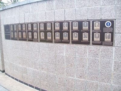
Our Constitution names the President of the United States the Commander in Chief of all the Armed Forces. Presidents who have served in our military are displayed on the following . . . — — Map (db m92384) HM WM
Site of
Joshua Tennison's Hotel 1818. John Strother 1821. Basil Williamson 1824. Frederick Barnard 1828. Proprietor of Mansion Hotel, Azariah Fuller American House 1833. City Hotel 1843. Willard's Hotel 1847-1901.
Distinguished Guests . . . — — Map (db m6618) HM
This County, created by Act of the Legislature December 18, 1857, is named for Franklin Pierce, New Hampshire Democrat and fourteenth President of the United States, 1853 to `57. He was a General in the Mexican War. Blackshear, incorporated . . . — — Map (db m24037) HM
Born 1786 in New Jersey; admitted to the bar 1810. Residing in Vincennes, Indiana Territory in 1815; later elected Speaker of the first state House of Representatives. In September 1817, Governor Jennings appointed Blackford to Indiana Supreme . . . — — Map (db m60668) HM
Before it became the Kansas capital, Topeka was the seat of a free-state government — an alternative to the official proslavery territorial legislature elected in 1855. These two bodies represented opposing factions in Kansas’ battle over . . . — — Map (db m118962) HM
Topeka was founded in 1854 at the site of Papan's Ferry where a branch of the Oregon Trail crossed the Kansas river as early as 1842. Anti-slavery leaders framed the Topeka Constitution, 1855, in the first attempt to organize a state government. The . . . — — Map (db m20479) HM
When Kansas territory was opened for white settlement on May 30, 1854, a bitter contest developed over the slavery question. Established the following December, Topeka, 25 miles ahead, favored the Free-State cause even though the territorial . . . — — Map (db m55359) HM
Samuel Casey, 1788-1859, Treasurer of the United States, 1853-59, under Presidents Pierce and Buchanan. He resided 1811-1859 in Caseyville, three miles west. Elected clerk of Circuit and County Courts; later, 1830-32, member of the State Senate. — — Map (db m123922) HM
Baltimore's first fish market stood near the site of this structure as searly as 1773. The first market building, Centre Market, was authorized by act of the State legislature in 1784. It was also known as Marsh Market since it was built on Thomas . . . — — Map (db m7322) HM
The Piney Point area possesses its own unique social history and charm. Named for the loblolly and long leaf yellow pines along the shoreline, Piney Point became the social center of Washington D.C. between 1820 and 1910. President James Monroe . . . — — Map (db m94280) HM
The Project
This is the bell from the steeple of the First Congregational Church of Rockport. It is the bell that is rung hourly by the Town Clock, still owned by the Town of Rockport. It is also rung by means of a rope and bell wheel on . . . — — Map (db m115529) HM
To the glory of God and in honor of the first settlers of Sandy Bay
The First Parish in Rockport was constituted in 1755. The corner stone of this meeting house laid in 1803. The tower was shattered by a British bombardment in 1814. . . . — — Map (db m73110) HM
Abel Crawford and son, Ethan Allen Crawford, built the first Crawford House in 1828. It was run by Ethan's brother, Thomas, until sold in 1852. Fires in 1854 and 1859 destroyed the original inn and a replacement. Col. Cyrus Eastman erected the . . . — — Map (db m75236) HM
Thayers Inn has welcomed countless guests over the years. Among them have been the famous (and the infamous). A brief listing includes visiting Presidents Ulysses S. Grant, Franklin Pierce, Richard Nixon, and Jimmy Carter. Also stopping here were . . . — — Map (db m243268) HM
Built in 1804 by Benjamin Pierce
Officer in the Revolutionary War
and Governor of New Hampshire in 1827-1829
Birthplace of his son Franklin Pierce
Fourteenth President of the United States
Restored and given to the
State of New . . . — — Map (db m230451) HM
The Pierce Homestead was built in 1804 by Benjamin Pierce, a general in the American Revolution, twice governor of New Hampshire (1827-28, 1829-30), and father of Franklin Pierce, the 14th President of the United States (1853-57). Franklin Pierce . . . — — Map (db m83659) HM
Fourteenth President of the United States Born at Hillsborough New Hampshire November 23, 1804 A lawyer who loved his profession and was a great leader in it. Member New Hampshire Legislature at 25 and Speaker at 27 Congressman at 29 United States . . . — — Map (db m81834) HM
Lies buried in nearby Minot enclosure. Native son of New Hampshire, graduate of Bowdoin College, lawyer, effective political leader, Congressman and U.S. Senator, Mexican War veteran, courageous advocate of States’ Rights, he was popularly known as . . . — — Map (db m77802) HM
Honoring New Hampshire History
The State House grounds hold the state's foremost display of sculpture and memorials, many fashioned from local granite.
After Concord became the state capital in 1808, its citizens donated land to erect . . . — — Map (db m115908) HM
One tenth of a mile east of here stands the only house in Concord owned (1842-1848) by Franklin Pierce, 14th President of the United States. Removed to this site in 1971 from Montgomery Street, it was restored by the Pierce Brigade. Opened to the . . . — — Map (db m130013) HM
[Upper Marker:]
22/26 Market Square
Built 1803
The Oldest Bank Building
New Hampshire Bank 1803-1842
Portsmouth Savings Bank 1823-C.1950
Piscataqua Bank 1842-1863
Piscataqua Exchange Bank 1844-1863
First National Bank of . . . — — Map (db m74731) HM
Governor Wilson Shannon (1802–1877),
Ohio, first native-born governor, Wilson Shannon was born in February 1802 in the Mt. Olivet area near Barnesville. After attending Ohio University and studying law in Kentucky, he returned to Belmont . . . — — Map (db m21055) HM
Side A:
On this site stood the home of Elisha and Polly Mygatt Whittlesey and their ten children. Also here was his law office and a records office that was moved in 1965 to Pioneer Village at the Canfield Fairgrounds. Already an attorney in . . . — — Map (db m65433) HM
The utmost good faith shall always be observed towards the Indians; their lands and property shall never be taken from them without their consent; and, in their property, rights, and liberty, they shall never be invaded or disturbed, unless in . . . — — Map (db m112807) HM
This Pioneer Park and Blockhouse honors General Joel Palmer, Superintendant of Indian Affairs for the Oregon Territory from 1853 to 1857. Appointed by President Franklin Pierce. Frontiersman, author, legislator and friend of the Indian. His journal, . . . — — Map (db m114312) HM
"The Acropolis of Harrisburg" is a way in which to describe this Greek Revival, temple-like edifice that rests on a mound of retaining walls jutting from Allison Hill. Although these walls are relatively recent, built when the structure was . . . — — Map (db m6830) HM
“The incorruptible statesman whose walk was upon the mountain ranges of the law.”
Life long friend Jermiah S. Black
U.S. Attorney General 1857-1860, U.S. Secretary of State 1860-1861
James Campbell was born in Philadelphia on September 1, 1812. He studied law and was admitted to the Bar on Sept. 14, 1833. He was made a commissioner for the district of Southwark for the city of Philadelphia. He was appointed to the Board of . . . — — Map (db m213973) HM
This historic mansion and estate was built as a summer home circa 1850 in the Italianate style by Charles Macalester, Jr., a prosperous businessman and banker. He held close personal relations with Presidents Jackson, Van Buren, Polk, Pierce, . . . — — Map (db m194951) HM
Camels in the Big Bend
Camel ancestors first appeared in North America approximately 40 million years ago. Modern camels migrated to Asia over a land bridge that submerged when sea level rose at the end of the last Ice Age. Camels became . . . — — Map (db m111499) HM
Edward Fitzgerald “Ned” Beale was a significant figure in 19th century America. In his long career, he was a naval officer, military general, explorer, diplomat, rancher and frontiersman. He fought in the U.S. - Mexico War, emerging as a . . . — — Map (db m93344) HM
After a convention of Republic of Texas citizens accepted terms on July 4, 1845, for annexation to the United States, General Zachary Taylor brought 4,000 men of the U.S. 3rd infantry to Corpus Christi to defend the embryonic state from Indians or . . . — — Map (db m134467) HM
Site of the American House 1808-1893 Presidents Monroe, Van Buren, Pierce, Grant
Generals Scott, Wool, Hampton
Henry Clay, and other famous famous people entertained here. — — Map (db m21813) HM
This small park is the last remnant of Fairfax County’s only major Civil War battlefield. The Battle of Ox Hill, also known as the “Battle of Chantilly,” lasted but a few hours on the afternoon of September 1, 1862. Here, some 6,000 Union troops . . . — — Map (db m182229) HM
Brig. Gen. Isaac I. Stevens, USA: • Born North Andover, Massachusetts, 1818 • West Point 1839 • Corps of Engineers • Mexican War, wounded, 1847 • Post war, US Coast Survey • Resigned US Army, 1853 • Appointed first governor of Washington . . . — — Map (db m182217) HM
Built in 1834-1835 by Stephen Henderson First Summer White House Occupied by Martin Van Buren John Tyler Millard Fillmore Franklin Pierce James Buchanan — — Map (db m85210) HM
Capon Springs bears Indian name meaning the "Medicine Waters." Discovered in 1765. Famous resort of early days. President Franklin Pierce, Daniel Webster, and his guest, Sir Henry Bulwer, the British Minister, were among guests. — — Map (db m50808) HM