Created in 1818 by an act of Alabama Territorial Legislature. Autauga Indians lived on creek from which the county takes its name. Autaugas were members of the Alibamo tribe. They sent many warriors to resist Andrew Jackson's invasion in Creek War. . . . — — Map (db m27907) HM
Standing on a low limb of a giant oak tree near here, General Andrew Jackson made a pep talk to his troops, fresh from their victory at the Battle of Horse Shoe Bend and poised before advancing on the British and Spanish at Pensacola, and the . . . — — Map (db m100852) HM
The American Revolution gave the United States its independence but the War of 1812 gave it status among the nations and established permanent peace with Great Britain.
Alabama had a significant role during the War of 1812. The Creek Indian . . . — — Map (db m122670) HM
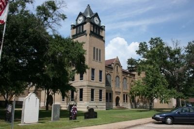
1820-1889 seat of Blount County, a county older than the State.
Named for Tennessee Governor W. G. Blount who sent Andrew Jackson to aid Alabama settlers in Creek Indian War, 1812-1814.
Indian Chief Bear Meat lived here at crossing of . . . — — Map (db m156445) HM
While traveling south with his troops, General Andrew Jackson camped at the fork of the river in 1813. General Jackson carved his name in a locust tree naming this area Locust Fork. In 1817, the Hanby family came from Virginia and settled in this . . . — — Map (db m50125) HM
Created Feb. 7, 1818 by Alabama Territorial Legislature from lands ceded by the Creek Indian Nation. Named for the Tennessee Governor W. G. Blount, who sent militia under Andrew Jackson to punish the Creeks for Fort Mims massacre. Jackson fought and . . . — — Map (db m24353) HM
The Treaty of Fort Jackson of August 9, 1814, by Major General Andrew Jackson on behalf of the President of the United States of America and the Chiefs, Deputies and Warriors of the Creek Nation, established a boundary line between the Mississippi . . . — — Map (db m61026) HM
The Treaty of Fort Jackson of August 9, 1814, by Major General Andrew Jackson on behalf of the President of the United States of America and the Chiefs, Deputies and Warriors of the Creek Nation, established a boundary line between the Mississippi . . . — — Map (db m202468) HM
At this site, on Nov. 3, 1813, after the Battle of
Tallasehatchee, known then as Talluschatches,
during the Creek Indian War,
Gen. Andrew Jackson found a dead
Creek Indian woman embracing her living
infant son. Gen. Jackson, upon hearing that . . . — — Map (db m36551) HM
This stone marks the site of the Tallasahatchie Battle Field. On this spot Lieut. Gen. John Coffee with Gen. Andrew Jackson's men won a victory over the Creek Indians, Nov. 3, 1813. — — Map (db m36554) HM
The Chief Ladiga Trail was named for a Creek Indian leader who signed the Cusseta Treaty in 1832. Under the terms of that agreement, the Creeks gave up claim to their remaining lands in northeast Alabama. Because he had signed the treaty, Ladiga was . . . — — Map (db m36438) HM
Town first called Drayton.
Renamed in 1834 to honor
President Andrew Jackson.
Seat moved to Anniston in 1899.
Calhoun Co. originally was Benton Co.,
for Col. T. H. Benton, Creek War officer,
later U. S. Senator from Missouri.
. . . — — Map (db m36471) HM
A Memorial to
Gen. Andrew Jackson,
the Tennessee Patriots,
the Alabama Patriots, and
pioneers who by their
courage and fortitude in
1813 - 1814, won five successful
battles in the Creek Indian
Campaign.
Side . . . — — Map (db m106593) HM
By AD 1730, the English, French and Spanish had all established colonies
in the region. It was also around this time that the people within the
Coosa, Tallapoosa and Chattahoochee Valleys, known to history as the
Arbekas (Abihkas), Tallapoosas, . . . — — Map (db m145022) HM
One mile south was an important Indian Council site from about 1707. Named for noted chief, the "Turkey". Here in October 1816, a council of Cherokees, Creeks, and Chickasaws met to settle boundaries and ratify a peace treaty. General Andrew . . . — — Map (db m114989) HM
Side 1
First home of Creek and Choctaw Indians, Jackson’s first pioneer settlers arrived about 1800. The little village was first called Republicville, then Pine Level, before its incorporation by an act of the Mississippi Territory . . . — — Map (db m101591) HM
First village called Republicville. Town laid out in 1815 by Pine Level Land Company and named Pine Level. Incorporated 1816 and renamed Jackson for General Andrew Jackson. First commissioners, David Taylor, David White, Reuben Saffold, Peregrin . . . — — Map (db m101589) HM
Here passed the Old Indian Trail used as a dividing line between the Choctaw and Creek Tribes.
General Andrew Jackson and his troops rested here for the night in 1813. — — Map (db m47633) HM
Hostile Creeks attacked Andrew Jackson, withdrawing to Ft. Strother, Jan. 24, 1814. His troops broke through lines, kept on to Ft. Strother. But Creeks boasted that they defeated 'Capt. Jack', drove him to the Coosa. — — Map (db m95076) HM
George Colbert operated a ferry across the Tennessee River from 1800 to 1819. His stand or inn offered travelers a warm meal and shelter during their journey on the Old Trace. Colbert looked after his own well-being and once charged Andrew Jackson . . . — — Map (db m69630) HM
In the early 1800s, ferries like the one George Colbert ran near here on the Tennessee River linked segments of the Natchez Trace. Ferries carried people across the river—for a fee. Post riders, Kaintucks, military troops, casual travelers, . . . — — Map (db m107258) HM
After the Battle of New Orleans in 1815, General Andrew Jackson proposed this road as a shorter and improved route for military movements between Nashville and New Orleans. The U.S. War Department authorized Jackson to appoint an engineer and . . . — — Map (db m83401) HM
The Winston family settled this area in the early 1820s. Andrew Jackson purchased the property at the U.S. government land sale and conveyed it to Col. Anthony Winston (1782-1841) who lived nearby in a two-story brick Federal-style house (razed . . . — — Map (db m28566) HM
[Side A:]
Three Notch Road
Established 1824
The Three Notch Road was a 90-mile section of a 230-mile military road to connect Pensacola with Fort Mitchell in Russell County on the Chattahoochee River. Capt. Daniel E. . . . — — Map (db m83456) HM
The name Florala came from combining the names of Florida and Alabama. Lake Jackson, located in Florala, is the state's largest natural lake. It is named for Andrew Jackson, who in 1818 camped on the lake with his soldiers while en route to . . . — — Map (db m83457) HM
Andrew Jackson in Seminole War
with an army of 1200 camped here
in May 1818
enroute westward from Fort Gadsden
to subdue marauding Indians
abetted by Spaniards at Pensacola.
Jackson determined to seize Pensacola . . . — — Map (db m99237) HM
At this site stood Fort Toulouse,
later Fort Jackson, named in honor of
Gen. Andrew Jackson
who on
March 27, 1814,
defeated the Creek Indians in a
decisive battle at Horseshoe Bend.
Erected
by
Peter Forney Chapter D.A.R. . . . — — Map (db m69705) HM
Fort Crawford was established in 1816 by elements of the 7th U.S. Infantry under orders from Major General Andrew Jackson. Purpose was to monitor Spanish activities in West Florida and curtail hostile Creek Indian activities.
Named after . . . — — Map (db m84373) HM
Established as a supply camp by General Andrew Jackson, September 1813, on the banks of Big Wills Creek. It was here that Jackson directed the first campaign of the Creek War, and promoted Colonel John Coffee to Brigadier General and Captain Newton . . . — — Map (db m73993) HM
Created by state legislature on December 1, 1868 from territory taken from Cherokee, DeKalb, Marshall, Blount, St. Clair and Calhoun Counties, having originally been formed December 7, 1866 as Baine County in honor of Confederate hero David W. . . . — — Map (db m83735) HM
Side A:
In the early 1840’s, John S. Moragne, along with Gabriel and Joseph Hughes, began surveying for a city on the banks of the Coosa River near the settlement of Double Springs. The new city would be located on 120 acres of land at the . . . — — Map (db m39139) HM
First known as New Boston when a post office was established here in 1832, by 1834 the community was known as Newburg. The Newburg Masonic Lodge #388 was organized in 1872. Since its completion in 1878, the Lodge hall has been a center for community . . . — — Map (db m80561) HM
Incorporated on November 27, 1819, three weeks before Alabama achieved statehood, Russellville was platted around the intersection of two historic roads.
Edmund Pendleton Gaines began work on the road that would bear his name on December 26, . . . — — Map (db m83750) HM
The Treaty of Fort Jackson on August 9, 1814 by Major General Andrew Jackson on behalf of the President of the United States of America and the Chiefs, Deputies and Warriors of the Creek Indian Nation, established a boundary line between the . . . — — Map (db m71836) HM
The Treaty of Fort Jackson on August 9, 1814 by Major General Andrew Jackson on behalf of the President of the United States of America and the Chiefs, Deputies and Warriors of the Creek Indian Nation, established a boundary line between the . . . — — Map (db m71838) HM
Jackson County was created by the State Legislature on December 13, 1819 while in session in Huntsville, Ala. The county was named in honor of Gen. Andrew Jackson who was visiting in Huntsville at the time.
This Statue was presented by the . . . — — Map (db m22262) HM
Once an Indian hunting ground, this land was opened for settlement after the War of 1812. The first settlers, who fought in that war under Andrew Jackson, came here in the early 1820’s after the U.S. acquired the land in the Creek Cession of 1814. . . . — — Map (db m83923) HM
Pinson, one of Alabama’s oldest communities, was settled by General Andrew Jackson’s soldiers in the early 1800s, after victory at Horseshoe Bend during the War of 1812. The community was originally known as Hagood’s Crossroads for settler . . . — — Map (db m88406) HM
Construction of this road, as ordered by General Andrew Jackson, began in May 1817 by troops of the U.S. Army for national defense purposes. Beginning near Nashville, Tennessee and continuing to Madison, Louisiana, it shortened the distance from . . . — — Map (db m80321) HM
Cavalry Commander under Andrew Jackson throughout War of 1812:
(Creek War, Pensacola, New Orleans).
Negotiated many treaties ceding Indian lands to U.S.
Made original surveys of Tennessee Valley. — — Map (db m35259) HM
Through his personal and business relationship with Andrew Jackson, Gen. Coffee led Jackson's cavalry in the Battle of New Orleans in 1815 and became a celebrated American hero. — — Map (db m219304) HM
Built by Andrew Jackson, 1816~1820. Shortened by 200 miles the route from Nashville to New Orleans for movement of supply wagons and artillery.
Built with U.S. funds and troops.
Followed in part Doublehead's Road from Columbia, Tenn., to Muscle . . . — — Map (db m65290) HM
(side 1)
John Coffee was born in Prince Edward County, VA, in 1772, the son of Joshua and Elizabeth Graves Coffee. The family moved to NC in 1777. After his father died in 1798, Coffee and other family members moved to Davidson County, TN . . . — — Map (db m100248) HM WM
A County Older Than the State
Lauderdale County
created Feb. 6, 1818
by Alabama Territorial Legislature (Alabama became a state in 1819).
Named for Col. James Lauderdale, cavalryman under Gen. John Coffee and Andrew Jackson, War of . . . — — Map (db m35185) HM
This is one of the earliest community burial grounds in Lauderdale County. The oldest dated gravestone is for Catherine Hill, first wife of Green Berry Hill, for whom the community is named. She died on June 8, 1825. George Kennedy deeded five acres . . . — — Map (db m154332) HM
Side A Federal lands in this area were first sold in 1818 and quickly purchased by settlers and speculators. A group of investors calling themselves the “Courtland Land Company” and consisting of William H. Whitaker, James M. . . . — — Map (db m28989) HM
Born 11 June 1769, in Maryland and married 18 Nov 1797, Anne Royall became a wealthy widow upon her Revolutionary War Veteran husband's death in 1813. However, her husband's family filed an ultimately successful suit for his estate. While she waited . . . — — Map (db m84309) HM
Form the late 1700's to 1807 a Cherokee Chief named Doublehead guarded this area, that was claimed by both the Cherokee and Chickasaw Nations as sacred hunting grounds against encroachment of white settlers.
Chief Doublehead had the reputation . . . — — Map (db m84646) HM
On this spot, camped his army, October 11, 1813, after marching from Fayetteville, Tenn.,~"32 miles without halting,"~ enroute to the Battle of Horseshoe Bend. — — Map (db m30382) HM
Brahan Spring Park, formerly Beaty's Spring, was the site of Camp Beaty, the encampment of Andrew Jackson's army of volunteers and militia after their celebrated non-stop march of "32 miles in 5 hours" from Fayetteville, Tennessee on October 11, . . . — — Map (db m105131) HM
Seminole Wars
1814-1858
I am Private Pet Younger of the 4th US Infantry Regiment. I joined the Regular Army in November 1835 at age 15. I was specially trained as part of the light infantry company whose main jobs were scouting and . . . — — Map (db m85604) WM
During the original Madison County Land Sales of 1809, LeRoy Pope of Petersburg, GA, secured among other purchases a majority of Section 36, Township 3, Range 1 West, the site of the future town of Twickenham, as Huntsville was originally known. . . . — — Map (db m32480) HM
Buckhorn Tavern
Located in Section 18, Township 2, Range 2 East, this site was an early wayside stop for pioneer settlers as they traveled the road from Winchester, Tennessee into Madison County. The tavern predates the creation of the . . . — — Map (db m155018) HM
Side 1
Pikeville, designated as the first permanent county seat for Marion County, lies along General Andrew Jackson's Military Road. Earlier temporary county seats were mostly along the Tombigbee River in what was Mississippi when the . . . — — Map (db m96485) HM
Andrew Jackson returned victorious from the Battle of New Orleans along this path to Tennessee after the War of 1812. Already in use by 1812, it was improved with federal funds in 1816. The road handled foot, horse, wagon, and stagecoach traffic and . . . — — Map (db m96483) HM
(Side A) This area's proximity to the Tennessee River and Indian trails made it a crossroads for early habitation, settlement, and trade. Archaeological studies reveal it was first inhabited about 12,000 years ago by Paleo-Indians. They . . . — — Map (db m33305) HM
In 1811, the Mount Vernon Cantonment, located on a hill about three miles west of the Mobile River, was laid out by Col. Thomas H. Cushing. The cantonment was on the site of a spring called Mount Vernon Springs. In 1814, the garrison at Mt. Vernon . . . — — Map (db m85911) HM
Little River was the home of Creek Chief William Weatherford, also known as War Chief Red Eagle. This was the area of much discussion and debate, bringing the Creeks into the War of 1812 and the Creek Civil War of 1813-1814. These events weighed . . . — — Map (db m86271) HM
Several cultures have occupied this region including
Woodland, Mississippian and, later, Muskogeans.
Called "Creeks" by Europeans, the latter made
their homes along banks of streams. A loose
confederation of tribes, Creeks developed a . . . — — Map (db m146977) HM
The community of Crockettsville was settled at about the time Russell County was formed in 1832. Among the first settlers were Jerry Segar and Green Sewell. It was named in honor of David "Davy" Crockett who served as a scout in Andrew Jackson's . . . — — Map (db m33541) HM
Fort Mitchell
Fort Mitchell is located on the Federal Road on the West bank overlooking the Chattahoochee River.
General John Floyd received orders from Governor David B. Mitchell to pick up supplies, cross the Chattahoochee River and . . . — — Map (db m120003) HM
The Battle of Horseshoe Bend, March 1814, ended the Creek Indian War. General Andrew Jackson met with Chief William Weatherford and signed the Treaty. The Creek Indians returned to their own land in the southeast Alabama territory. Travel over . . . — — Map (db m120004) HM
Side A
Creek Indians once owned and hunted the land where the City of Chelsea now stands. In 1813, Andrew Jackson and his army won millions of acres of Creek land from the Indians at the Battle of Horseshoe Bend, including the area where . . . — — Map (db m38488) HM
This site began as the burying ground for Harmony Presbyterian Church, the first church built in the area that would become Helena. The earliest marked grave is Jones Griffin (died 1836), one of Andrew Jackson's Tennessee volunteers who was credited . . . — — Map (db m76237) HM
Home of the University of Montevallo, American Village and the Alabama Veterans Cemetery, Montevallo is located in the geographical center of Alabama at 33° 6’ 18” N 86° 51’ 46” W. In 1814, Jesse Wilson laid claim to “Wilson’s . . . — — Map (db m37178) HM
John Looney and son, Henry, served in General Andrew Jackson's volunteer company which built Fort Strother on Coosa River and later fought at Horseshoe Bend in 1814. Looney's family of nine moved from Maury Co. Tenn. to homestead 1817 in St. Clair . . . — — Map (db m24066) HM
Created in 1818 by territorial legislature. Named for Revolutionary hero, Gen. St. Clair. First settlers from Tennessee, Georgia – veterans of Creek Indian War, 1813-14.
Pell City established as industrial town in 1890 by George H. Pell of . . . — — Map (db m49666) HM
Side 1
Livingston, Alabama
Prior to the signing of the Treaty of Dancing Rabbit Creek on September 27, 1830, this site belonged to the Choctaw Nation. Early settlers to the area came from the Carolinas, Georgia, Tennessee, and . . . — — Map (db m92665) HM
Here in 1814 Tennessee Troops Joined Andrew Jackson's force which won the Creek Indian War.
After Indian removal in 1836 these veterans brought their families here, named this community for their old home in Tennessee. Fayetteville Academy . . . — — Map (db m57993) HM
To The Memory of General Jackson and his Tennessee Volunteers while camped here 1814. He fought the Battle of Horseshoe Bend and discharged his Volunteers. — — Map (db m45706) HM
Built by Andrew Jackson with U.S. Regulars, Tennessee Volunteers and friendly Cherokees and Creeks. Used as advance base during final phases of Creek Indian War, 1813-1814. Military cemetery nearby. — — Map (db m57761) HM
Settled in 1748 by Shawnee
Indians from Ohio.
They joined Creek Confederacy,
fought against U.S. in War of 1812,
were moved west in 1836.
Settled before 1836 by men
who had fought in this area
under Andrew Jackson.
Indian name: . . . — — Map (db m40595) HM
Here Andrew Jackson led Tennessee Volunteers and friendly Indians to victory over hostile “Red Sticks.”
This action rescued friendly Creeks besieged in Fort Leslie.
Creek Indian War 1813 - 1814. — — Map (db m28205) HM
This tablet is placed by
Tallapoosa County
in commemoration of the
one hundredth anniversary
of the
Battle Of Horseshoe Bend,
fought within its limits
on March 27, 1814.
There the Creek Indians, led by
Menawa and other chiefs, . . . — — Map (db m28751) HM
There on March 27, 1814 General Andrew Jackson commanding U. S. forces and friendly Indians, broke the power of the Creek Confederacy. — — Map (db m39812) HM
Any officer or soldiers who flies before the enemy-shall suffer death.
With these harsh words, Maj. Gen. Andrew Jackson marched his soldiers 52 miles from the Coosa River to Horseshoe Bend and a bloody contest with the Red Sticks. His . . . — — Map (db m46674) HM
Having maintained for a few minutes a very obstinate contest, muzzle to muzzle, through the port-holes, in which many of the enemy's balls were welded to the bayonets of our musquets, our troops succeeded in gaining possession of the opposite . . . — — Map (db m46676) HM
...[The Creek] had erected a breast-work, of greatest compactness and strength-from five to eight feet high, and prepared with double rows of port-holes very artfully arranged...an army could not approach it without being exposed to a double and . . . — — Map (db m46677) HM
I ordered [Lt. Jesse] Bean to take possession of the Island below, with forty men, to prevent the enemy's taking refuge there...as many of the enemy did attempt their escape...but not one were landed-they were sunk by [Lt.] Beans command ere . . . — — Map (db m46389) HM
Here on the Horseshoe Battleground General Andrew Jackson and his brave men broke the power of the Creek Indians under Chief Menawa March 29, 1814 — — Map (db m51673) HM
Horseshoe Bend National Military Park
The park offers activities designed to commemorate the events that occurred here on March 27, 1814. The Battle of Horseshoe Bend ended the Creek Indian War and added nearly 23 million acres of land to the . . . — — Map (db m46232) HM
[The] high ground which extended about mid-way from the breastwork to the river was in some manner open, but the declivity and flat which surrounded it was filled with fallen timber, the growth of which was very heavy, and had been so arrayed . . . — — Map (db m47498) HM
By dark, more than 800 Red Stick warriors were dead and at least 350 women and children were prisoners. Jackson's army suffered 154 men wounded and 49 killed. The Battle of Horseshoe Bend effectively ended the Creek Indian War. Five months later, . . . — — Map (db m51665) HM
In this meadow 350 women and children, sheltered in the village of Tohopeka, listened to the sounds of battle drifting back from the barricade 1,000 yards away. Alarmed, they watched as enemy Cherokee and Lower Creek warriors crossed the river, . . . — — Map (db m47469) HM
On the morning of the battle, Maj. Gen. Andrew Jackson’s Indian allies surrounded the lower portion of Horseshoe Bend.
The Cherokee were positioned across the river from where you stand; the Lower Creek were farther upriver to your left.
. . . — — Map (db m47446) HM
Our Constitution names the President of the United States the Commander in Chief of all the Armed Forces. Presidents who have served in our military are displayed on the following plaques. Each has served either on Active Duty, in the National . . . — — Map (db m92382) HM WM
One of the oldest settlements in Columbia County. Here Colonel John Dockery had his plantation and home. Here T.P. Dockery, who became a general in the War Between the States, was born and reared. The Caddo Indian Trail from Camden on the Ouachita . . . — — Map (db m121136) HM
Down the trail from where you are standing is the most well-preserved remaining section of the historic Trail of Tears in Arkansas.
Tradition and heritage run deep jn the collective souls of the Five Southeastern Tribes (Choctaw, Chickasaw, . . . — — Map (db m142034) HM
After Congress passed the Indian Removal Act, May 28, 1830, the Government forceably relocated about 60,000 Indians from the southeastern U.S. to what is now Oklahoma. This included the five (5) civilized tribes Cherokee, Chickasaw, Creek, Choctaw, . . . — — Map (db m97912) HM
A founder of Lafayette County
First governor of Arkansas
In 1823 James Sevier Conway began a successful plantation in the rich soils near the Red River. In 1826 he married Mary Jane Bradley, a beautiful young women who had moved to the . . . — — Map (db m181517) HM
This Ante-Bellum Home was built on land granted to Washington County by an Act of Congress to build a court house, entitled “An Act for the Relief of Fayetteville, in the Territory of Arkansas,” and signed June 26, 1834 by . . . — — Map (db m59911) HM
In Loving Memory to These Pioneers Who “Held the Ribbons” but Have Turned the Bend in this Road
One of the best known and beloved men in California
Williamson Lyncoya Smith • Aug 6. 1830. Born on a plantation on the James River, Bedford . . . — — Map (db m1177) HM
In Loving Memory to the These Pioneers who “Held the Ribbons” but have Turned the Bend in the Road.
One of the Best Known and Beloved Men in California.
Willianson Lyncoya Smith
Aug. 6, 1830, born on a plantation on the James . . . — — Map (db m69798) HM
Packet boats from Philadelphia met stage coaches here for Frenchtown, Maryland, chief line of communication from North to Baltimore and South. Andrew Jackson, David Crockett, Daniel Webster, Henry Clay, Lord Ashburton, Sam Houston, Louis Napoleon, . . . — — Map (db m25559) HM
These 22 Corinthian sandstone columns were among 24 that were part of the east portico of the United States Capitol. Architect Charles Bullfinch oversaw construction of the portico using a design handed down by his predecessors, William Thornton and . . . — — Map (db m918) HM
The Washington National Cathedral, standing majestically on the commanding heights of the city, was not the first religious institution on Mount Alban. Joseph Nourse, a Revolutionary War veteran who moved his family to the site in 1813, dreamed . . . — — Map (db m152177) HM
This plaque marks the home of Francis Preston Blair (1791-1876) Founder and Editor of The Globe (1830-1845) A newspaper which championed Democratic causes and vigorous journalism notably during the administration of President Andrew Jackson . . . — — Map (db m4047) HM
This urban oasis exists because President Andrew Jackson needed water. The site of excellent springs (a rare commodity in the early city when everyone was dependent on private wells), . . . — — Map (db m29594) HM
This urban oasis exists because President Andrew Jackson needed water. The site of excellent springs (a rare commodity in the early city, when everyone was dependent on private wells), . . . — — Map (db m211818) HM
430 entries matched your criteria. The first 100 are listed above. Next 100 ⊳