Battlefield Trails - War of 1812 Historical Markers
Links to “trail heads” for battlefield tours. Each marker page listed here is a virtual trailhead. Go to each page’s Related Markers section to start the virtual tour of a battlefield or portion of a battlefield. Follow the markers shown there in order to take your tour. Before you start each individual tour, you may want to use the map icon in the upper right to see a map of all the stops.
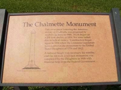
[Main Marker]:
This monument was erected by the State of Louisiana and the United States to commemorate the memorable victory won here by General Andrew Jackson and the men under his command in the Battle of New Orleans, January 8, 1815. . . . — — Map (db m59218) HM
1776
Whetstone Point shore battery
1794
Star Fort begun.
Later named for Washington’s Secretary of War
1795
Reservation partly acquired by the United States
1814
Gallant defence during British bombardment inspired the . . . — — Map (db m2569) HM
During the War of 1812, a circular 180° earthen artillery redoubt was erected as a defense for Fort McHenry. On September 13, 1814, Lt. George Budd commanded naval forces that assisted in repulsing a nighttime British attack on the Ferry Branch . . . — — Map (db m36849) HM
On August 24, 1814, British forces broke camp at Melwood Park and moved northwest to Bladensburg. The Baltimore militia, under the command of General Tobias Sansbury, was positioned west of the Anacostia River along the Bladensburg-Washington Road . . . — — Map (db m6069) HM
[Marker side facing south]
Describing the American victory of January 18, 1813, Capt. John McCalla of the 5th Kentucky, wrote: "I have seen the enemy, and I have seen him defeated. I have seen my fellow soldiers extended lifeless bloody . . . — — Map (db m20945) HM
Hull’s Trail was a rough passageway through Ohio to the Canadian border, used by General William Hull’s army during the War of 1812 on its way to attack the English at Detroit. Woodsmen cleared the trail to permit the Ohio Army Militia with its . . . — — Map (db m198037) HM
This tablet marks the site of Fort Seneca built in July 1813 by Major General William Henry Harrison during the War of 1812 with Great Britain; and also marks the military road known as the "Harrison Trail" blazed through the forest in 1812 by . . . — — Map (db m21948) HM
In September 1813 the British squadron under R. Barclay sailed from Amherstburg to collect desperately needed food supplies. They were met by the larger, more heavily armed American squadron commanded by O. Perry. The British had the initial . . . — — Map (db m37707) HM
[Text on the West Side]:
Battle of Chippawa
5 July 1814
In memory of all those who fought on this ground, many of whom are buried nearby,
and to commemorate the peace that has prevailed between Canada and the . . . — — Map (db m49393) HM