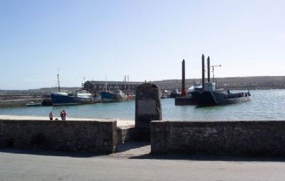
John Ridgeway & Chay Bylth
rowed the Atlantic in English Rose III
from Orleans to Kilronan, Aran,
Ireland 4th June 1966 - 3rd Sept. 1966
Na laga dia iad — — Map (db m22850) HM
This, one of the finest prehistoric fortresses in Western Europe, consists of three dry-stone ramparts, and the remains of a fourth, the outermost of which encloses an area of 11 acres.
Outside the second rampart there is a 30 foot band of . . . — — Map (db m109137) HM
Poet, Writer, Life-Long Worker
in the Irish Cause
was born in this house Sept. 29. 1854.
——•——
“For peace of mind I'll never find
until my own I call
that little Irish cailín
in her ould plaid . . . — — Map (db m28091) HM
Welcome to Port Corrúch Seal Colony
[First part of the marker is about the seal colony along the coastline and is not transcribed]
As you look across the North Sound you can see the Coast of Connemare and the Twelve pins of Connemara. Near . . . — — Map (db m22928) HM
Sraith Bhuí – The Yellow River Land
This is one of the finest megalithic tombs in Ireland. This particular example is a wedge tomb, so-called because of its shape, wider and higher at the entrance and gradually tapering towards . . . — — Map (db m28063) HM
Bún na hInes - Bottom of the River Meadow
This clapperbridge is a very unusual feature in the West of Ireland. The word clapper originally meant plank in the Sussex area of England, where there are many examples. Clapperbridges are a . . . — — Map (db m28058) HM
Monk's Fishing House
Fish was a staple in the diet of the mediaeval monastery, and this small building, probably built in the 15th or 16th century, is believed to have been used by the monks of Cong to make the task of catching fish a little . . . — — Map (db m28068) HM
This graveyard is now in the area known as Killeen. There is no trace of the early Christian church but there is a circular raised platform within the graveyard which could indicate where the original church stood. Tradition has it that if a . . . — — Map (db m28056) HM
Cluain Cearbhán - Meadow of the Buttercups
The Famine Museum in Louisburgh recounts local memories of the famine, presents coverage of the famine in the media, nationally and locally, and shows how links have been established . . . — — Map (db m28044) HM
Móinín - Small Bog
Lime Kilns date from the 18th century and were used until the 1940s in some areas. By lighting fires in these kilns and adding crushed limestone, lime was produced for use as fertiliser in the fields and also for . . . — — Map (db m27989) HM
Murrisk Abbey • site 6
Muraisc - Sea Marsh
Murrisk Abbey was founded circa 1456 by the Augustinian Friars because “the inhabitants of those parts have not hitherto been instructed in their faith.” It quickly . . . — — Map (db m27757) HM
Ag Críost an mhuir
Ag Críost an t-iasc
I líontaih Dé go gcastar sinn
This monument was erected to honour the
contributions of the traditional seafaring
fishing community in Murrisk.
We celebrate their memory and ask you to remember . . . — — Map (db m80404) HM
Murrisk - from Muraisc (Sea-marsh)
Murrisk Friary
This small house of Augustinian friars, located here on the south shore of Clew Bay in the shadow of Croagh Patrick, was founded in 1457 by Hugh O'Malley. It was dedicated . . . — — Map (db m27587) HM
To honour the memory of all who died, suffered and
emigrated due to the Great Famine of 1845 - 1850,
and the victims of all famines.
The Memorial was unveiled by the President of Ireland,
Mary Robinson, on 20 July 1997.
I gcuimhna . . . — — Map (db m27583) HM
In loving memory of
Squadron Leader
R.F.C. Garvey D.F.C. & Bar
Only son of J.C. & Gladys Garvey
Born at Murrisk Abbey 11th July 1918
Killed in a flying accident
at Shawbury, England,
on 14th January 1948 & buried there
Dearly . . . — — Map (db m28259) HM
To commemorate
the Hungry Poor
who walked here in 1849
and walk the Third World today
Freedom for South Africa 1994.
“How can men feel themselves
honoured by the humiliation
of their fellow beings.”
Mahatma Gandhi in . . . — — Map (db m27687) HM
IgCuimhne ar an maor
Seán Mac Giolla Bríde
Major John Mac Bride
Vice-Commandant
Irish Republican Army,
Major in the Army of the South
African Republic,
Organizer of the Transvaal
Irish Brigade,
who died for Ireland
5th . . . — — Map (db m27564) HM WM
This memorial was erected to
commemorate the memory of
Comdt. Patrick Glynn
Lieut. Michael Glavey
Vol. Michael Keane
who gave their lives for
the cause of freedom
during an attack on
Ballinlough R.I.C. Barracks
on Sept. . . . — — Map (db m27768) HM
Cruachan is traditionally said to be the inauguration place of the Kings of Connacht. There are a number of monuments spread over an area of about two square miles. These include a large mound, a number of differently-shaped enclosures and some . . . — — Map (db m28192) HM
This memorial is erected on the site
of the birthplace of
William Percy French
Born 1st May 1854
and commemorates his life as
engineer, song-writer, entertainer,
artist and journalist.
“Remember me is all I ask,
and yet if . . . — — Map (db m28177) HM
Rathmoyle Cemetery is unique in that it is the property of the parish and is maintained solely by the local population.
The site appeas on the 1st edition of the 6 inch O.S. series of maps for Co. Roscommon as a Mortuary Chapel with surrounding . . . — — Map (db m28204) HM
Fine example
of town's Georgian
architecture.
Home of Dr. Dudley Forde
popular medical practitioner
in this area for many years
Died 1945 — — Map (db m27557) HM
Ireland's National Monument
to the Fighting 69th Regiment &
Brigadier General Michael Corcoran
Unveiled by
The Honourable Major Michael R. Bloomberg
New York City
22 August 2006
John Perry T.D
Chariman
Ballymore Community . . . — — Map (db m85947) WM
We sent you our starving and our evicted
you gave them freedom and opportunity
1861-1865
You sounded the call of arms
We answered with loyalty and courage
We gave service, limb and life
To the honour and lasting memory of Irish . . . — — Map (db m85946) WM