Marker Logo HMdb.org THE HISTORICAL
MARKER DATABASE
“Bite-Size Bits of Local, National, and Global History”


2 entries match your criteria.  


Historical Markers in Jutiapa

 
Tamasulapa River Bridge Marker image, Touch for more information
By J. Makali Bruton, July 11, 2015
Tamasulapa River Bridge Marker
1 Guatemala, Jutiapa, Asunción Mita — Tamasulapa River Bridge
On Panamerican Highway, on the left when traveling east.
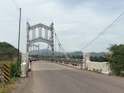
Rio Tamasulapa 1937 Erigido Cooperativamente por la Republica de Guatemala y los Estados Unidos de America English translation: Tamasulapa River 1937 Erected cooperatively by the Republic of Guatemala . . . Map (db m85317) HM
2 Guatemala, Jutiapa, San Cristóbal — Amatal River Bridge
On Panamerican Highway, on the right when traveling east.
Rio Amatal 1937 Erigido Cooperativamente por la Republica de Guatemala y los Estados Unidos de America English translation: Amatal River 1937 Erected cooperatively by the Republic of Guatemala and the . . . Map (db m85316) HM


CeraNet Cloud Computing sponsors the Historical Marker Database.
This website earns income from purchases you make after using our links to Amazon.com. We appreciate your support.
Paid Advertisement
Apr. 25, 2024