On National Route N81, 3 kilometers south of Leinster Route R756, on the left when traveling south.
Clocha an Phiobaíre
Tá 14 chloch mhóra eibhir, cuid acu ina seasamh agus cuid eile ina luí, so chiorcal cloch seo. Tá cloch mhór ina seasamh taobh amuigh den chiorcal ar an taobh thoir agus tá dhá chloch fhorimeallacha eile ar an . . . — — Map (db m135891) HM
On Church Lane, 0.3 kilometers north of Main Street (Leinster Route R747), on the right when traveling north.
Mainistir Bhealach Conglais
Ba é Diarmaid mac Murchú, an rí ar Laighean a bhain cáil amach dó féin nuair a thug sé na hAngla-Normannaigh go hÉirinn i 1169, a bhunaigh an mhainistir Chirstéirseach seo i 1148 mar chraobhtheach den . . . — — Map (db m135982) HM
On Main Street (Leinster Route R747) at Market Square, on the left when traveling east on Main Street.
To commemorate
the
heroism and sacrifices
of
Michael Dwyer
and
his faithful comrade,
Sam MacAllister,
and also
to perpetuate the memory
of those who participated
in the
Insurrectionary Movements
of
1798, 1803, . . . — — Map (db m135943) WM
On Main Street (Leinster Route R747) at Market Square, on the left when traveling east on Main Street.
In memory and honour of
Private Michael McGuinn,
Parkmore, Baltinglass,
And his comrades,
Killed in action at Niemba,
8th November 1960
While serving with the
United Nations Emergency Force
O.N.U.C. Congo,
"We . . . — — Map (db m135921) WM
Near Lake Drive, on the left when traveling south.
Named after a rebel scout who was beheaded here on 31st May 1798, but whose bravery saved c. 1000 men on Blackmore Hill. Ar dheis Dé go raibh a anam "May his soul be on the right hand of God" — — Map (db m117924) HM
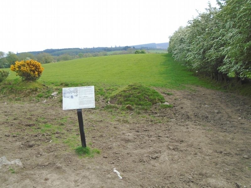
On Local Route L4321, 1.2 kilometers east of National Route N81, on the right when traveling east.
Ciorcal Cloch le Claífort Chaisleán an Ridire
Baineann an láthair seo le ceann de na cineálacha séadchomharthaí searmanais is neamhghnáthaí in Éirinn. Ciorcal cloch a thugtar ar an láthair san áit ach i ndáirire baineann sé leis . . . — — Map (db m135894) HM
These terraces were commenced in 1843
by Richard 6th Viscount Powerscourt
The first stone was laid by Mervyn Wingfield his son
————————————— . . . — — Map (db m135677) HM
Here lies
Tiny
Pet of John Slazenger
A miniature long-haired
Dachsund
Died 1965
Aged 7
and
Teddy
The first pet of Mervyn
and Wendy Wingfield
Died accidentally
Aged 2 . . . — — Map (db m135692) HM
On Local Route L1011, 0.6 kilometers east of Leinster Route R115, on the left when traveling east.
This military cemetery was constructed by the German War Graves Commission between 1959 and 1961. It is located, by agreement with the Government of Ireland, in this peaceful setting of an abandoned quarry beside the Glencree River. On . . . — — Map (db m135698) HM WM
On Local Route L1011, 0.6 kilometers east of Leinster Route R115, on the left when traveling east.
The general layout of the cemetery is fan-shaped with eight curved pathways alongside which the graves are laid out. The remains are buried in pairs with two names, where these are known, on each flat grave slab. The average age of the . . . — — Map (db m135749) HM WM
An Ardeaglais
Is í seo an eaglais is mó i nGleann dá Loch agus tá sí ar cheann de na heaglaisí is mó ó luathré na Críostaíochta in Eirinn. Is faoi choimirce Pheadair agus Phóil a bhí sí i dtosach, ach éiríodh as a húsáid mar . . . — — Map (db m135830) HM
An Cloigtheach
Mar is léir as a n-ainm bhaintí leas as na foirgnimh seo le clog a bhualadh uathu d'fhonn na manaigh a ghairm chun urnaí. 100 troigh ar airde atá an cloigtheach seo agus bhíodh sé urlár adhmaid ann - táid imithe anois. . . . — — Map (db m135831) HM
On Leinster Route R757, on the right when traveling east.
An Geata
Anois tá tú ag dul isteach i seanmhainstir Ghleann dá Loch, a bhunaigh Caoimhín sa 6ú haois agus a bhí faoi bhláth, d'ainneoin ionradh a dhéanamh uirthi ó am go ham, go dtí sa 17ú haois. Ba é an geata dúbailte seo, an t-aon . . . — — Map (db m135788) HM
To the affectionate memory
of
Revd Edward Rowan
Born at Dungarvan 7th April 1830
Died 28th September 1893,
who as parish priest of Blackditches
for nineteen years.
This cross is erected by
the parishioners of . . . — — Map (db m135790) HM
On Leinster Route R757, on the left when traveling east.
St. Kevin's Road is a walk of about 30 kilometers which has two alternative starting points (Hollywood and Valleymount), reflecting the different directions from which pilgrims to Glendalough are likely to have come during the medieval period, . . . — — Map (db m135836) HM
'Teach na Sagart'
Foirgneamh beag ón 12ú haois is ea 'Teach na Sagart', scrín nó aireagai b fhéidir. Os cionn an dorais tá blúire d'fhardoras ar a bhfuil eaglaiseach nó rí greanta agus ab ar gach aon taobh de bachail ag duine acu . . . — — Map (db m135833) HM
On Wicklow Gap Road (Leinster Route R756), on the left when traveling west.
D'oscail Comhlacht Mianadóireachta Éireann (1824-1890) an Mianach Hero sa bhliain 1827. In 1833 osclaíodh an Hero Nua thall sa ghleann agus forbraíodh an t-urlár cóireála chun amhluaidhe ón ngleann a scaradh ón gcarraig fhuílligh roimh . . . — — Map (db m135872) HM