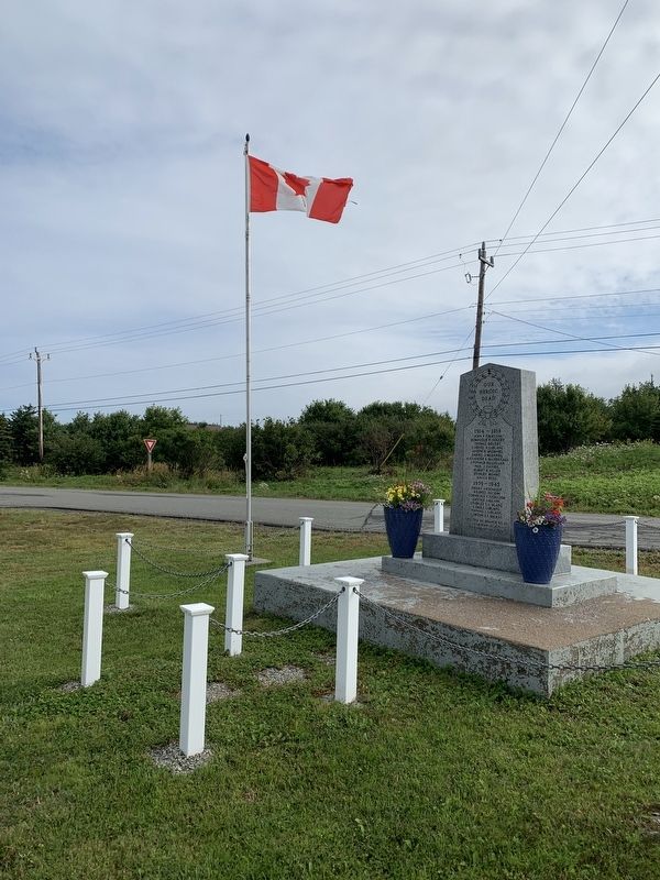
On Cabot Trail (Nova Scotia Route 19) at East Margaree Road, in the median on Cabot Trail.
1914-1918
John F. Chiasson
Dominique F. Doucet
Thomas Doucet
Gabriel A. LeBanc
Joseph H. McDaniel
Daniel J. McDaniel
Alexander E. MacDougall
J. Ronald MacLellan
Neil K. MacNeil
Albert B. Miller
Stanley Munro
Angus Ross . . . — — Map (db m139815) WM
En mémoire des paroissiens de Chéticamp
morts dans les deux guerres mondiales
In memory of the parishioners of Chéticamp who died in the two World Wars
1914 - 1918
Hypolite H. AuCoin
Hubert AuCoin
William W. . . . — — Map (db m139821) WM
The life story of Jeanne Dugas illustrates
the experiences of Acadíans in the second
half of the 18th century. She and her
family fled Ile Royale (Cape Breton Island)
to escape the deportation of 1758, but
were later captured by the . . . — — Map (db m139618) HM
1790-1990 On September 27, 1790, His Excellency William MacCormick, Governor of the Province of Cape Breton, graciously and generously granted
7 000 acres of land at Chéticamp to our «Quatorze Vieux». By this
historical act, our . . . — — Map (db m140169) HM
Near Cabot Trail just north of Barren Road, on the left when traveling north.
Français:
Dés l'année suivante, en 1927, M. J. Macfarland engage M. A. Boudreau à temps plein comme directeur-adjoint des opérations à Chéticamp. M. Boudreau s'occupe particulièrement de la comptabilité de la compagnie, . . . — — Map (db m139698) HM
Near Cabot Trail just north of Barren Road, on the left when traveling north.
Français:
Cette bouée ancrée dans le havre de Chéticamp permettait aux grands transatlantiques de tourner sur eux-mêmes. Elle avait été entièrement attachée avec des rivets chauds. Elle servit de 1928 à 1946.
. . . — — Map (db m139797) HM
Near Cabot Trail just north of Barren Road, on the left when traveling north.
Français:
La guerre met cependant fin aux opérations quand l'Angleterre réquisitionne les bateaux pour le ravitaillement des troupes. La dernière cargaison pour l'Angleterre fut déchargée en mer pour permettre au bateau de se . . . — — Map (db m139734) HM
Near Cabot Trail just north of Barren Road, on the left when traveling north.
Français:
Après plusieurs vaines tentatives de ressusciter l'entreprise, ce n'est qu'en 1926 que l'Atlantic Gypsum Company de Boston achète toutes les installations et engage M. Joseph MacFarland pour relancer l'exploitation de la . . . — — Map (db m139697) HM
Built in 1893, St-Pierre's Church majestically watches over
the Acadian community of Chéticamp. An imposing 212
feet long, 74 feet wide and with a steeple rising to 167 feet,
St-Pierre's lavish Baroque interior and original . . . — — Map (db m139872) HM
On Cabot Trail just north of Barren Road, on the left when traveling north.
Father Pierre Fiset, Chéticamp parish priest, is generally recognized as being responsible
for starting the gypsum mine in Chéticamp in 1907. When news broke that a prospector named Grandin had found gypsum in Chéticamp, Father Fiset . . . — — Map (db m139335) HM
Near Cabot Trail just north of Barren Road, on the left when traveling north.
Français:
On creuse un tunnel de l'entrepôt jusqu'à la mer, passant sous le chemin ; on construit un long quai recouvert dans lequel on achemine le gypse par convoyeur. Tous les travaux sont terminés en 1929, et au mois de juin de . . . — — Map (db m139696) HM
Near Cabot Trail just north of Barren Road, on the left when traveling north.
Français: Les affaires vont bien, on décide d'agrandir. Après le décès du Père Fiset, on emprunte 100,000$ pour construire une voie ferrée entre la carrière et le quai des Fiset. On achète une locomotive à vapeur avec dix wagons de . . . — — Map (db m139695) HM
On Cabot Trail close to Nova Scotia Route 19, on the right when traveling west.
English: Margaree is the proud birthplace of Dr. Moses Coady (1882-1959) and his double first cousin and mentor, Father Jimmy Tompkins (1870-1853), two men who devoted themselves to improving the minds and lives of the poor and uneducated. . . . — — Map (db m80070) HM
On Cabot Trail close to Nova Scotia Route 19, on the right when traveling west.
English:
A Canadian Heritage River, the Margaree has carved its way through Cape Breton since ancient times, creating the beautiful landscape and diversity of wildlife that has made this island famous. Essential for fishing, hunting and . . . — — Map (db m80069) HM
On Cabot Trail close to Nova Scotia Route 19, on the right when traveling west.
English:
The Margaree-Lake Ainslie River System, the largest on Cape Breton Island, includes the Margaree River, the Northeast and Southwest Margaree Rivers, and Lake Ainslie. From its origins in the Cape Breton Highlands, it . . . — — Map (db m80068) HM
They will never know the beauty of this
place see the seasons change, enjoy
nature's chorus, all we enjoy we owe to
them, men and women who lie buried in the earth of foreign lands and in the Seven Seas dedicated to the memory of Canadians who . . . — — Map (db m139476) WM
Near Cabot Trail, 6 kilometers east of Pleasant Bay Road, on the right when traveling east.
From the lone shieling of the misty island, mountains divide us, and the waste of seas – yet still the blood is strong, the heart is Highland, and we in dreams behold the Hebrides.
This shieling was erected in accordance with the terms of . . . — — Map (db m139857) HM
Near Trans Canada Highway (National Route 104) 0.5 kilometers west of Ceilidh Trail (Route 19), on the right when traveling west.
Making a Living in the Strait of Canso Area since 1784.
Transportation and Communication Early Years: Stage Coach Lines, Ferries, Mail Service Link, Telegraph Offices, American Consular Offices, Railroads, Boston Boats and Coastal . . . — — Map (db m139296) HM
Near Trans Canada Highway (National Route 104) 0.5 kilometers west of Ceilidh Trail (Route 19), on the right when traveling west.
English:
Work began on a causeway and canal complex between Cape Breton Island and mainland Nova Scotia in 1953 under a tri-party agreement between the federal Department of Transport, the Nova Scotia Department of Highways and . . . — — Map (db m139301) HM
Near Trans Canada Highway (National Route 104) 0.5 kilometers west of Ceilidh Trail (Route 19), on the right when traveling west.
English:
The Strait of Canso separates Cape Breton Island from the mainland of Nova Scotia. The Mi'kmaq were the original settlers in the area until the 1780's, when other settlements were established on both shores. Historically, . . . — — Map (db m139299) HM
Near Trans Canada Highway (National Route 104) 0.5 kilometers west of Ceilidh Trail (Route 19), on the right when traveling west.
English:
A canal is a manmade waterway connecting two bodies of water. When one body of water is higher than the other, the canal uses a lock, in this case, a tidal lock consisting of two sets of gates, to compensate for the . . . — — Map (db m139302) HM
Near Trans Canada Highway (National Route 104) 0.5 kilometers west of Ceilidh Trail (Route 19), on the right when traveling west.
English:
The foundation of this massive stone structure rests 66 metres below the Strait of Canso, creating the world’s deepest causeway. More than 9 million tonnes of rock fill were dumped into the strait between 1952 and 1955 . . . — — Map (db m139303) HM
On Cabot Trail, 0.2 kilometers north of Viev Moulin, on the left when traveling north.
English:
This monumentErected in memory of the 93 families who founded the parish of Saint Joseph du Moine. Was blessed by Reverend Charles Omer Cormier, and unveiled by Mr. and Mrs. Pat J. AuCoin on July 28, 1979 during the . . . — — Map (db m140308) HM
En memoire des défunts combattants
des dux guerres mondiales
In memory of the fallen soldiers of the two World Wars 1914 - 1918
Arsene F. Cormier
Daniel S. Leblanc
Jean D. Doucet
Elie P. Poirier
Jean S. . . . — — Map (db m139818) WM