24 entries match your criteria.
Historical Markers and War Memorials in Inverness County, Nova Scotia
By Steve Stoessel
Belle Côte War Memorial
| 1 ► Nova Scotia, Inverness County, Belle Côte — Belle Côte War Memorial — Our Heroic Dead — |
| On Cabot Trail (Nova Scotia Route 19) at East Margaree Road, in the median on Cabot Trail. | |||
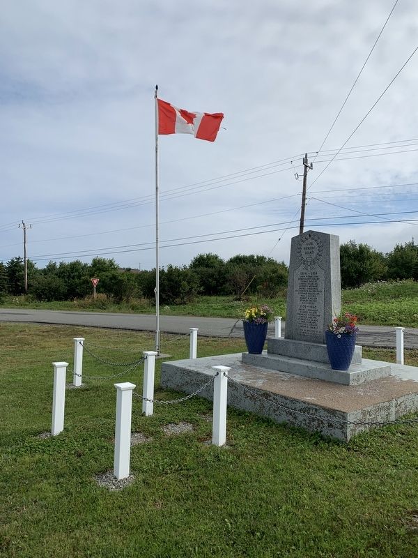
| 2 ► Nova Scotia, Inverness County, Cheticamp — Chéticamp War Memorial — Dieu et Patrie — For God and Country — |
| On Cabot Trail. | |||
| 3 ► Nova Scotia, Inverness County, Cheticamp — Jeanne Dugas — |
| On Cabot Trail. | |||
| 4 ► Nova Scotia, Inverness County, Chéticamp — 1790 - 1990 — La Société Saint-Pierre / Église Saint-Pierre — |
| On Cabot Trail, on the left when traveling north. | |||
| 5 ► Nova Scotia, Inverness County, Chéticamp — Dés l'année suivante, en 1927 / The following year, in 1927 — |
| Near Cabot Trail just north of Barren Road, on the left when traveling north. | |||
| 6 ► Nova Scotia, Inverness County, Chéticamp — La Bouée du havre / The Harbour Bouy — |
| Near Cabot Trail just north of Barren Road, on the left when traveling north. | |||
| 7 ► Nova Scotia, Inverness County, Chéticamp — La fin d'un rêve / The End of a Dream — |
| Near Cabot Trail just north of Barren Road, on the left when traveling north. | |||
| 8 ► Nova Scotia, Inverness County, Chéticamp — M. Joseph Macfarland / Mr. Joseph MacFarland — 1923-1947 — |
| Near Cabot Trail just north of Barren Road, on the left when traveling north. | |||
| 9 ► Nova Scotia, Inverness County, Chéticamp — The Cabot Trail — St. Pierre’s Church and Father Fiset/L'église Saint-Pierre et le Pere Fiset — |
| On Cabot Trail, on the left when traveling north. | |||
| 10 ► Nova Scotia, Inverness County, Chéticamp — The Gypsum Mine/La Mine De Plâtre — |
| On Cabot Trail just north of Barren Road, on the left when traveling north. | |||
| 11 ► Nova Scotia, Inverness County, Chéticamp — Tunnel et Quai de la mine / Tunnel and Mine Wharf — |
| Near Cabot Trail just north of Barren Road, on the left when traveling north. | |||
| 12 ► Nova Scotia, Inverness County, Chéticamp — Voie ferrée et « Lu vieille Louise » / The railroad and "The Old Louise" — 1910-1914 — |
| Near Cabot Trail just north of Barren Road, on the left when traveling north. | |||
| 13 ► Nova Scotia, Inverness County, Margaree Forks — Dr. Moses Coady and Father Jimmy Tompkins — Père Moses Coady, Ph.D., et Père Jimmy Tompkins — |
| On Cabot Trail close to Nova Scotia Route 19, on the right when traveling west. | |||
| 14 ► Nova Scotia, Inverness County, Margaree Forks — Margaree River — Rivière Margaree — |
| On Cabot Trail close to Nova Scotia Route 19, on the right when traveling west. | |||
| 15 ► Nova Scotia, Inverness County, Margaree Forks — The Margaree-Lake Ainslie River System — Le Réseau Fluvial Margaree-Lac Ainslie — The Canadian Heritage Rivers System / Le Réseau de rivières du patrimoine canadien — |
| On Cabot Trail close to Nova Scotia Route 19, on the right when traveling west. | |||
| 16 ► Nova Scotia, Inverness County, Petit Etang — Canada War Memorial — |
| On Cabot Trail when traveling north. | |||
| 17 ► Nova Scotia, Inverness County, Pleasant Bay — The Lone Shieling — |
| Near Cabot Trail, 6 kilometers east of Pleasant Bay Road, on the right when traveling east. | |||
| 18 ► Nova Scotia, Inverness County, Port Hastings — Canso Causeway — "Air Lorg Nan Eilean," The Road to the Isles — |
| Near Trans Canada Highway (National Route 104) 0.5 kilometers west of Ceilidh Trail (Route 19), on the right when traveling west. | |||
| 19 ► Nova Scotia, Inverness County, Port Hastings — Construction of the Canso Canal / Construction du Canal de Canso — |
| Near Trans Canada Highway (National Route 104) 0.5 kilometers west of Ceilidh Trail (Route 19), on the right when traveling west. | |||
| 20 ► Nova Scotia, Inverness County, Port Hastings — History of the Canso Canal / Historique du Canal de Canso — |
| Near Trans Canada Highway (National Route 104) 0.5 kilometers west of Ceilidh Trail (Route 19), on the right when traveling west. | |||
| 21 ► Nova Scotia, Inverness County, Port Hastings — Operation of the Canso Canal / Exploitation du Canal — |
| Near Trans Canada Highway (National Route 104) 0.5 kilometers west of Ceilidh Trail (Route 19), on the right when traveling west. | |||
| 22 ► Nova Scotia, Inverness County, Port Hastings — The Building of the Canso Causeway / La Construction de la Levée de Canso — |
| Near Trans Canada Highway (National Route 104) 0.5 kilometers west of Ceilidh Trail (Route 19), on the right when traveling west. | |||
| 23 ► Nova Scotia, Inverness County, Saint Joseph du Moine — Founders of the Parish of St-Joseph du Moine — Fondateurs de la Paroisse de St-Joseph du Moine — |
| On Cabot Trail, 0.2 kilometers north of Viev Moulin, on the left when traveling north. | |||
| 24 ► Nova Scotia, Inverness County, St. Joseph du Moine — St. Joseph du Moine War Memorial — |
| On Cabot Trail, on the left when traveling north. | |||