On Trans-Canada Highway (Provincial Highway 17) 0.1 kilometers east of Logos Land Road, on the right when traveling west.
Nearby was found in 1867 by Edward George Lee an Astrolabe bearing the date 1603. This instrument, used for determining latitude, is believed to have been lost by Champlain about 7th June, 1613, on his exploratory expedition up the Ottawa River. — — Map (db m105537) HM
Near Trans-Canada Highway (Provincial Highway 17) 0.3 kilometers west of Main Street.
The Father of New France, Samuel de Champlain, made the first of two voyages into what is now Ontario in 1613. He travelled up the Ottawa River seeking the northern sea (Hudson Bay) which one of his five companions, Nicolas de Vignau, claimed to . . . — — Map (db m105539) HM
On Dunlop Crescent, 0.1 kilometers north of Trans-Canada Highway (Provincial Highway 17), on the right when traveling north.
For over two centuries the Ottawa River was part of the main canoe route to the West. Some of the river's most spectacular and dangerous rapids were located immediately downriver from here: the Rapide de la Veillée, the Trou and the Rapide des Deux . . . — — Map (db m105622) HM
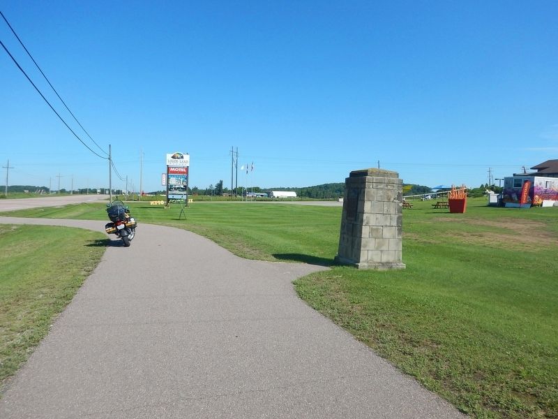
On Trans-Canada Highway (Provincial Highway 17) 0.4 kilometers east of Swisha Road (County Highway 635), on the right when traveling west.
On June 4, 1962 the Nuclear Power Demonstration (NPD) Reactor 3 km east of Rolphton supplied the Ontario power grid with the first nuclear-generated electricity in Canada. A joint project of Atomic Energy of Canada Limited, Ontario Hydro and . . . — — Map (db m105620) HM
On Provincial Highway 17, 0.1 kilometers west of Kirkwood Way, on the right when traveling east.
The first steamboat on the Upper Ottawa River was the 25 horse-power "Lady Colborne" built in 1833 for service between Aylmer and Chats Falls. Gradually other sections of the river where opened to steam navigation and in 1854 the "Pontiac" was . . . — — Map (db m105618) HM
On James Street, 0.1 kilometers north of Mary Street, on the right when traveling north.
Jeanne Lajoie, a dedicated teacher and advocate for the establishment of French schools in Ontario, was born in Lefaivre, near Hawkesbury, in 1899. In 1923, Lajoie helped a group of Francophone parents to establish the first independent French . . . — — Map (db m105544) HM
On Pembroke Street East (Provincial Highway 17) at Angus Campbell Drive, on the right when traveling south on Pembroke Street East.
Peter White, born in Edinburgh, was a merchant seaman when he was pressed into the Royal Navy in 1813 and sent to Canada. Following service on the Great Lakes under Commodore Sir James Yeo, he left the Navy and entered the lumber trade in the . . . — — Map (db m105542) HM
On Pembroke Street West at Riverside Drive, on the right when traveling west on Pembroke Street West.
Constructed primarily as a supply route to the lumber camps in the Upper Ottawa Valley, this Colonization Road was begun in 1853 and opened the following year as a winter road from Pembroke to the mouth of the Mattawa River. The relocating of a . . . — — Map (db m105547) HM
On Paquette Road (County Highway 55) at Petawawa Boulevard (County Highway 51), on the right when traveling west on Paquette Road.
The first military demonstration of aircraft flight in Canada was given at Petawawa Camp in August 1909, by J.A.D. McCurdy and F.W. Baldwin, with the assistance of the Royal Canadian Engineers. On the morning of 2 August, they made three successful . . . — — Map (db m105616) HM
On Railway Avenue just east of Raglan Street South (County Highway 60), on the left when traveling east.
In commemoration of the first meeting of the Municipal Council of the Village of Renfrew held on 30 August 1858, by petition to Her Majesty's Signet, Lord Lyon King of Arms, unto the town of Renfrew was granted on 9 September 1982 this coat of . . . — — Map (db m181244) HM
On Railway Avenue at Raglan Street South, on the right when traveling north on Railway Avenue.
This firebell was used from 1897 at the fire station on Duke Street.
It was moved to this tower and remained in use until 1963. — — Map (db m181235) HM
On Ragland Street South (County Highway 60) at Railway Avenue, on the left when traveling south on Ragland Street South.
Welcome to the Renfrew's Book Tree!
[Informational and not transcribed]
Renfrew's Book Tree means there are now 7 community Book Trees in Renfrew County - Arnprior, Killaloe, Petawawa, Pembroke, Cobden, Bonnechere Park on Round Lake and now . . . — — Map (db m181237) HM
On Railway Avenue just east of Raglan Street South (County Highway 60), on the left when traveling east.
Attracted by the development of the lumbering industry in the Upper Ottawa Valley, a few settlers had located in this region by 1830. Six years later Xavier Plaunt acquired land here near the second chute of the Bonnechère River and by 1848 was . . . — — Map (db m181233) HM
On Ragland Street South (County Highway 60) at Railway Avenue, on the right when traveling north on Ragland Street South.
To All Our
Honoured Dead
✠ ✠ ✠
"They shall not grow old,
as we that are left grow old;
age shall not weary them,
nor the years condemn.
At the going down of the sun
and in the morning we will . . . — — Map (db m181253) WM