The Historical Marker Database
A catalog of public history cast in metal, carved on stone, or embedded in resin
|
| HMdb.org |
Tel. +1 614 495-1232
Bill Pfingsten, Associate Editor
J. Makali Bruton of Accra, Ghana
Bernard Fisher of Richmond, Virginia
Michael Herrick of Southbury, Connecticut
James Hulse of Medina, Texas
Bill Pfingsten of Bel Air, Maryland
J. J. Prats of Powell, Ohio
Andrew Ruppenstein of Lamorinda, California
Kevin W. of Stafford, Virginia
TOPIC EDITORS
Bernard Fisher, Civil War Editor
Michael Herrick, Revolutionary War Editor
Bill Pfingsten, Colonial Era Editor
AK, DC, HI, IL, IN, MO, OH, WV
AZ, IA, KS, MI, MN, ND, NE, NM, OK, PR, SD, VI, WI
Caribbean, Central America, Mexico, South America
FL, GA, NC, SC, VA
CT, MA, ME, NH, NJ, NY, RI, VT
AL, KY, LA, MS, OR, TN, TX, WA
DE, MD, PA
AR, AS, CA, CO, FM, GU, ID, MH, MP, MT, NV, PW, UT, WY
Africa, Asia, Canada, Europe, Oceania
Mark Hilton, Series Editor
plus two more who wish to remain anonymous
To join our organization, add a marker, photo, link or commentary, or correct an error. You can do so anonymously.
A Note from the Publisher
Do you collect historical markers? Would you like to start?
There are a finite number of markers out there, and just like stamp or coin collecting, you can specialize and aim to collect all of a particular subject, geographical location, era, or whatever other category you come up with. The important thing is to make it interesting and enjoyable.
Maybe the better analogy would be bird watching. How many markers have you seen? How many have you stopped to read? For how many have you looked further into the history they describe, either by visiting the site they point out or looking up the person they commemorate in the encyclopedia or on the Internet?
There are a lot of historical marker collectors out there. And a lot of other folks who are fascinated by them and go out of their way to stop and read them.
If you’re a collector, or want to get started, consider uploading your discoveries to this site.
The database is in its acquisition phase and we look forward to your submissions. Creating a marker page is an easy, three–step process which is as simple as filling out an online questionnaire. You’ll find it on the Add-A-Marker link at the top of every page. Uploading photos is just as easy, via another questionnaire. After you click Submit on the last step you’ll see the marker page you created immediately and your entry will be queued for one of our editors to take a look at and publish. If we need any more information we’ll contact you. We get a lot of entries each week, so your patience is appreciated.
We’re also looking for folks who will add to the information on existing marker pages or start a nuanced discussion about the person, site, or event commemorated by a marker. Use the links at the top of every marker page to add commentary, links to other information, or additional photos relevant to the marker.
Welcome to the excitement of historical marker collecting. Please join me, my fellow editors, and all of the contributing correspondents—volunteers all—in building the most comprehensive catalog of local history on the Internet. And please let me know how we can make the site more useful to you. All suggestions are welcome.
J. J. Prats, Editor and Publisher
Powell, Ohio USA
+1 614 495-1232
Editorial Guidelines
This database stores permanent outdoors historical markers and commemorative plaques. It is not for memorials, dedication and donor plaques, survey disk “monuments” or gravestones. It is not a listing of historical sites. You will find photographs of memorials, dedication and donor plaques, survey disks, gravestones, and historical sites in this database, but they are shown because a historical marker pointed them out, or because the plaque, monument or gravestone was itself inscribed with a bit of history, qualifying it as a historical marker. For this database: no marker, no listing.
Here’s the rule: Marker must be outdoors, must be permanent, and must state historical or scientific facts beyond names, dates, and titles.
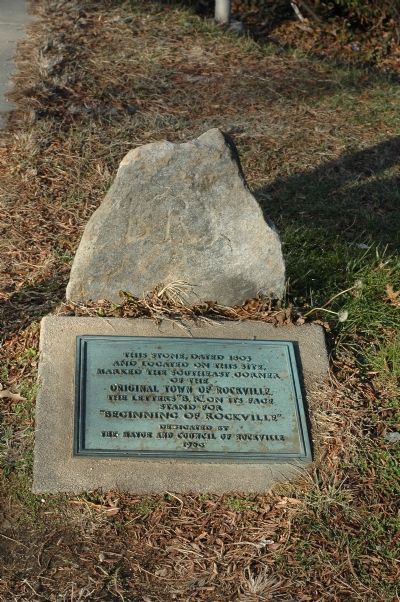
A distinction is made between a marker with historical significance—such as an old boundary marker—and a marker that has an inscription that describes the un-allowed marker with the historical significance. In this example, this historical boundary stone got included in the database because it had a historical plaque laying next to it. The first marker in this example, the boundary stone, would not be allowed into the database. The second marker in this example would. And because the second marker is allowed, its entry can contain photos, descriptions and commentaries about the first.
For the most part memorial and dedication plaques will not be allowed, including police and firefighter memorials. Most name and date the memorial, and follow with a list of names and titles. But if they enlighten the passerby with the reason or significance of the installation then they become historical markers and get in. “John Smith was a great public servant” does not enlighten. Neither does “John Smith died in the line of duty.” “John Smith served from 1889 to 1923 as Chief of Police” is just name, title and dates. But “John Smith was the first Chief of Police” or “John Smith reduced crime by 50%” could be argued into the database.
An exception is made for war memorials. These will be allowed in the database regardless of inscription (or lack thereof).
Blue Star Memorial Highway markers are not war memorials and are not considered historical markers unless they also contain historical facts (typically on a secondary tablet attached to the pole). Regrettably, most do not. It is the highway that is the memorial, not the marker. But they are welcome as an additional photo for a nearby historical marker or war memorial.
A second exception in these guidelines are National Register of Historic Places and other officially sanctioned brass tablets that simply name the historic building or site. They can only anchor a marker page when there is no other qualifying marker nearby. When there is one, it should be used to further illustrate that other marker’s page. When a qualifying marker subsequently arrives on the site, then the tablet’s page will be retired. The very rare NRHP or similar tablet that goes on to describe the reason the site is historic is of course a bona fide historical marker under our rules and will always be welcome to its own page.
The majority of grave markers are not allowed, no matter how historic, because they state no historical fact beyond name and dates. But if one is inscribed with a bit of history beyond just a recitation of the deceased’s titles or positions, then it may be allowed. Gravestone photographs are a welcome addition to a historical marker (nearby or not) that celebrates (or excoriates) the person.
Markers that exclusively discuss natural history (the study of animals and plants), geology, geography, and other non-historical facts do not qualify for inclusion in this database. The exception is when adding to a series of bona fide historical markers with one that would otherwise not qualify. This is an example of an allowable exception. Of course, when the marker also discusses history, then it qualifies.
Is the marker indoors? Indoor markers do not qualify, unless they were outdoors when they were first erected and moved indoors later. What about if they are sheltered out of the weather? A courthouse portico is outdoors but the courthouse lobby is indoors. A marker inside an open-air monument is out of doors. A covered railroad platform is generally outdoors, but an underground subway station is not.
You may occasionally find a database entry that violates these guidelines. These got in before the guidelines were tightened, or were snuck in when no one was looking. There should be very few of them and no, they will probably not be purged if you bring them to our attention. At the same time, they cannot be used to argue for the inclusion of your non-complying marker.
A photograph of the marker or plaque is almost always required. The marker may no longer be there, but if you have a photograph of a marker that was, then it will be accepted into the database. Proof of existence other than a photograph may be acceptable, at the discretion of the editor.
All markers must have map coordinates (latitude and longitude) before they are published. If you can’t provide them, an editor will guess the coordinates from the location information you supply. So please be very specific as to where your marker is located including which side of the road or which corner of the intersection.
Also see Typographic Guidelines.
Technical Information About This Site
This website has been designed and implemented and is maintained after-hours and off-the-clock. It went live January 1, 2006. Advertising on this site is clearly marked. We rent the space inside the advertising boxes to Google and Amazon.com who dynamically control what shows there. We also have links to Amazon.com books. This revenue is used to offset the cost of maintaining the site. This site does not launch pop-up or pop-under ads, your browsing is not tracked by us, and we won’t sell or give your name or email to anyone. (But we do sell space to advertisers and they may do things you do not like. Check our privacy policy for more information on what advertisers may do.)
This site is designed for recent versions of the following browsers: Mozilla Firefox, Google Chrome, and Microsoft Edge. It should also display well on other browsers. The only testing that is done is on the three browsers initially mentioned. Pages are rendered in Hypertext Markup Language (HTML) and its conjoined partner Cascading Style Sheets (CSS) with the occasional bit of JavaScript to move things along. Salvattore, an open-source browser-side JavaScript assist for masonry-tight block alignment, is used on the home page and some interior pages. A few pages use the so-called AJAX method (Asynchronous JavaScript And XML) to update portions of themselves on demand, except that Xtensible Markup Language (XML) has nothing to do with it.
The pages are Active Server Pages (ASP) written in Visual Basic Script (vbScript) that run on a Microsoft Internet Information Server (IIS). The vbScript code issues Standard Query Language (SQL) statements via the ActiveX Data Object (ADO) interface to the database, which has been implemented on a Microsoft SQL Server. Using the information fetched from the database, the code composes the HTML text that is transmitted to your browser for display. Photographs are uploaded, resized, rotated, cropped and stored with Persits Software’s AspUpload and AspJpeg components for IIS. The subscription feed is an XML page coded in Really Simple Syndication (RSS) protocol.
This database and website is currently running at a CeraNet Cloud Computing facility. CeraNet is headquartered in Columbus, Ohio.
Search Button. All text fields in the Main Marker Table records are indexed daily at 2:00 a.m. North American Eastern Time by the Microsoft Full-Text Index Service for linguistically-based searches that is provided with the SQL Server license. Since the Search button is searching the index and not the database itself, results are fast. But because the index is updated only once a day, new markers and additional information added today will not be found by searching until tomorrow. Another limitation of the system is that it can only search one table at a time. This means that text in photo captions, links, and comments are separately indexed. This is also why the search button does not find contributor's names.
Layout.The layout of the marker pages has been automated so that the same ASP page displays all markers, regardless of text length, information present or missing, and the number and dimensions of the photographs. Photographs are interspersed with the text and any remaining photographs are shown below the text side by side (when the browser width allows). Each photograph is tagged with a sequence number that determines the order of display on the page.
Two copies of each uploaded photograph are stored in the database: the original as uploaded, and a smaller copy no larger than 400 pixels on its longest dimension. The smaller copy is used for faster display on the marker page. The full-size copy is accessible by clicking on the smaller image.
Mapping. The nearby marker location algorithm has been designed to put as little strain on the SQL Server as possible This is done by first “drawing” a square with edges approximately 10 miles in each of the cardinal directions from the current marker to initially select only other markers that are inside the square. Then the more time-consuming Spherical Law of Cosines is used to obtain the distance to only the markers found within the square. Using the calculated distances, the nearest markers are selected. All this is done, without looping, in a single SQL Select statement: The square is “drawn” in the Where clause with a pair of Between predicates, the cosine calculation is performed in the Select list and an Order By sort with a Top keyword delivers the recordset. Because we made it easier for the computer by using a square rather than a circle, some markers near the corners of the square may be further than 10 miles away and may still make the list.
The maps themselves are courtesy of Google Maps and their Javascript Application Programming Interface (API). They provide us with a generous monthly allowance before they start charging.
Interactive County Maps. Many U.S. geographic marker lists display a small interactive map in a sidebar showing the pertinent county or equivalent and its surrounding jurisdictions. These maps are generated on-the-fly using Scalable Vector Graphics (SVG) coding that cobbles together U.S. Census Bureau public domain USA county polygons sourced from Wikimedia.org, and assisted by another public domain file: the County Adjacency File also from the U.S. Census Bureau. The sourced adjacency spreadsheet was converted to a database table and enhanced by adding the polygons from the first source, then programatically calculating and adding polygon bounding boxes so the mini-maps would center and scale correctly to the size of each county. The final enhancement is to manually add adjacent jurisdictions in Canada and Mexico. Javascript provides the interactivity.
Linking Information for Webmasters. You are encouraged to link directly to any page on the site. When markers pages are updated their ID may change. But you can link to specific marker pages with confidence because IDs are not reused and a Redirect will be left behind on the old page so that the correct page will automatically display.
With permission you may source your image tags to our server. But when you do, remember that you must also display the photographer’s name and the date of the photo, when shown; and this web site. For example use this format in small type,