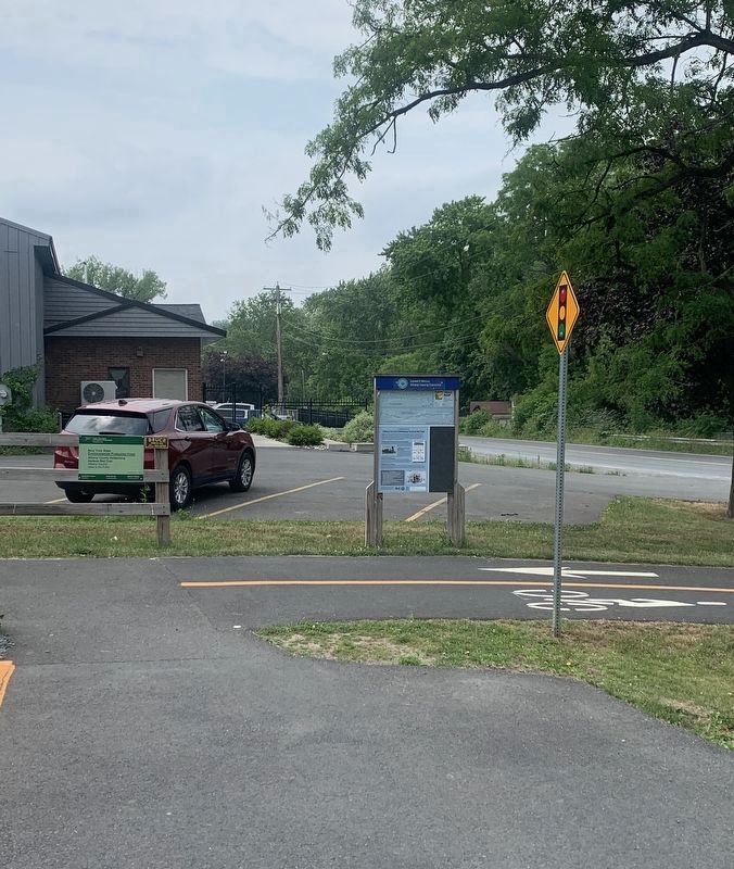
This trail is a 9-mile pathway which follows the old Albany and Susquehanna Railroad between Albany and Voorheesville. This pathway connects visitors with landscapes and communities, including the dramatic Normanskill Gorge in the City of Albany, . . . — — Map (db m185899) HM
In 2014, the Albany Pine Bush was designated
a National Natural Landmark by the U.S.
Department of the Interior in recognition of
outstanding geological and biological features
including the largest area of inland sand dunes
in the eastern . . . — — Map (db m191105) HM
This straight path, sometimes known as the "Knox Street Mall", is the only portion of Washington Park that follows the pattern of the surrounding urban grid. It marks the west side of what was known as Middle or Washington Square.
This . . . — — Map (db m144256) HM
Albany's coomercial growth boomed after
the Erie Canal was completed
in 1825. From a small basin,
barges entered the river through a final lock.
Lining a mile of the canal above the basin was in
the Lumber District, where towering piles . . . — — Map (db m227414) HM
In memory of Lou Rossi
1945-2020
NYSDOT Planner, lead founder of NYBC
Everyone in New York who loves bicycling
owes much to Lou Rossi. Smart and energetic,
he was the principal shaper of the state's
cycling infrastructure.
Two thousand . . . — — Map (db m227417) HM
In 1886 the site was unimproved: “wild and rugged in every respect.” Formerly known as Delaware Square, Delaware Park, Beaver Park — — Map (db m131656) HM
The Lakehouse that appears in these images is very different than the building that stands in front of you. The existing Lakehouse, designed by J. Russell White, was built of brick and terra cotta in 1929. It replaced the original 1875 wood . . . — — Map (db m144255) HM
In 1947, residents of Albany collected 300 tons of donated food, clothing, medical supplies, household goods and building materials to help rebuild Nijmegen, The Netherlands, which had been devastated by bombing and fighting during World War II. . . . — — Map (db m144257) HM
Attained its present form in the years 1869-1884 Design attributed to the concepts of renowned Landscape Architect Frederick Law Olmsted — — Map (db m138130) HM
Named in memory of
Hon. John Swinburne, M.D., Mayor
of Albany 1882-84. One of four
surgeon's to found Albany Medical
College. Member of Congress. — — Map (db m115735) HM
Orsini Park was carved from land the Albany & Susquehanna Railroad purchased from George Severson (1794-1883) in the early 1850s for the railroad's right-of-way. In addition to the railroad tracks, the land included room for a depot, . . . — — Map (db m131477) HM WM
Peebles Island State Park is located in the city of Cohoes (Albany County) and the village of Waterford (Saratoga County). Surrounded by the third and fourth branches of the Mohawk River, this 191-acre park includes Polrump, Goat, and Peebles . . . — — Map (db m115377) HM
Cluett, Peabody & Co., a Troy-based manufacturer of men's collars and shirts, purchased Peebles Island in 1909. The abundant water, existing rail lines, and proximity to the company's Troy factory made the island an ideal location for treating . . . — — Map (db m115364) HM
During the Revolutionary War, American troops camped on Van Schaick and Peebles Islands. Thaddaeus Kosciuszko, a prominent Polish engineer who aided the American cause, designed the earthworks that are visible today near the bridge to Waterford. . . . — — Map (db m115385) HM
You are looking at the northern tip of Van Schaick Island. The Hudson River flows to the east, and the third and fourth branches of the Mohawk River flow around the rest of this rocky island.
Dutch merchants Philip Pietersen Schuyler and Goosen . . . — — Map (db m115371) HM
This 70-acre property was donated to the Mohawk Hudson Land Conservancy by
Dr. Patricia Fox in 2015. Dr. Fox owned the property for over 30 years, and it is one of the last remaining areas of open space in this area of the Town of Colonie. Through . . . — — Map (db m147937) HM
This trail is a 9-mile pathway which follows the old Albany and Susquehanna Railroad between Albany and Voorheesville. This pathway connects visitors with landscapes and communities, including the dramatic Normanskill Gorge in the City of . . . — — Map (db m185901) HM
Al-Tro Park In the 19th and early 20th centuries the Hudson River Islands offered places of escape and amusement to residents of Albany and Troy. In the early 20th century, this was the location of Al-Tro Park, an amusement park on what was . . . — — Map (db m227339) HM
The Mohican Indians and
their ancestors lived in this
area along the Hudson.
River where the ocean tides
flowed. The name
Moh-He-Con-Nuck means
"People of the
Waters That Are
Never Still"
The Grandfather by artist
Len Tantillo, is set in . . . — — Map (db m230106) HM
A History of the Albany County Helderberg-Hudson Rail Trail This trail is a 9-mile pathway which follows the old Albany and Susquehanna Railroad between Albany and Voorheesville. This pathway connects visitors with landscapes and communities, . . . — — Map (db m142351) HM
The freight house and post office were central
businesses in small railroad communities. In
1864, a year after the first train came through, a
combination passenger and freight station was
built, which remains today near Kenwood Avenue.
In . . . — — Map (db m142349) HM
This trail is a 9-mile pathway which follows the old Albany and Susquehanna Railroad between Albany and Voorheesville. This pathway connects visitors with landscapes and communities, including the dramatic Normanskill Gorge in the City of . . . — — Map (db m185907) HM
You are standing in historic Astor Court, wit its symmetrical great lawn and surrounding classical buildings. The Wildlife Conservation Society, founded in 1895 as the New York Zoological Society, opened the Bronx Zoo in 1899.
A Foundation . . . — — Map (db m193296) HM
As seen on "The Zoo!"
Members of our nyala herd are descendents from the original herd dating back to 1941, when the Bronx Zoo opened the ground-breaking African Plains exhibit. It was the first exhibit in North America to show . . . — — Map (db m193277) HM
The 265 acre Wildlife Conservation Park/Bronx Zoo is the result of a partnership with New York City dating from 1895. The Zoo is operated by the Wildlife Conservation Society, a non-profit membership corporation, under City and State agreements. . . . — — Map (db m193298) HM
State-of-the-art in 1903
When the Lion House first opened in 1903, it featured state-of-the-art exhibits for that time. With the careful transformation of the building into Madagascar!, we continue to establish and maintain . . . — — Map (db m193294) HM
A Landmark Goes Green
The historic Lion House, originally built in 1903, has been updated to become New York City's first LEED* certified landmark building. The Lion House now uses 57% less energy than a conventional building—and . . . — — Map (db m193293) HM
These small gazelles may seem delicate, but antelopes like Thompson's Gazelle (also called Tommies) have to fight for mates, space, and to stay alive.
Fighting for Mates
All male antelopes have horns they use to fight each other over . . . — — Map (db m193280) HM
The Heinrich Heine Fountain (also known as the Lorelei Fountain) honors the German poet, writer, and social dissident Heinrich Heine (1797-1856), whose poem Die Lorelei immortalized the mysterious creature of romantic legend.
Born in . . . — — Map (db m228750) HM
The Heinrich Heine Fountain (also called The Lorelei Fountain) honors the German poet and writer (1797-1856) whose poem "Die Lorelei" immortalized the siren of Romantic legend. The marble sculptural group depicts Lorelei seated on a rock in the . . . — — Map (db m228752) HM
On this Co-Op City site in 1960-1964 was the entrance to Freedomland USA "The World's Largest Outdoor Entertainment Center" A true theme park shaped in the map of the United States with rides, attractions and performers depicting the history of our . . . — — Map (db m143192) HM
The Highbridge World War I Memorial, popularly known as the Highbridge Doughboy originally stood proudly at a small park triangle at Ogden and University Avenues in the University Heights or Highbridge section of the Bronx. It . . . — — Map (db m228746) HM
What was here before?
A creek, called Metipathe by the Lenape, once ran through this land into the Harlem River after following a course along what are now River and Jerome Avenues. When European settlers arrived, the creek was sold to John . . . — — Map (db m228714) HM
Marble Hill Playground is located on Marble Hill Avenue, between West 228th and West 230th Streets. The City of New York acquired this property, along with the area that comprises the Marble Hill Houses, on August 26, 1948. The Board of Estimate . . . — — Map (db m226347) HM
What was here before?
A Scottish surveyor named the Bronx neighborhood of Melrose in tribute to Sir Walter Scott's (1771-1832) popular work Melrose Abbey. This part of the southeastern Bronx was part of the land granted to the Morris . . . — — Map (db m241502) HM
This park at the intersection of Courtlandt Avenue, East 161st, and East 162nd Streets in the Bronx neighborhood of Melrose takes its name from the nearby railroad station.
A Scottish surveyor named the Bronx neighborhood of Melrose as a . . . — — Map (db m241504) HM
Mill Brook known as Acrahung by the indigenous Lenape people "Its waters once flowed, clear and crystal, through the Webster and Brook Avenues valleys." Now lost to the neighborhood. Its rainwater recharges the current Brook Mill . . . — — Map (db m209724) HM
What was here before?
In the 1930s, the Interborough Rapid Transit Company used this site for storage of materials used in subway operations. It also contained a field office of the Board of Transportation.
For several decades, this . . . — — Map (db m241535) HM
Padre Plaza honors Father Roger Giglio (1943-1990), founder of St. Benedict the Moor Neighborhood Center. A native of Woburn, Massachusetts, Father Giglio was ordained in 1970 and served as the director of the Christian Formation Retreat Center . . . — — Map (db m209734) HM
What was here before?
In 1938, a site adjacent to this playground was surveyed and acquired by the City. At that time, there were five brick residences along Alexander Avenue, ten wood-framed residences, and two garages along East 136th . . . — — Map (db m209721) HM
This playground is named for the Saw Mill Creek, also known as the Mill Brook, which once flowed by this parkland. The creek originated in Gates Place in the North Bronx, ran along what is now Brook and Webster Avenues, and emptied into the Bronx . . . — — Map (db m209723) HM
Vinmont Veteran Park serves as a memorial honoring local veterans who served their country in past wars. the park is named after both the surrounding Vinmont neighborhood and adjacent Vinmont Road. These, in turn, are named after Robert C. . . . — — Map (db m193300) HM
What was here before?
This site was once a tract of farmland owned by the Pugsley family in the early 19th century. The land became part of the Cobb and Larkin family farms in the late 1800s, until the City acquired it incrementally in the . . . — — Map (db m238051) HM
This limestone sculpture once stood at the top of the grandstand of Rice Stadium in Pelham Bay Park. The stadium, built in the early 1920s and funded through a gift of Julia Rice in memory of her late husband Isaac Rice, was demolished in 1989. . . . — — Map (db m226276) HM
How did this become a monument?
The efforts to create a Memorial Grove coincided with a plan to erect a unified monument that would honor all servicemen from the Bronx. Bronx Parks Commissioner Thomas J. Dolen submitted plans for the war . . . — — Map (db m226278) HM
The Power House, an engineering marvel of the 1920s, housed mechanical equipment vital to the operations of the Bronx Terminal Market.
The Power House
The only building remaining on the site of the Bronx Terminal Market, the . . . — — Map (db m241540) HM
Located at the convergence of the Chenango and Susquehanna Rivers, Confluence Park is the hub of the Two Rivers Greenway and a meeting of Binghamton’s past and present.
[captions] The South Washington Street Bridge, shown here, was designed by . . . — — Map (db m198124) HM
This park capitalizes on the natural beauty of the Susquehanna and Chenango Rivers, maintaining a strong vista of the river confluence. The hub of a network of Binghamton's riverfront greenways, the park was planned to provide safe public access to . . . — — Map (db m198126) HM
On February 11th Donald was driving a tractor fitted with a sweeper brush to remove snow from sidewalks. Donald noticed co-workers shoveling the sidewalks of this bridge. In an act of kindness he volunteered to clear the bridge sidewalks with his . . . — — Map (db m198180) HM
Allegany State Park's
Camp Allegany
This ca. 1930 photograph shows the original mess hall and double cabins
at Group Camp 11. Camp Allegany is one of Allegany State Park's 12 group camps. Constructed in 1928, the camp was designated Group . . . — — Map (db m119514) HM
During the early 1920s, campers at Allegany State Park stayed in large canvas tents acquired as World War I surplus. The original tents were improved by adding wooden sides. These hybrids were known as "tent cabins." Early campers at a tent cabin . . . — — Map (db m136279) HM
Site of first wild turkey trap & transfer program Allegany State Park Founding site for the N.Y.S. Conservation Dept. wild turkey trap & transfer program. Birds trapped at this site helped reintroduce the eastern wild turkey to the . . . — — Map (db m155753) HM
The Tornado On August 28, 1990, at approximately 6:15 PM, an F1 tornado swept through the Quaker Run drainage of Allegany State Park. This tornado was one of four that occurred in Western New York on that date. The tornado first touched down on . . . — — Map (db m136333) HM
In April of 1933, President Franklin D. Roosevelt established the Civilian Conservation Corps to serve two purposes. The first was to put young Americans to work and the second was to accomplish conservation projects nationwide. With a . . . — — Map (db m155418) HM
Sweet Water Spring Legend has it that the Sweet Water Spring gets its name from a Buffalo druggist who was in the area searching for gold with the property owner, N.L. Mr. Kysor. Evidently when the druggist tasted the water, he pronounced it . . . — — Map (db m60092) HM
Dedicated Nov. 15, 1888 on land given to city by Seward family. Bronze statue depicts William H. Seward delivering "Higher Law" speech to Senate — — Map (db m226039) HM
Picnic and recreation area opened in 1898 by Jamestown & Lake Erie Rwy. Visitors came via steam train, then by electric interurbans 1914 - 1947. — — Map (db m207727) HM
Saved through fundraising by Jamestown school teachers and students, this small forest became one of the first school parks in the nation in 1916. "Preserved by generations that are and for those that are to be." — — Map (db m172764) HM
Harbor Activity Timeline
2000
1982 First Harbor Day celebration. 1971 Last commercial fishing boat is sold. 1962 Lighthouse is re-lighted. 1960 Corps of Engineers builds Daniel Reed breakwall and pier. 1913 Trolley service ends. 1900 . . . — — Map (db m117525) HM
When Ausable Chasm opened to the public in 1870, access was limited to a couple of places, one being Table Rock from the Chasm rim via a long steep staircase. This changed in 1873 when Philadelphia entrepreneurs acquired lands along the Chasm's . . . — — Map (db m160734) HM
Each boat, and each boatman paining, made many trips down the Chasm a day (often 10-20). Getting 1-to 2-ton boats back upriver 1 mile (16 km) from the Boat Landing to Table Rock for another ride posed quite the challenge. So how was this done? . . . — — Map (db m160736) HM
Seneca R Stoddard, eminent Adirondacks photographer and guidebook author, penned these words about the Ausable Chasm (Kaz' m] Best Ride in 1890—
"Through a cleft in the lower edge of Table Rock we descend and enter the large bateaux . . . — — Map (db m160733) HM
The boat displayed here belonged to the last fleet of wooden boats used for the highly popular scenic boat tour of Ausable Chasm [Aw-SAY-bull Kaz-'m], enjoyed by millions of people since it began in 1873. Then—as now—the boat tour . . . — — Map (db m160731) HM
Bash Bish Creek cascades down more than 1300 feet from a spring-fed source in Mt. Washington, Massachusetts, through a picturesque gorge to meet the Roeliff Jansen Kill at the base of the Taconic Ridge. Bash Bish Falls, where the creek waters . . . — — Map (db m218651) HM
The Harlem Valley derives its name from "The New York and Harlem Railroad", chartered in 1831 and opened in lower Manhattan in 1832 with horse drawn cars. In 1842 the line crossed the Harlem River, and in 1873 joined the New York Central Railroad, . . . — — Map (db m245244) HM
The Harlem Valley derives its name from "The New York and Harlem Railroad," chartered in 1831 and opened in lower Manhattan in 1832 with horse drawn cars. In 1842 the line crossed the Harlem River, and in 1873 joined the New York Central . . . — — Map (db m116811) HM
Maps dating to the mid-19th century indicate that two dwellings once stood in this location. The homes were probably built in the early 1850's. One of the houses belonged to the first owner of the Copake Iron Works, Lemuel Pomeroy II, and later to . . . — — Map (db m135871) HM
The Taconic Mountain range is a part of the Appalachian Mountains that runs along the eastern border of New York. The range extends into western Connecticut and Massachusetts, terminating in Vermont. Taconic, translated from the Native American . . . — — Map (db m230387) HM
October 1777 marked a defining moment in Clermont's history. Seeking to put down the rebellious colonists, British forces burned Kingston, several private homes, and the Livingston estate. Upon receiving word of the potential danger only days . . . — — Map (db m149833) HM
The Lilac Walk, which connects the mansion with the Locust Avenue, was planted in the 1820s by Edward P. Livingston (1779–1843). A son-in-law of Chancellor Robert R. Livingston, he became Lt. Governor of New York State; his Jamaican birth . . . — — Map (db m149147) HM
Overlooking the Hudson River, this grassy strip paralleling the historic site's main parking lot was laid out as a road in the 18th century by Chancellor Robert R. Livingston. Meandering through the beautiful, irregularly planted locust trees for . . . — — Map (db m149863) HM
Frederic Church transformed a treeless hillside into
the wooded park you see across the lake. There, on 31
acres, he planted hundreds of trees and shrubs, singly
and in clumps, in a landscape design conceived in
the Picturesque Style (a . . . — — Map (db m132074) HM
was dedicated May 3, 1975 to honor the volunteers
and the nation. This fountain was made possible
through the generosity of the following:
[Concerned Citizens and Organizations] . . . — — Map (db m118546) HM
James Clark, who was born April 10th 1785 and died May 15th 1832, was, during the many years of his residence in the Village of Kinderhook, a public-spirited citizen, actively engaged in commercial pursuits and always foremost in every enterprise . . . — — Map (db m46702) HM
The Stockport Flats Reserve is a five-mile mosaic of landscapes with a rich diversity of plants and animals. Here you'll find tidal and non-tidal wetlands, floodplain forest, tidal flats, forested islands and an extensive tidal wetland at the mouth . . . — — Map (db m244941) HM
In 1900, electricity was a novel source of power
and light. This was also the dawn of the golden
age of amusement parks. Electrified passenger
rail line operators, some of whom generated their own
electricity, created "electric parks" as . . . — — Map (db m229674) HM
The Albany-Hudson Electric Trail follows the route of a thirty-seven-mile-long
electrified rail line that connected its namesake cities from 1900 to 1929. This
interurban line, which used electricity to power high-speed travel between cities
and . . . — — Map (db m242396) HM
This Park, a Bi-Centennial Eagle Scout Project developed by Keith Monthie
in cooperation with Town of Stuyvesant, and Chemetron Corp.
Dedicated in 1976
Stuyvesant Falls---1823 Also called "Third Falls" - 26 feet high,
Lower Falls, below the . . . — — Map (db m242403) HM
Why is It Called the Albany-Hudson Electric Trail?
The "AHET" name honors the trail's history as well as its present day use. The 36-mile rail-trail follows the route of an electric trolley that operated from 1899 to 1929 running from . . . — — Map (db m242409) HM
Why is It Called the
Albany-Hudson
Electric Trail?
The "AHET" name honors the trail's history as well as its
present-day use. The 36-mile rail-trail follows the route
of an electric trolley that operated from 1899 to 1929,
running from . . . — — Map (db m229754) HM
Factory Brook: Home to Cortland's fly fishing ambassador to the world. "I can't help but feel a bit sorry for those who have never fished with a fly rod" Nat'l. Trout Unlimited Pres. 1979 & 80 — — Map (db m226663) HM
Centuries ago, the land including this park was the site of a stockaded Indian village and burial knoll. Other Indian villages followed at intervals. The area is rich in Revolutionary history. In 1901, a factory was built on this and adjoining . . . — — Map (db m220624) HM
WELCOME TO HYDE PARK TRAILS
The Hyde Park Trail system includes over 14 miles of trails linking parks, preserves and historic sites throughout the town. Many of our trails follow wide and gentle woods roads left by generations of farms and . . . — — Map (db m210511) HM
WELCOME TO HYDE PARK TRAILS
The Hyde Park Trail system includes over 14 miles of trails linking parks, preserves and historic sites throughout the town. Many of our trails follow wide and gentle woods roads left by generations of farms and . . . — — Map (db m210665) HM
Welcome to the Winnakee Educational Arboretum!
Download the Winnakee Arboretum Guidebook App at
www.winnakeeland.org or scan QR below.
This 1.1 mile self-guided loop trail showcases many of the important native, naturalized, and . . . — — Map (db m210521) HM
WOODLANDS OF A GREAT ESTATE
The Winnakee Land Trust Nature Preserve was once part of the Crumwold estate, one of three magnificent Hudson River estates which supported the people of Hyde Park. Built by Colonel Archibald Rogers in the 1800s, . . . — — Map (db m210666) HM
In 1992, Walkway Over the Hudson was established to preserve the Poughkeepsie-Highland Railroad Bridge, transform it into a linear park and trailway and provide long-term stewardship. With public and private support, the bridge-to-park . . . — — Map (db m142779) HM
has been placed on the National Register of Historical Places in 1979 by The United States Department of the InteriorWilliam G. Pomeroy Foundation 2019 • 201 — — Map (db m136100) HM
First opened in 1889, the Poughkeepsie-Highland Railroad Bridge was the longest cantilevered and truss span bridge in the world. Reborn in 2009, Walkway Over the Hudson State Historic Park is the longest elevated pedestrian bridge in the world. . . . — — Map (db m142776) HM
History This beautiful hill, rising 550 feet above the Hudson River, has a long history. The region was first populated at the end of the last ice age, nearly 10,000 years ago, by bands of roaming hunter-gatherers who gradually established . . . — — Map (db m204987) HM
Carnwath Farms
On this day, the Members of the Town of
Wappinger Town Board assembled with invited
dignitaries and guests to dedicate this property,
known as Carnwath Farms, to be a place for the
arts, culture, history and leisure for the . . . — — Map (db m144445) HM
Mr. William Henry Willis built Carnwath Manor Home in 1850 and called it Carnwath Farms. The name is derived from a Manor home set in Scotland. Just after the ending of the Civil War, General Barclay purchased the estate from Mr. Willis. In 1870, . . . — — Map (db m144442) HM
813 entries matched your criteria. The first 100 are listed above. Next 100 ⊳