Stonycreek Township near Stoystown in Somerset County, Pennsylvania — The American Northeast (Mid-Atlantic)
Mayday!
Flight 93
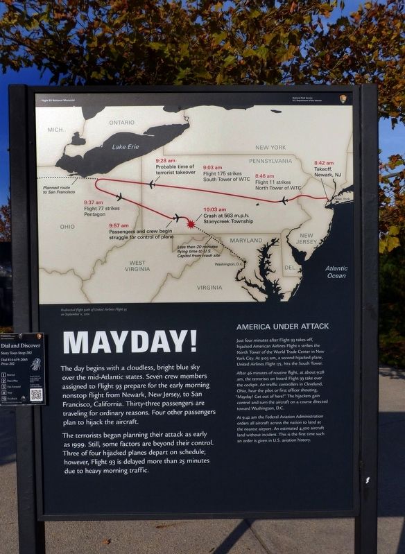
The day begins with a cloudless, bright blue sky over the mid-Atlantic states. Seven crew members assigned to Flight 93 prepare for the early morning nonstop flight from Newark, New Jersey, to San Francisco, California. Thirty-three passengers are traveling for ordinary reasons. Four other passengers plan to hijack the aircraft.
The terrorists began planning their attack as early as 1999. Still, some factors are beyond their control. Three of our hijacked planes depart on schedule; however, Flight 93 is delayed more than 25 minutes due to heavy morning traffic.
America Under Attack
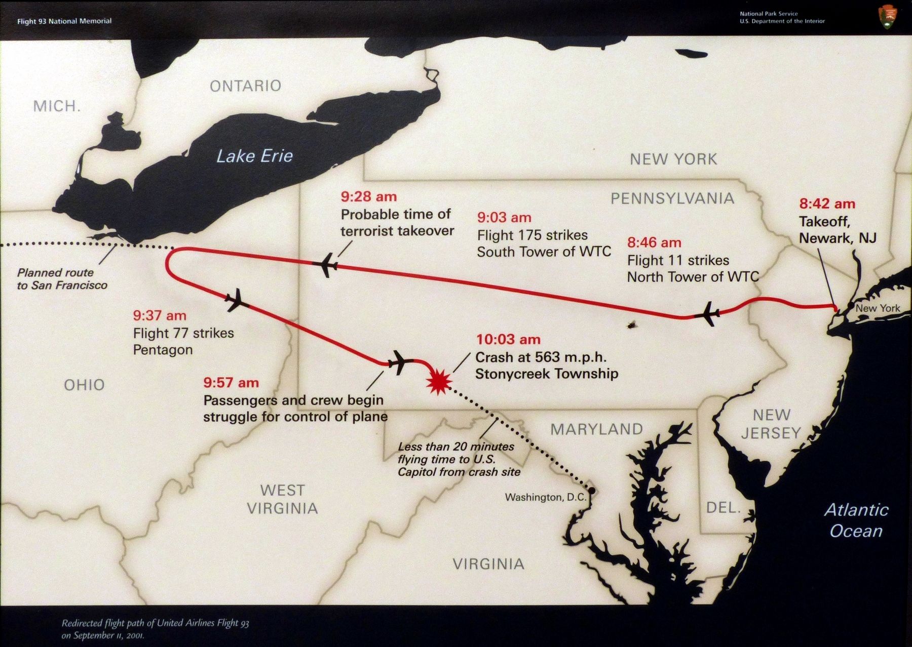
Just four minutes after Fight 93 takes off, hijacked American Airlines Flight 11 strikes the north Tower of the World Trade Center in New York City. At 9:03 am, a second hijacked plane, United Airlines Flight 175, hits the South Tower.
After 46 minutes of routine flight, at about 9:28 am, the terrorists on board Flight 93 take over the cockpit. Air traffic controllers in Cleveland, Ohio hear the pilot or first officer shouting, "Mayday! Get out of here!" The hijackers gain control and turn the aircraft on a course directed toward Washington, D.C.
At 9:42 am the Federal Aviation Administration orders all aircraft across the nation to land at the nearest airport. An estimated 4,500 aircraft land without incident. This is the first time such an order is given in U.S. aviation history.
Topics. This memorial is listed in these topic lists: 9/11 Attacks • Air & Space. A significant historical date for this entry is September 11, 2001.
Location. This marker has been replaced by another marker nearby. It was located near 40° 3.035′ N, 78° 54.083′ W. Marker was near Stoystown, Pennsylvania, in Somerset County. It was in Stonycreek Township. Memorial could be reached from Approach Road. Touch for map. Marker was in this post office area: Stoystown PA 15563, United States of America. Touch for directions.
Other nearby markers. At least 8 other markers are within walking distance of this location. America Attacked (here, next to this marker); Welcome to the Memorial Plaza (here, next to this marker); Threat in the Air (here, next to this marker); "In the cockpit. If we don't, we'll die!" (a few steps from this marker); Since September 11 (a few steps from this marker); The Investigation (a few steps from this marker); a different marker also named Welcome to the Memorial Plaza (within shouting distance of this marker); Crash Site and Debris Field (about 600 feet away, measured in a direct line). Touch for a list and map of all markers in Stoystown.
Regarding Mayday!. This marker was replaced sometime after 2016 with a revised marker, titled Threat in the Air. In addition to the new title, the text was revised and has a slightly different font.
Related marker. Click here for another marker that is related to this marker. The new marker: Threat in the Air
Credits. This page was last revised on April 25, 2024. It was originally submitted on December 26, 2016, by Allen C. Browne of Silver Spring, Maryland. This page has been viewed 727 times since then and 36 times this year. Photos: 1, 2, 3. submitted on December 26, 2016, by Allen C. Browne of Silver Spring, Maryland. • Bill Pfingsten was the editor who published this page.


