West Point in Clay County, Mississippi — The American South (East South Central)
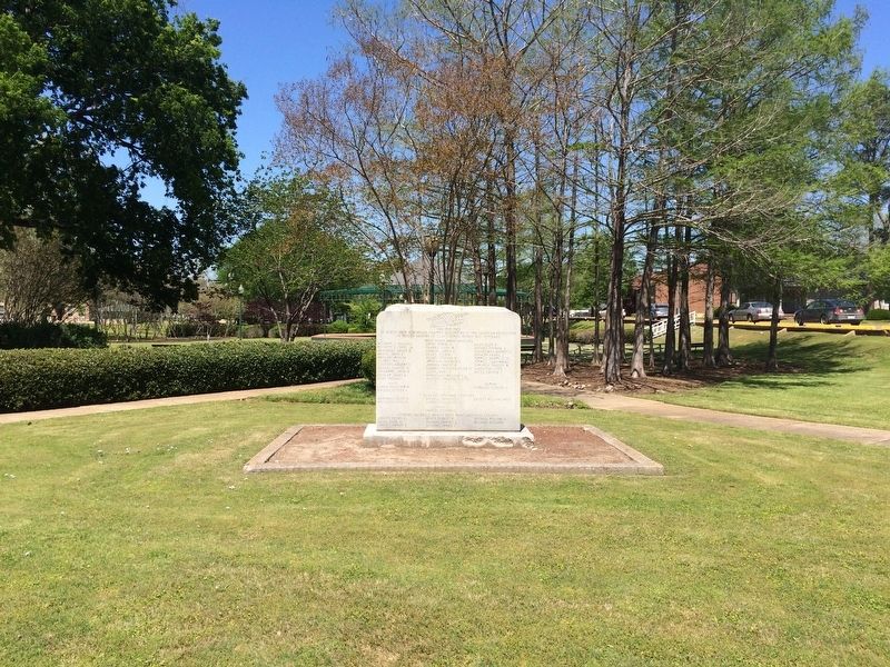
Clay County World War I Memorial
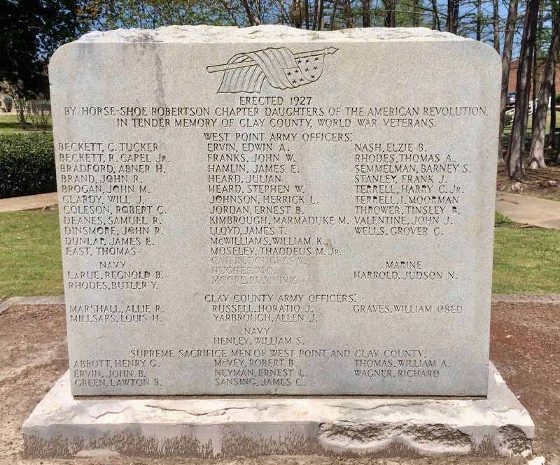
Front
Erected 1927 by Horse-Shoe Robertson Chapter Daughters of the American Revolution in tender memory of Clay County World War Veterans.
Navy - Marine
{List of names}
Clay County Army Officers:
{List of names}
Navy
Supreme sacrifice men of West Point and Clay County:
{List of names}
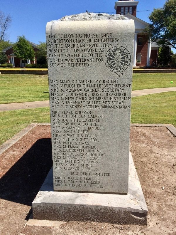
The Horse Shoe Robertson Chapter Daughters of the American Revolution wish to go on record as deeply grateful to the World War veterans for service rendered.
{List of chapter member names}
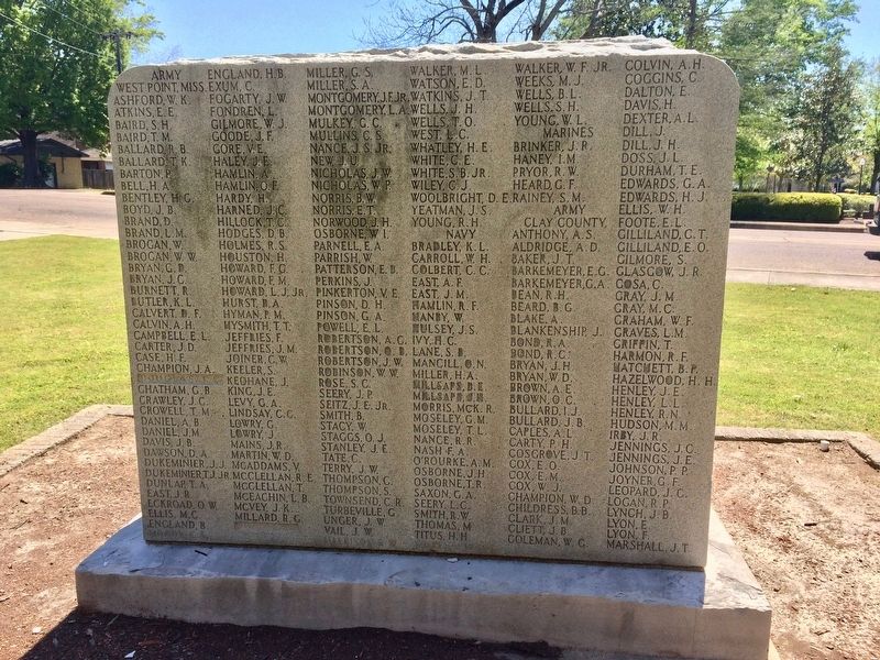
Rear
West Point, Miss. & Clay County
Army, Navy & Marines
{Lists of names}
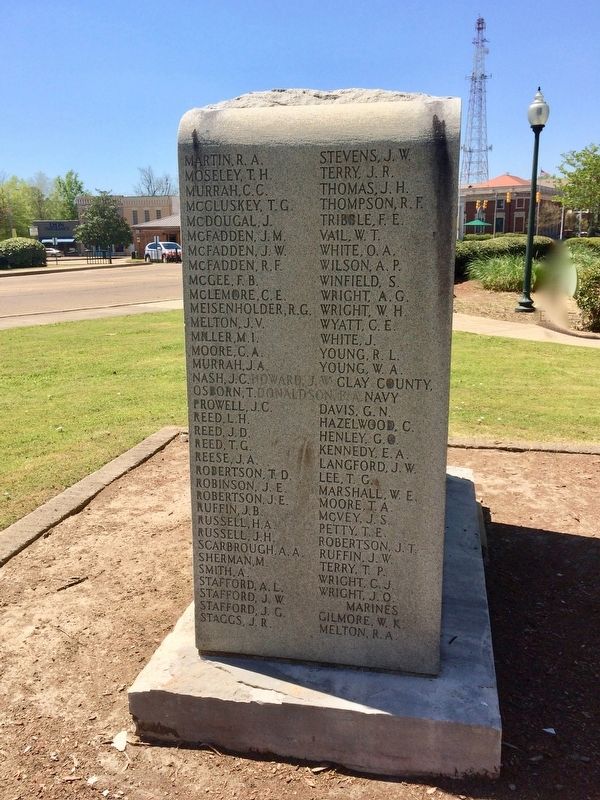
Right side
Clay County Army, Navy & Marines
{continuation of names}
Erected 1927 by Horse-Shoe Robertson Chapter Daughters of the American Revolution.
Topics and series. This memorial is listed in this topic list: War, World I. In addition, it is included in the Daughters of the American Revolution series list.
Location. 33° 36.298′ N, 88° 38.801′ W. Marker is in West Point, Mississippi, in Clay County. Memorial is on East Broad Street west of East Street, on the right when traveling west. Located in the southeast corner of West Point City Park. Touch for map. Marker is at or near this postal address: East Broad Street, West Point MS 39773, United States of America. Touch for directions.
Other nearby markers. At least 8 other markers are within 4 miles of this marker, measured as the crow flies. Howlin' Wolf (within shouting distance of this marker); West Point (about 300 feet away, measured in a direct line); Waverley (approx. 0.7 miles away); Mary Holmes College (approx. 1.2 miles away); Chickasaw Burial Ground (approx. 2.4 miles away); Prehistoric Indian Burial Mound (approx. 2.4 miles away); Indian Camp Ground (approx. 2.4 miles away); Payne Field Site (approx. 3.2 miles away). Touch for a list and map of all markers in West Point.
Credits. This page was last revised on August 21, 2017. It was originally submitted on August 21, 2017, by Mark Hilton of Montgomery, Alabama. This page has been viewed 242 times since then and 17 times this year. Photos: 1, 2, 3, 4, 5. submitted on August 21, 2017, by Mark Hilton of Montgomery, Alabama.
