Potomac Yard in Alexandria, Virginia — The American South (Mid-Atlantic)
Potomac Yard in Transition
City of Alexandria Est. 1749
— Potomac Yard —
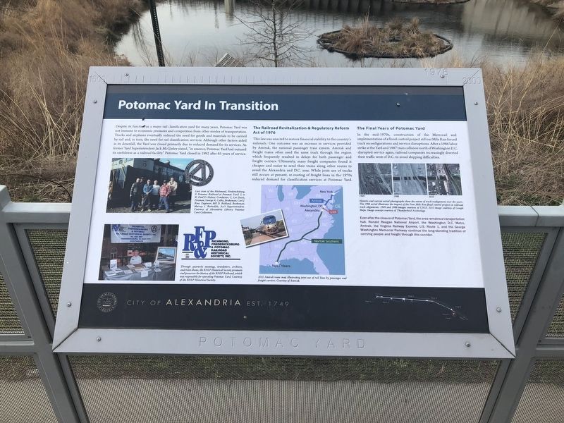
Despite its function as a major rail classification yard for many years, Potomac Yard was not immune to the economic pressures and competition from other modes of transportation. Trucks and airplanes eventually reduced the need for goods and materials to be carried by rail and, in turn, the need for rail classification services. Although other factors aided in its downfall, the Yard was closed primarily due to reduced demand for its services. As former Yard Superintendent Jack McGinley stated, "in essence, Potomac Yard had outused its usefulness as a railroad facility." Potomac Yard closed in 1992 after 85 years of service.
The Railroad Revitalization & Regulatory Reform Act of 1976
This law was enacted to restore financial stability to the country's railroads. One outcome was an increase in services provided by Amtrak, the national passenger train system. Amtrak and freight trains often used the same track through the region which frequently resulted in delays for passenger and freight carriers. Ultimately, many freight companies found it cheaper and easier to send their trains along other routes to avoid the Alexandria and D.C. area. While joint use of tracks still occurs at present, re-routing of freight lines in the 1970s reduced demand for classification services at Potomac Yard.
The Final Years of Potomac Yard
In the mid-1970s, construction of the Metrorail and implementation of a flood control project at Four Mile Run forced track reconfigurations and service disruptions. After a 1986 labor strike at the Yard and 1987 train collision north of Washington D.C. disrupted service again, railroad companies increasingly diverted their traffic west of D.C. to avoid shipping difficulties.
Even after the closure of Potomac Yard, the area remains a transportation hub. Ronald Reagan National Airport, the Washington D.C. Metro, Amtrak, the Virginia Railway Express, U.S. Route 1, and the George Washington Memorial Parkway continue the long-standing tradition of carrying people and freight through this corridor.
Erected by City of Alexandria.
Topics and series. This historical marker is listed in these topic lists: Industry & Commerce • Railroads & Streetcars. In addition, it is included in the Virginia, The City of Alexandria series list. A significant historical year for this entry is 1992.
Location. 38° 49.349′ N, 77° 2.942′ W. Marker is in Alexandria, Virginia. It is in Potomac Yard. Marker is at the intersection of Potomac Avenue and Main Line Boulevard, on the right when traveling east on Potomac Avenue. The marker stands in the Potomac Yard neighborhood of
Other nearby markers. At least 8 other markers are within walking distance of this marker. The Rail Yard Hump (within shouting distance of this marker); Crossroads of Transportation (within shouting distance of this marker); The Alexandria Almshouse (approx. ¼ mile away); The People of Potomac Yard (approx. 0.3 miles away); Potomac Town Hall and Firehouse (approx. half a mile away); Building Potomac Yard (approx. half a mile away); Corporal Charles William Hill (approx. half a mile away); St. Asaph Racetrack (approx. half a mile away). Touch for a list and map of all markers in Alexandria.
Credits. This page was last revised on January 27, 2023. It was originally submitted on March 30, 2018, by Devry Becker Jones of Washington, District of Columbia. This page has been viewed 271 times since then and 22 times this year. Photos: 1, 2. submitted on March 30, 2018, by Devry Becker Jones of Washington, District of Columbia. • Bernard Fisher was the editor who published this page.

