Climax in Lake County, Colorado — The American Mountains (Southwest)
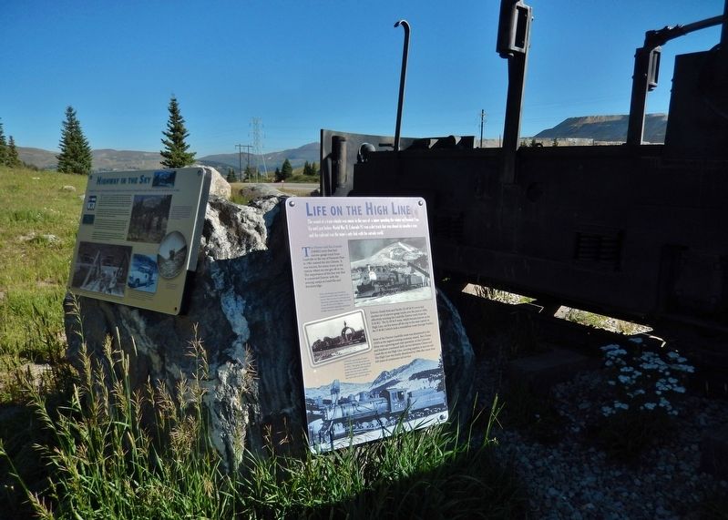
Life on the High Line
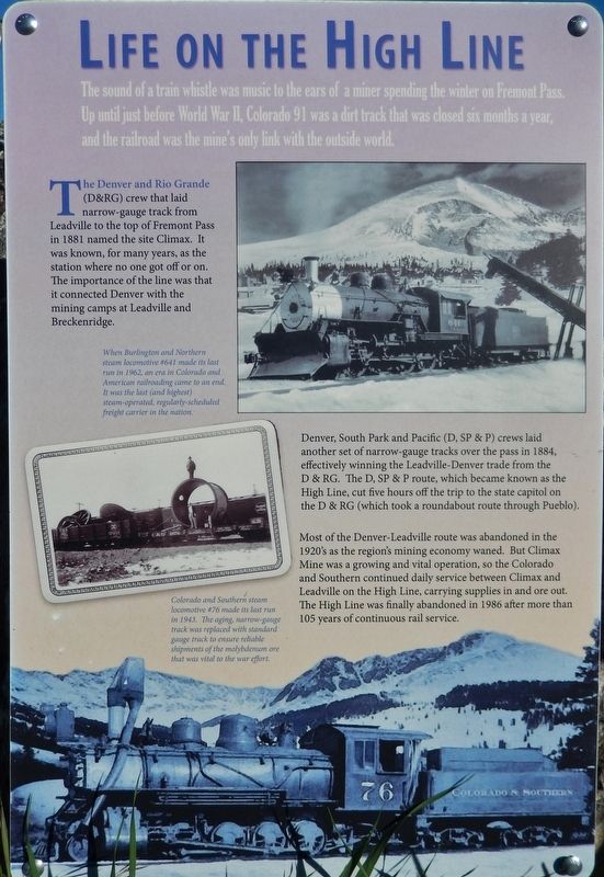
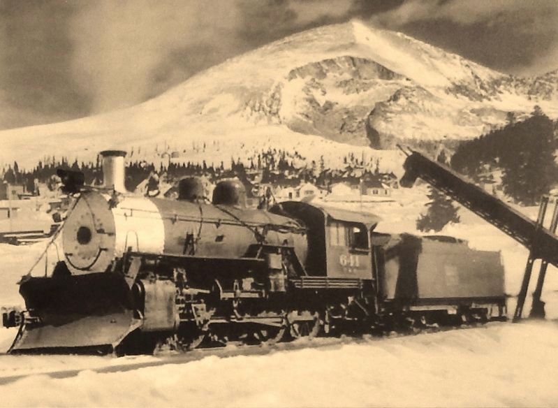
The Denver and Rio Grande (D&RG) crew that laid narrow-gauge track from Leadville to the top of Fremont Pass in 1881 named the site Climax. It was known, for many years, as the station where no one got off or on. The importance of the line was that it connected Denver with the mining camps at Leadville and Breckenridge.
Denver, South Park and Pacific (D, SP & P) crews laid another set of narrow-gauge tracks over the pass in 1884, effectively winning the Leadville-Denver trade from the D & RG. The D, SP & P route, which became known as the High Line, cut five hours off the trip to the state capitol on the D & RG (which took a roundabout route through Pueblo).
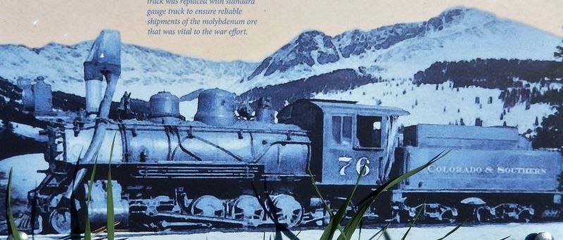
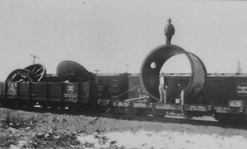
Most of the Denver-Leadville route was abandoned in the 1920's as the region's mining economy waned. But Climax Mine was a growing and vital operation, so the Colorado and Southern continued daily service between Climax and Leadville on the High Line, carrying supplies in and ore out. The High Line was finally abandoned in 1986 after more than 105 years of continuous rail service.
Erected by Climax Molybdenum Company & the Federal Highway Administration.
Topics. This historical marker is listed in these topic lists: Industry & Commerce • Railroads & Streetcars.
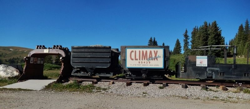
Location. 39° 22.053′ N, 106° 11.307′ W. Marker is in Climax, Colorado, in Lake County. Marker can be reached from State Highway 91, 11 miles south of Interstate 70, on the right when traveling south. Marker is located on the west side of Colorado Highway 91, at the summit of Fremont Pass, directly across from the Climax Molybdenum Mine, within a small park containing historical markers and mining exhibits. Touch for map. Marker is in this post office area: Climax CO 80429, United States of America. Touch for directions.
Other nearby markers. At least 8 other markers are within walking distance of this marker. Highway in the Sky (here, next to this marker); Welcome to Climax! (a few steps from this marker); The Big Shot (a few steps from this marker); Skiing on Top of the World (a few steps from this marker); More Than Just a Mine (a few steps from this marker); Top Secret (a few steps from this marker); Climax (within shouting distance of this marker); The Highest Compost Pile in the World (within shouting distance of this marker). Touch for a list and map of all markers in Climax.
More about this marker. Marker is a large composite plaque, mounted on a large boulder.
Related markers.
Click here for a list of markers that are related to this marker. Climax Historical Park
Also see . . .
1. The Colorado and Southern Railway Company. The Colorado and Southern narrow gauge lines were formed in 1898 from the Colorado Central and the Denver, South Park and Pacific Railroads. The last narrow gauge operation between Leadville and the Climax mines was converted to standard gauge due to heavy traffic from World War II. The last Colorado and Southern narrow gauge train, pulled by engine 76, ran the 28 mile roundtrip on August 25, 1943. The next day standard gauge trains began hauling the load. The C&S narrow gauge was now part of history. (Submitted on September 3, 2018, by Cosmos Mariner of Cape Canaveral, Florida.)
2. D&RGW Leadville Branch History. In 1880, narrow gauge rails were extended from the gorge through Salida to Malta, where California Gulch opens out into the Arkansas River valley. At that point, the Rio Grande track crews headed northeast via Leadville towards Fremont Pass and the eventual endpoint of Robinson, on the other side of the Continental Divide. While the section beyond Leadville - to become known as the Blue River Branch - was a near complete failure, the Malta to Leadville segment (aka the Leadville Branch) would become an important source of traffic for the Grande for sixty
years. (Submitted on September 2, 2018, by Cosmos Mariner of Cape Canaveral, Florida.)
Credits. This page was last revised on September 6, 2018. It was originally submitted on September 2, 2018, by Cosmos Mariner of Cape Canaveral, Florida. This page has been viewed 427 times since then and 35 times this year. Photos: 1, 2, 3, 4, 5, 6. submitted on September 3, 2018, by Cosmos Mariner of Cape Canaveral, Florida. • Andrew Ruppenstein was the editor who published this page.
