La contribution des troupes allemandes à la défense du Canada
The Contributions of German Troops to the Defence of Canada
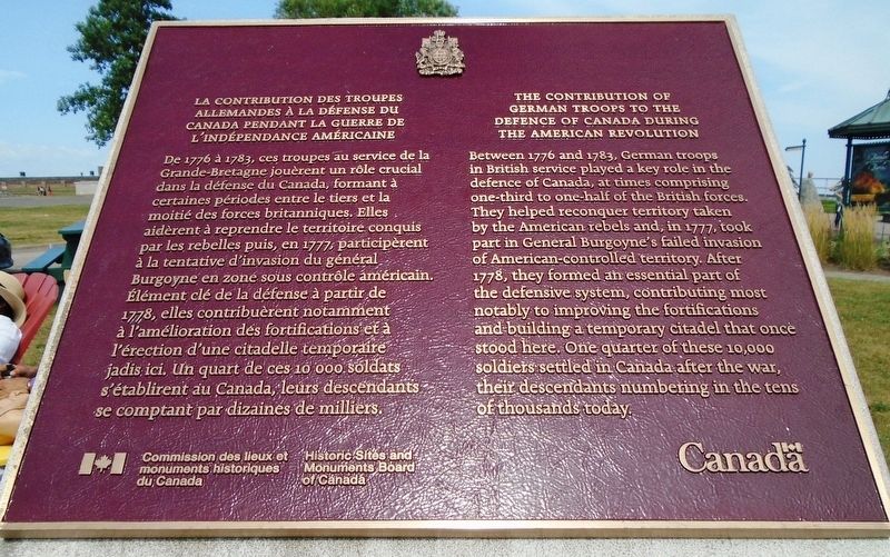
La contribution des troupes allemandes à la défense du Canada pendant la guerre de l'indéndance américaine
De 1776 à 1783, ces troupes au service de la Grande-Bretagne jouèrent un rôle crucial dans la défense du Canada, formant à certaines périodes entre le tiers et la moitié des forces britanniques. Elles aidèrent à reprendre le territoire conquis par les rebelles puis, en 1777, participèrent à la tentative d'invasion du général Burgoyne en zone sous contrôle américain. Élément clé de la défense à partir de 1778, elles contribuèrent notamment à l'amélioration des fortifications et à l'érection d'une citadelle temporaire jadis ici. Un quart de ces 10 000 soldats s'établirent au Canada, leurs descendants se comptant par dizaines de milliers.
The Contributions of German Troops to the Defence of Canada During the American Revolution
Between 1776 and 1783, German troops in British service played a key role in the defence of Canada, at times comprising one-third to one-half of the British forces. They helped reconquer territory taken by the American rebels and, in 1777, took part in General Burgoyne's failed invasion of American-controlled territory. After 1778, they formed an essential
part of the defensive system, contributing most notably to improving the fortifications and building a temporary citadel that once stood here. One quarter of these 10,000 soldiers settled in Canada after the war, their descendants numbering in the tens of thousands today.Erected by Commission des lieux et monuments historiques du Canada / Historic Sites and Monuments Board of Canada.
Topics and series. This historical marker is listed in these topic lists: Settlements & Settlers • War, US Revolutionary. In addition, it is included in the Canada, Historic Sites and Monuments Board series list. A significant historical year for this entry is 1776.
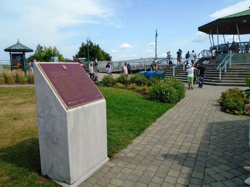
Location. 46° 48.28′ N, 71° 12.531′ W. Marker is in Québec, in Communauté-Urbaine-de-Québec. It is in Vieux-Québec-Cap-Blanc-colline Parlementaire. Marker is on avenue du Cap-Diamant, on the right when traveling north. Marker is in the Battlefields Park, near the Governor's Promenade and Kiosk south of the Citadel. Touch for map. Marker is in this post office area: Québec G1R, Canada. Touch for directions.
Other nearby markers. At least 8 other markers are within walking distance of this marker. Abraham Martin (a few steps from this marker); Les gouverneurs généraux à l'honneur (within shouting distance of this marker); The Quebec Conferences (approx. 0.3 kilometers away); The Québec Citadel (approx. 0.3
Also see . . . German Canadians, in The Canadian Encyclopedia. (Submitted on September 12, 2018, by William Fischer, Jr. of Scranton, Pennsylvania.)
Credits. This page was last revised on February 9, 2023. It was originally submitted on September 12, 2018, by William Fischer, Jr. of Scranton, Pennsylvania. This page has been viewed 189 times since then and 17 times this year. Photos: 1, 2. submitted on September 12, 2018, by William Fischer, Jr. of Scranton, Pennsylvania.

