Blacksburg in York County, South Carolina — The American South (South Atlantic)
Kings Mountain Battlefield Trail
Kings Mountain National Military Park
— National Park Service, U.S. Department of the Interior —
Erected by National Park Service, U.S. Department of the Interior.
Topics. This historical marker is listed in this topic list: War, US Revolutionary. A significant historical date for this entry is October 7, 1780.
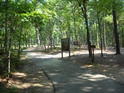
Location. 35° 8.549′ N, 81° 22.609′ W. Marker is in Blacksburg, South Carolina, in York County. Marker can be reached from Kings Mountain Park Road, on the right when traveling east. Located at the start of a 1.5 mile trail around Kings Mountain Battlefield. Touch for map. Marker is in this post office area: Blacksburg SC 29702, United States of America. Touch for directions.
Other nearby markers. At least 8 other markers are within walking distance of this marker. Fighting in a Forest Primeval (within shouting distance of this marker); God Save the King! (about 400 feet away, measured in a direct line); Liberty! (about 400 feet away); Major Winston's (about 400 feet away); Carolina Backwoodsmen (about 400 feet away); Two Parks, One Mountain (about 500 feet away); Americans Vanquished (about 500 feet away); American Victors (about 600 feet away). Touch for a list and map of all markers in Blacksburg.
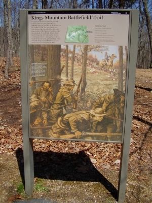
More about this marker. In the upper center is a map of the battlefield indicating the location of the visitor center, the trail head, and the trail. Ironically although an army loyal to the king fought here in 1780, this mountain was not named for King George, but for a local settler family.
The lower half of the marker is a depiction of the fighting. Patriot leader and future President John Adams once guessed that during the American Revolution about one-third of the population supported independence, one-third supported the King, and one-third stayed out of the fight. The bitter fighting here in South Carolina reveals that the Revolution was Americas' first civil war.
Also see . . .
1. Kings Mountain National Military Park. National Park Service (Submitted on September 10, 2019.)
2. Kings Mountain National Military Park, Historic Resource Study (pdf file). National Park Service (Submitted on September 10, 2019.)
Additional commentary.
1. Trail information on the marker
Battlefield Trail
• Trail is paved, 1.5 miles round-trip
• Allow one hour to walk.
• Moderate to steep grades
• Use wheelchairs or strollers with caution
• Please stay on trails to prevent erosion.
• Relic hunting or damaging resources is prohibited. Report any suspicious behavior to a ranger.
— Submitted July 6, 2020.
Credits. This page was last revised on July 6, 2020. It was originally submitted on April 5, 2009, by Stanley and Terrie Howard of Greer, South Carolina. This page has been viewed 1,148 times since then and 13 times this year. Last updated on October 19, 2018, by Bruce Guthrie of Silver Spring, Maryland. Photos: 1. submitted on April 5, 2009, by Stanley and Terrie Howard of Greer, South Carolina. 2. submitted on August 22, 2010, by Bill Coughlin of Woodland Park, New Jersey. • Bernard Fisher was the editor who published this page.

