Korčula in Opcina Korcula, Dubrovnik-Neretva, Croatia — Central and Southeastern Europe
The Memorial Tablet
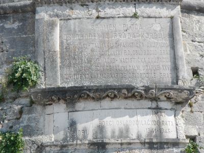
Spomen Ploča
Croatian:
25.IV.1941 - Talijansko-Fasisticka Okupacija
9.IX.1943 - Korčulanski P.O.Oslobodio Grad
23.IX.1943 - Njemačko - Nacistička Okupacija
13.IX.1944 - Jedinice Slavne Dalm. Udarne XXXVI
Divizije N.O.V.J. I Mornarice Oslobodile Grad
Na Sjecanje Pokoljenɉima!
Borci Oslobodilačkog Rata - 1941-1945
English translation:
Liberation of the City of Korcula
25.IV.1941 - Italian-Fascistic Occupation
9.IX.1943 - Korčulanski P.O. Free City
23.IX.1943 - German - Nazi Occupation
13.IX.1944 - Unity Slaves Dalm. Hit his XXXVI
Divisions N.O.V.J. And the Navy Get Free City
To Remember the Hells!
Liberation Warrior Fighters - 1941-1945
Erected 1951.
Topics. This memorial is listed in this topic list: War, World II. A significant historical year for this entry is 1941.
Location. 42° 57.665′ N, 17° 8.088′ E. Marker is in Korčula, Dubrovacko-neretvanska (Dubrovnik-Neretva), in Opcina Korcula. Memorial is on Obala Franje Tuđmana close to Foša, on the right when traveling north . Touch for map. Marker is in this post office area: Korčula, Dubrovacko-neretvanska 20260, Croatia. Touch for directions.
Other nearby markers. At least 5 other markers are within walking distance of this marker. The Town of Korčula (within shouting distance of this marker); Silk Road (about 150 meters away, measured in a direct line); Marco Polo (about 150 meters away); The Naval Battle in the Waters Off Korčula (about 150 meters away); Reconstruction of the House of Marco Polo 2015.-2020. (about 150 meters away).
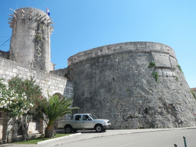
More about this marker. The memorial tablet is on the Velika kneževa kula (Great Prince's Tower) on the outside wall of Old Town.
Credits. This page was last revised on February 10, 2022. It was originally submitted on December 5, 2018, by Barry Swackhamer of Brentwood, California. This page has been viewed 160 times since then and 7 times this year. Photos: 1, 2. submitted on December 5, 2018, by Barry Swackhamer of Brentwood, California.

