Oil City in Venango County, Pennsylvania — The American Northeast (Mid-Atlantic)
Rynd Farm
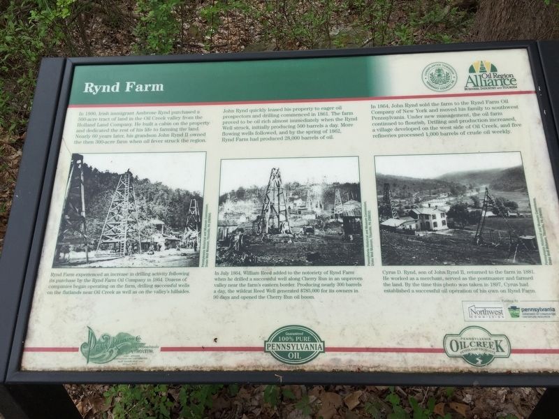
In 1800, Irish immigrant Ambrose Rynd purchased a 500-acre tract of land in the Oil Creek from the Holland Land Company. He built a cabin on the property and dedicated the rest of his life to farming the land. Nearly 60 years later, his grandson John Rynd II owned the then 300-acre farm when oil fever struck the region.
John Rynd quickly leased his property to eager oil prospectors and drilling commenced in 1861. The farm proved to be oil rich almost immediately when the Rynd Well struck, initially producing 500 barrels a day. More flowing wells followed, and by the spring of 1862, Rynd Farm had produced 28,000 barrels of oil.
In 1864, John Rynd sold the farm to the Rynd Farm Oil Company of New York, and moved his family to southwest Pennsylvania. Under new management, the oil farm continued to flourish. Drilling and production increased, a village developed on the west side of Oil Creek, and five refiners processed 1,000 barrels of crude oil weekly.
Erected by Venango County, Oil Region Alliance.
Topics. This historical marker is listed in this topic list: Industry & Commerce. A significant historical year for this entry is 1800.
Location. 41° 28.925′ N, 79° 41.661′ W. Marker is in Oil City, Pennsylvania, in Venango County. Marker can be reached from the intersection of Pennsylvania Route 8 and Old Bankson Road. In trailhead parking lot. Touch for map. Marker is in this post office area: Oil City PA 16301, United States of America. Touch for directions.
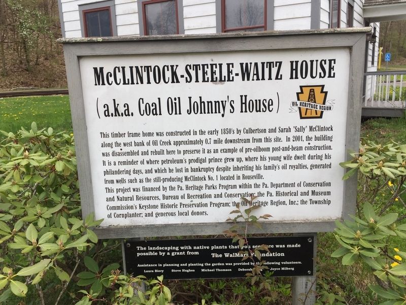
Other nearby markers. At least 8 other markers are within 3 miles of this marker, measured as the crow flies. McClintock-Steele-Waitz House (about 500 feet away, measured in a direct line); Henry R. Rouse (1823-1861) (approx. 0.9 miles away); McClintock Well #1 (approx. 1˝ miles away); McClintock's Story (approx. 1˝ miles away); H. McClintock Farm (approx. 1˝ miles away); Oldest Producing Oil Well (approx. 1.6 miles away); Humboldt Refinery (approx. 2.2 miles away); Coy Coquette Locates Gusher (approx. 2.4 miles away). Touch for a list and map of all markers in Oil City.
Credits. This page was last revised on May 9, 2019. It was originally submitted on May 8, 2019, by Steve Stoessel of Niskayuna, New York. This page has been viewed 800 times since then and 117 times this year. Photos: 1, 2, 3, 4, 5. submitted on May 8, 2019, by Steve Stoessel of Niskayuna, New York. • Bill Pfingsten was the editor who published this page.


