Marker Logo HMdb.org THE HISTORICAL
MARKER DATABASE
“Bite-Size Bits of Local, National, and Global History”
Kilgore in Gregg County, Texas — The American South (West South Central)
 

"Oil City of the World" Kilgore


"Oil City of the World" Kilgore Marker image. Click for full size.
Photographed By Mark Hilton, August 31, 2019
1. "Oil City of the World" Kilgore Marker
Inscription. Founded 1872 with coming of the I.G.N. Railroad. Named for site donor, a Confederate colonel, Constantine B. Kilgore, State Senator and U. S. Congressman.

Geographical center of huge East Texas oil field. World's greatest concentration of steel derricks. Petroleum production, service, supply, processing hub.

Commercial, industrial, farm, education and medical center.

Home of Kilgore College and its famous "Rangerettes", women's precision drill team; and of Van Cliburn, international concert pianist.
 
Erected 1965 by State Historical Survey Committee. (Marker Number 9967.)
 
Topics. This historical marker is listed in these topic lists: Industry & CommerceNatural ResourcesRailroads & Streetcars. A significant historical year for this entry is 1872.
 
Location. 32° 23.451′ N, 94° 51.908′ W. Marker is in Kilgore, Texas, in Gregg County. Marker is on North Kilgore Street near North Henderson Boulevard (Business U.S. 259), on the right when traveling east. Located in traffic triangle. Touch for map. Marker is at or near this postal address: North Kilgore Street, Kilgore TX 75662, United States of America. Touch for directions.
 
Other nearby markers. At least 8 other markers are within walking distance of this marker. Kilgore High School (approx. half a mile away); First Baptist Church of Kilgore (approx. 0.6 miles away); Site of Alexander Institute

Paid Advertisement
Click on the ad for more information.
Please report objectionable advertising to the Editor.
Click or scan to see
this page online
(approx. 0.6 miles away); St. Luke's United Methodist Church (approx. 0.6 miles away); The Kilgore I&GN-Missouri Pacific Railroad Station (approx. 0.7 miles away); Removal (approx. 0.7 miles away); Drilling Completed, 1940 (approx. 0.7 miles away); During Drilling (approx. 0.7 miles away). Touch for a list and map of all markers in Kilgore.
 
Also see . . .  Texas State Historical Association on Kilgore, Texas history. (Submitted on September 5, 2019, by Mark Hilton of Montgomery, Alabama.)
 
"Oil City of the World" Kilgore Marker near oil derrick. image. Click for full size.
Photographed By Mark Hilton, August 31, 2019
2. "Oil City of the World" Kilgore Marker near oil derrick.
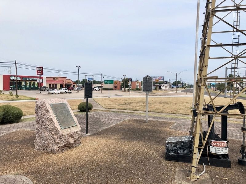
Wide view of markers and oil derrick looking northerly. image. Click for full size.
Photographed By Mark Hilton, August 31, 2019
3. Wide view of markers and oil derrick looking northerly.
 
 
Credits. This page was last revised on September 5, 2019. It was originally submitted on September 5, 2019, by Mark Hilton of Montgomery, Alabama. This page has been viewed 246 times since then and 18 times this year. Photos:   1, 2, 3. submitted on September 5, 2019, by Mark Hilton of Montgomery, Alabama.

Share this page.  
Share on Tumblr
m=138956

CeraNet Cloud Computing sponsors the Historical Marker Database.
This website earns income from purchases you make after using our links to Amazon.com. We appreciate your support.
Paid Advertisement
May. 4, 2024