Millbrook in Dutchess County, New York — The American Northeast (Mid-Atlantic)
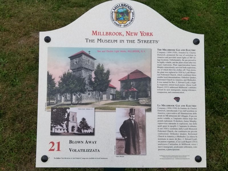
Blown Away / Volatilizzata
Millbrook, New York
— The Museum in the Streets® —
Blown Away
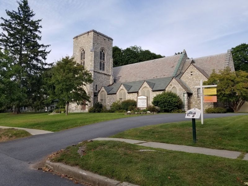
The Millbrook Gas and Electric Company (1894-1920), founded by Charles Dieterich, pioneered the use of acetylene in America and provided street lights at 300 village locations. Unfortunately, the gas proved to be highly volatile, and the plant closed after two major explosions. Plant superintendent James Murphy miraculously survived both explosions, one of which blew his clothes off. Torn down, the plant was replaced in 1926 by Lyall Memorial Federated Church, which combined three smaller local denominations: Orthodox Quaker Reformed Church in America, and Methodist. It was named for Rev. J. Edward Lyall, a highly respected, retired local pastor, whose Lyall Report (1913) addressed Millbrook's attitudes toward its new immigrants, urging tolerance, compassion, and communication.
La Millbrook Gas and Electric Company (1894-1920) fu fondata da Charles Dieterich, introducendo l'uso dell'acetilene in America, e provvedeva all'illuminazione delle strade di 300 abitazioni del villaggio. Il gas era molto volatile, e l'impianto chiuse dopo due grandi esplosioni. Il direttore, James Murphy, sopravvisse entrambe le esplosioni, una delle quali quasi lo spogliò. L'impianto fu abbattuto nel 1926 e sostituito dalla Lyall Memorial Federated Church, che combinava tre piccole confessioni: Orthodox Quaker, Reformed Church in America, e Methodist. La chiesa fu nominata in onore del Rev. J. Edward Lyall, un pastore rispettato, il cui Lyall Report (1913) analizzava l'attitudine di Millbrook verso i nuovi immigranti, predicando tolleranza, compassione, e partecipazione.
Erected 2014 by The Museum in the Streets®. (Marker Number 21.)
Topics and series. This historical marker is listed in these topic lists: Churches & Religion • Industry & Commerce. In addition, it is included in the Quakerism, and the The Museum in the Streets®: Millbrook, New York series lists. A significant historical year for this entry is 1926.
Location. 41° 47.191′ N, 73° 41.425′ W. Marker is in Millbrook, New York, in Dutchess County. Marker is at the intersection of Maple Avenue and Merrit Avenue, on the right when traveling north on Maple Avenue. Touch for map. Marker is in this post office area: Millbrook NY 12545, United States of America. Touch for directions.
Other nearby markers. At least 8 other markers are within walking distance of this marker. Tents and Togas / Tende e Toghe (about 300 feet away, measured in a direct line); Community Band Shell (about 300 feet away); The School That Launched a Village / La Scuola Chester Creò il Villaggio
(about 300 feet away); A Wing and a Prayer / La Chiesa delle Grazie (about 400 feet away); Millbrook Veterans Memorial (about 400 feet away); Athletics and Community / Sport e Comunità (about 500 feet away); A World of Information / Un Mondo di Informazioni (about 600 feet away); To Honor All Those Who Served (about 600 feet away). Touch for a list and map of all markers in Millbrook.
Also see . . .
1. Lyall Memorial Federated Church. (Submitted on September 26, 2019, by Michael Herrick of Southbury, Connecticut.)
2. Village of Milbrook. (Submitted on September 26, 2019, by Michael Herrick of Southbury, Connecticut.)
Credits. This page was last revised on November 30, 2021. It was originally submitted on September 26, 2019, by Michael Herrick of Southbury, Connecticut. This page has been viewed 174 times since then and 18 times this year. Photos: 1, 2. submitted on September 26, 2019, by Michael Herrick of Southbury, Connecticut.

