Near Whitehead in Guysborough County, Nova Scotia — The Atlantic Provinces (North America)
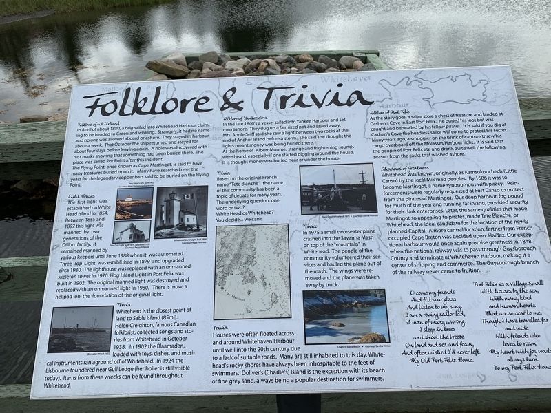
Folklore & Trivia
Folklore of Whitehead
In April of about 1880, a brig sailed into Whitehead Harbour, claiming to be headed to Greenland whaling. Strangely, it had no name, and no one was allowed aboard or ashore. They stayed in harbor about a week. That October the ship returned and stayed for about four days before leaving again. A hole was discovered with rust marks showing that something had been buried there. The place was called Pot Point after this incident.
The Flying Point, once known as Cape Martingot, is said to have many treasures buried upon it. Many have searched over the years for the legendary copper bars said to be buried on the Flying Point.
Light Houses
The first light was established on White Head Island in 1854. Between 1855 and 1897 this light was manned by two generations of the Dillion family. It remained manned by various keepers until June 1988 when it was automated. Three Top Light was established in 1879 and upgraded circa 1930. The lighthouse was replaced with an unmanned skeleton tower in 1970. Hog Island Light in Port Felix was built in 1902. The original manned light was destroyed and replaced with an unmanned light in 1980. There is now a helipad on the foundation of the original light.
Trivia
Whitehead is the closest point of the land to Sable Island (85mi.)
Helen Creighton, famous Canadian folklorist, collected songs and stories from Whitehead in October 1938. In 1902, the Blaamaden, loaded with toys, dishes, and musical instruments ran aground off of Whitehead. In 1924, the Lisbourne foundered near Gull Ledge (her boiler is still visible today). Items from these wrecks can be found throughout Whitehead.
Folklore of Yankee Cove
In the late 1860's a vessel sailed into Yankee Harbour and set men ashore. men ashore. They dug up a fair-sized pot and sailed away. Mrs. Annie Selff said she saw a light between two rocks at the end of Anchor Island before a storm. She said she thought the lights meant money was being buried there.
At the home of Albert Munroe, strange and frightening sounds were heard, especially if one started digging around the house. It is thought money was buried near or under the house.
Trivia
Based on the original French name "Tete Blanche” the name of this community has been a topic of debate for many years. The underlying question: one word or two? White Head or Whitehead? You decide... we can't.
Trivia
In 1975 a small two-seater plane crashed into the Savanna Mash on top of the “mountain” in Whitehead. The people of the community volunteered their services and hauled the plane out of the mash. The wings were removed and the plane was taken away by truck.
Folklore of Port Felix
As the story goes, a sailor stole a chest of treasure and landed at Cashen's Cove in East Port Felix. He buried his loot but was caught and beheaded by his fellow pirates. It is said if you dig at Cashen’s Cove the headless sailor will come to protect his secret. Many years ago, a smuggler on the brink of capture threw his cargo overboard off the Molasses Harbour light. It is said that the people of Port Felix ate and drank quite well the following season from the casks that washed ashore.
Shadows of Greatness
Whitehead was known, originally, as Kamsokoochech (Little Canso) by the local Mik'maq peoples. By 1686 it was to become Martingot, a name synonymous with piracy. Reinforcements were regularly requested at Fort Canso to protect from the pirates of Martingot. Our deep harbour, fog bound for much of the year and running far inland, provided security for their dark enterprises. Later, the same qualities that made Martingot so appealing to pirates, made Tete Blanche, or Whitehead, the ideal candidate for the location of the newly planned Capital. A more central location, farther from French occupied Cape Breton was decided upon: Halifax. Our exceptional harbour would once again promise greatness in 1848 when the national railway was to pass through Guysborough County and terminate at Whitehaven Harbour, making it a center of shipping and commerce. The Guysborough branch of the railway never came to fruition.
Topics. This historical marker is listed in this topic list: Settlements & Settlers. A significant historical month for this entry is June 1988.
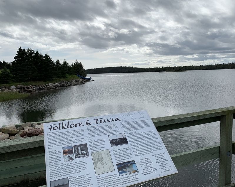
Location. 45° 14.572′ N, 61° 11.486′ W. Marker is near Whitehead, Nova Scotia, in Guysborough County. Marker can be reached from Whitehead Road, on the right when traveling south. Marker is on a little wharf at the western end of the canal. Touch for map. Marker is in this post office area: Whitehead NS B0H 1T0, Canada. Touch for directions.
Other nearby markers. At least 8 other markers are within 8 kilometers of this marker, measured as the crow flies. Port Felix (here, next to this marker); Yankee Cove (about 150 meters away, measured in a direct line); The Canal (about 150 meters away); Whitehead (about 150 meters away); Welcome to Place Savalette (approx. 2.2 kilometers away); Captain Savalette (approx. 2.2 kilometers away); #5 Radar Unit R.C.A.F Station (approx. 7 kilometers away); We Will Remember/Nous Nous Souviendrons (approx. 7 kilometers away). Touch for a list and map of all markers in Whitehead.
Credits. This page was last revised on October 4, 2019. It was originally submitted on September 30, 2019, by Steve Stoessel of Niskayuna, New York. This page has been viewed 200 times since then and 41 times this year. Photos: 1. submitted on September 30, 2019, by Steve Stoessel of Niskayuna, New York. 2, 3. submitted on October 1, 2019, by Steve Stoessel of Niskayuna, New York. • Andrew Ruppenstein was the editor who published this page.


