Mesquite in Clark County, Nevada — The American Mountains (Southwest)
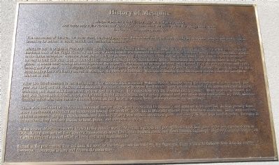
History of Mesquite
The remoteness of the area, the water woes, the scanty provisions, the scorched earth, and undoubtedly the scorpions, badgers and snakes offered incentive for settlers to recoil, rethink, and reestablish elsewhere
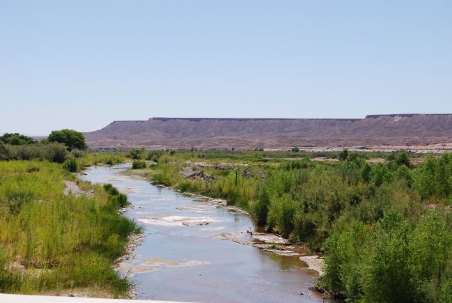
Mesquite had its origins in February 1880, when leaders and selected families of the Church of Jesus Christ of Latter-day Saints gathered on the northeast bank of the Virgin River. At that time William Branch was sustained as bishop, and church members were given specific duties related to the cotton enterprise. Because water was critical, the pioneers dug a seven-and-a-half mile irrigation canal. The settlers enjoyed an ample harvest in their first year. But in June of 1882, a flood wreaked havoc demolishing homes and causing the canal to be breached in fifty-eight places. A month later, Bishop Branch dispatched this report: The brethren are steadily working on the canal, 12 of the men are down with chills leaving but 9 at work … 110 degrees in shade and 140 degrees where the men work and filthy water to drink. Families began to leave. By 1883, when Dudley Leavitt’s family moved to Mesquite, the town was deserted. Widespread damage from subsequent storms forced the Leavitts to relocate as well.
After two failed attempts to settle Mesquite, a few resolute men, including William Abbott, camped along the abandoned irrigation canal. The year was 1894, and the workers, all in their early twenties, labored to repair the damage. Their rations consisted of an occasional crust of bread, molasses, and warm milk from an old red cow tied to a wagon. In a miraculous way the youthful men prevailed. Water once again flowed, the land was fenced and divided, crops were planted, school classes began, and a voting precinct and post office were established. By 1900, nineteen families called Mesquite home—a humble home, as they lived in wagons, tents, adobe structures and under tarps.
Those who continued on in Mesquite harvested meager crops, were resourceful by necessity, and resolved to be cheerful. In their poverty there arose a noticeable attachment and tenderness toward one another. Soon, life in Mesquite offered more than mere existence. There were magical musical moments: singing, choirs, bands, and dancing. Poetry was written, recitations given, and nearly all tried their hand at acting. Reveling in celebrations, they used any excuse to feast, picnic, and compete in sports.
In due course, Mesquite became known to the outside world. Mesquite’s grapes and pomegranates took first place at the San Francisco Fair in 1906. Young men served their country, missionaries went forth, trails became roads, and roads became highways. Highways needed bridges, all of which required a united effort at home and input from outside.
Etched in the past—more than the dam, the road, or the bridge—are the builders, the dreamers, those willing to dedicate their lives for a better tomorrow. Tomorrow is here and dreams do come true.
Erected 2003 by City of Mesquite.
Topics. This historical marker is listed in this topic list: Settlements & Settlers. A significant historical month for this entry is February 1880.
Location. 36° 48.229′ N, 114° 3.994′ W. Marker is in Mesquite, Nevada, in Clark County. Marker is on Mesquite Boulevard, on the right when traveling east. Touch for map. Marker is at or near this postal address: 2 E Mesquite Boulevard, Mesquite NV 89027, United States of America. Touch for directions.
Other nearby markers. At least 5 other markers are within walking distance of this marker. William Elias Abbott (here, next to this marker); Mary Jane Leavitt Abbott (here, next to this marker); Tithing Lot (within shouting distance of this marker); Dairy Barn (about 500 feet away, measured in a direct line); Rock House (about 500 feet away). Touch for a list and map of all markers in Mesquite.
Credits. This page was last revised on May 20, 2020. It was originally submitted on June 28, 2007, by Dawn Bowen of Fredericksburg, Virginia. This page has been viewed 2,129 times since then and 98 times this year. Photos: 1, 2. submitted on June 28, 2007, by Dawn Bowen of Fredericksburg, Virginia. • J. J. Prats was the editor who published this page.

