Scottsville in Albemarle County, Virginia — The American South (Mid-Atlantic)
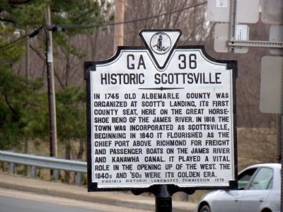
Historic Scottsville
Erected 1976 by Virginia Historic Landmarks Commission. (Marker Number GA-36.)
Topics and series. This historical marker is listed in this topic list: Notable Places. In addition, it is included in the Virginia Department of Historic Resources (DHR) series list. A significant historical year for this entry is 1745.
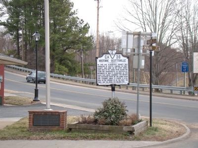
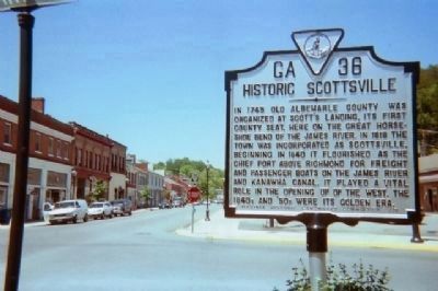
Location. 37° 47.933′ N, 78° 29.683′ W. Marker is in Scottsville, Virginia, in Albemarle County. Marker is at the intersection of Valley Street (Virginia Route 20) and Main Street (Virginia Route 6), on the left on Valley Street. Touch for map. Marker is in this post office area: Scottsville VA 24590, United States of America. Touch for directions.
Other nearby markers. At least 8 other markers are within 4 miles of this marker, measured as the crow flies. Hurricane Camille (about 300 feet away, measured in a direct line); Scottsville (about 400 feet away); Barclay House and Scottsville Museum (about 500 feet away); Scottsville Confederate Cemetery (approx. ¼ mile away); Hatton Ferry (approx. ¾ mile away); a different marker also named Hatton Ferry (approx. 2.9 miles away); a different marker also named Hatton Ferry (approx. 3 miles away); Wilson Cary Nicholas (approx. 3.6 miles away). Touch for a list and map of all markers in Scottsville.
Also see . . . Scottsville Transportation. “When the James River and Kanawha Canal opened in 1840 between Richmond and Lynchburg, the era of river navigation in Scottsville ended. Freight could be shipped on the canal more cheaply than by wagon. And the canal furnished an easy, safe, and unobstructed line of communication from east and west as it remained in operation both during floods and in times of low water. Trade in Scottsville grew, and the town’s population rose to about 1000 in 1841. Although the canal remained in operation until 1881, the poorly-kept roads leading to Scottsville hampered wagon traffic that carried freight for the canal. Trade to Scottsville began to decline in the late 1840s, and by 1850, the population of Scottsville slipped to 666.” (Submitted on April 12, 2009, by J. J. Prats of Powell, Ohio.)
Credits. This page was last revised on February 2, 2023. It was originally submitted on April 12, 2009, by J. J. Prats of Powell, Ohio. This page has been viewed 1,207 times since then and 52 times this year. Photos: 1, 2. submitted on April 12, 2009, by J. J. Prats of Powell, Ohio. 3. submitted on May 22, 2009, by Kevin W. of Stafford, Virginia. 4. submitted on April 12, 2009, by J. J. Prats of Powell, Ohio.


