Lincoln in Middlesex County, Massachusetts — The American Northeast (New England)
Thomas Nelson Jr. House
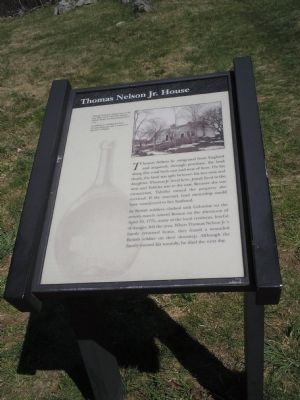
As British soldiers clashed with Colonists on the return march toward Boston on the afternoon of April 19, 1775, many of the local residents, fearful of danger, left the area. When Thomas Nelson Jr.’s family returned home, they found a wounded British soldier on their doorstep. Although the family nursed his wounds, he died the next day.
Erected by Minute Man National Historical Park.
Topics. This historical marker is listed in these topic lists: Notable Buildings • War, US Revolutionary. A significant historical date for this entry is April 19, 1864.
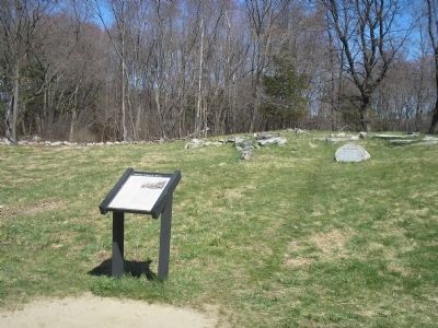
Location. 42° 27.032′ N, 71° 16.317′ W. Marker is in Lincoln, Massachusetts, in Middlesex County. Marker is on Battle Road, on the left when traveling east. Marker is located at the north end of the parking lot of the Minute Man Visitor Center in Minute Man National Historical Park. Touch for map. Marker is in this post office area: Lincoln MA 01773, United States of America. Touch for directions.
Other nearby markers. At least 8 other markers are within walking distance of this marker. Josiah Nelson House (about 300 feet away, measured in a direct line); Minute Man Visitor Center (about 400 feet away); Thorning Boulder (about 700 feet away); April 19, 1775-The Dawn of Revolution (approx. 0.2 miles away); Whittemore House (approx. ¼ mile away); Paul Revere Capture Site (approx. 0.4 miles away); This Bluff (approx. 0.4 miles away); End of Paul Revere’s Midnight Ride (approx. 0.4 miles away). Touch for a list and map of all markers in Lincoln.
More about this marker. The top of the marker features a photograph of the Nelson house. It has a caption of “Thomas Nelson Jr. House, seen in the late 19th century, after the Tabitha Nelson House was moved and joined to it. In addition to working his farm, Thomas Nelson Jr. was a ‘Liscenced Retailor’ of liquor.”
Also see . . .
1. Minute Man National Historical Park. National Park Service website. (Submitted on April 24, 2009, by Bill Coughlin of Woodland Park, New Jersey.)
2. The Battle of Concord. The American Revolutionary War website. (Submitted on May 7, 2009, by Bill Coughlin of Woodland Park, New Jersey.)
Credits. This page was last revised on June 16, 2016. It was originally submitted on April 24, 2009, by Bill Coughlin of Woodland Park, New Jersey. This page has been viewed 1,745 times since then and 43 times this year. Photos: 1, 2, 3. submitted on April 24, 2009, by Bill Coughlin of Woodland Park, New Jersey.


