Harpers Ferry in Jefferson County, West Virginia — The American South (Appalachia)
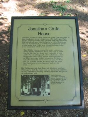
Jonathan Child House
"Last Friday toward evening the water commenced rising rapidly. Before two hours every way of escape was cut off from us. So we were compelled to stay within the crumbling walls which sheltered us from the terrible water which seethed and dashed about us. There were two bridges connecting the Island with the mainland, one wooden one near our house and the railroad bridge. So violent was the water that these were torn to fragments and carried away...."
The Childs survived that flood, but 42 others perished. With reports that the water rose six feet in four minutes the only industrial building standing after the deluge was the cotton/flour mill.
Topics. This historical marker is listed in this topic list: Disasters. A significant historical month for this entry is September 1836.
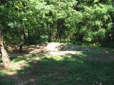
Location. 39° 19.308′ N, 77° 44.169′ W. Marker is in Harpers Ferry, West Virginia, in Jefferson County. Marker can be reached from Shenandoah Street (Business U.S. 340), on the right when traveling east. Located on Virginius Island in Harpers Ferry National Historic Site. Touch for map. Marker is in this post office area: Harpers Ferry WV 25425, United States of America. Touch for directions.
Other nearby markers. At least 8 other markers are within walking distance of this marker. Island Mills (within shouting distance of this marker); Island Access (within shouting distance of this marker); River Wall (about 300 feet away, measured in a direct line); Jefferson Rock (about 400 feet away); a different marker also named Jefferson Rock (about 400 feet away); House Ruins (about 500 feet away); Shenandoah Canal (about 500 feet away); Head Gates and Inner Basin (about 500 feet away). Touch for a list and map of all markers in Harpers Ferry.
More about this marker. In the lower part of the marker is a photo of the house. The Child House survived the 1870 flood, but the Shenandoah River finally toppled it in 1936. That flood also ended human occupation on Virginius Island.
Credits. This page was last revised on June 16, 2016. It was originally submitted on May 14, 2009, by Craig Swain of Leesburg, Virginia. This page has been viewed 1,526 times since then and 21 times this year. Photos: 1, 2. submitted on May 14, 2009, by Craig Swain of Leesburg, Virginia.

