Downtown in Norfolk, Virginia — The American South (Mid-Atlantic)
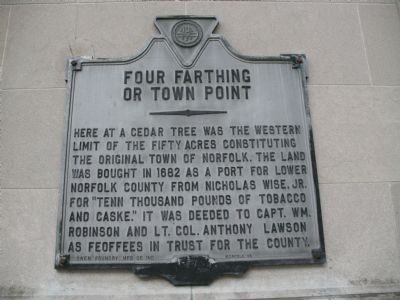
Four Farthing or Town Point
Erected by Norfolk, Virginia. Cast by Owen Foundry Mfg Co Inc.
Topics. This historical marker is listed in this topic list: Settlements & Settlers. A significant historical year for this entry is 1682.
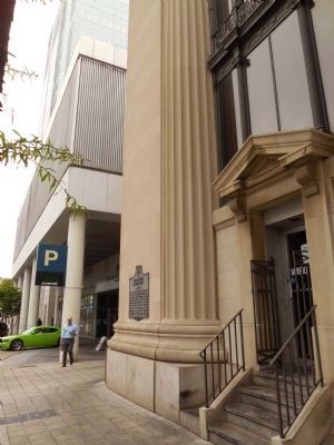
Location. 36° 50.786′ N, 76° 17.564′ W. Marker is in Norfolk, Virginia. It is in Downtown. Marker is at the intersection of West Main Street and Granby Street, on the right when traveling west on West Main Street. This marker is situated on the side of a building. Touch for map. Marker is in this post office area: Norfolk VA 23510, United States of America. Touch for directions.
Other nearby markers. At least 8 other markers are within walking distance of this marker. The Customhouse, 1859 (within shouting distance of this marker); Granby Street (within shouting distance of this marker); Flood Protection for Downtown Norfolk (about 300 feet away, measured in a direct line); Main Street (about 400 feet away); The Cedar (about 400 feet away); Half Moone Fort, 1673 (about 400 feet away); The First Battle of Ironclad Ships, 1862 (about 400 feet away); Norfolk 1682 (about 500 feet away). Touch for a list and map of all markers in Norfolk.
More about this marker. “Feoffees” is an old English law term roughly equivalent to today’s “trustee.” This marker was dropped from Scott Arnold’s 2007 Board of Historic Resources guidebook, most likely because it has no number. It is titled in all previous guides of Virginia historical markers going back to 1932 as “Fort Farthing or Town Point” even though the photograph clearly shows the word “Four” on the marker. Who’s wrong, the marker or the guides? The guides.
Regarding Four Farthing or Town Point. In 1673 Half Moon Fort was built at Four Farthing Point (now Town Point), before the birth of “Norfolk Towne” in 1682.
Additional commentary.
1. Dropped from the Guidebook?
Another explanation for this marker being dropped from the guidebook could be because it may not be a state marker. Though the design is similar, the state seal is not present on this marker. In its place is a seal of the city of Norfolk. (That may also explain why the manufacturers information appears where the year and the name of the state body placing the marker are normally found.)
Editor's Note: While local officials can approve historical markers in any shape, there are several markers in Virginia where they chose to use the standard state template. Another example is one for Hollins College, complete with a marker number (A-79), but approved only at the local level. The guidebook apparently chooses to publish only state approved markers.
— Submitted July 28, 2009, by Kristin Rollins of Portsmouth, Virginia.
Credits. This page was last revised on February 1, 2023. It was originally submitted on November 6, 2007, by Laura Troy of Burke, Virginia. This page has been viewed 1,244 times since then and 36 times this year. Last updated on July 28, 2009. Photos: 1. submitted on November 6, 2007, by Laura Troy of Burke, Virginia. 2, 3. submitted on June 8, 2015, by Marsha A. Matson of Palmetto Bay, Florida. • Kevin W. was the editor who published this page.


