Pennsville in Salem County, New Jersey — The American Northeast (Mid-Atlantic)
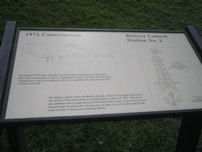
1872 Construction
Battery Control Station No. 2
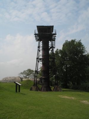
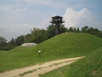
The battery control station for Battery Arnold, a fifty-five foot high steel tower, was built in 1902 and turned over to the artillery on May 27, 1902. This tower was outfitted with a single ten by ten foot observation room. It was used to assist fort personnel in aiming the 12-inch guns. In later years it was also used for the control of the 10-inch guns at Battery Harker.
Erected by State of New Jersey.
Topics. This historical marker is listed in these topic lists: Forts and Castles • Military. A significant historical date for this entry is May 27, 1902.
Location. 39° 36.29′ N, 75° 33.28′ W. Marker is in Pennsville, New Jersey, in Salem County. Marker can be reached from Fort Mott Road, on the right when traveling south. Marker is located on the walking trail in Fort Mott State Park. Touch for map. Marker is in this post office area: Pennsville NJ 08070, United States of America. Touch for directions.
Other nearby markers. At least 8 other markers are within walking distance of this marker. Peace Magazine: 1904 (within shouting distance of this marker); Battery Krayenbuhl’s 5-inch rapid fire guns (within shouting distance of this marker); Ammunition Hoist (within shouting distance of this marker); Battery Krayenbuhl (within shouting distance of this marker); Battery Edwards (about 300 feet away, measured in a direct line); Battery Commander’s Station (about 300 feet away); Switchboard Room / Plotting Room (about 400 feet away); Generator Room (about 400 feet away). Touch for a list and map of all markers in Pennsville.
More about this marker. The top of the marker features a blueprint of the Battery at Finn’s Point. A drawing of Battery Control Station No. 2 appears along the right side of the marker.
Also see . . . Fort Mott State Park. NJ Division of Parks & Forestry website. (Submitted on August 30, 2009, by Bill Coughlin of Woodland Park, New Jersey.)
Credits. This page was last revised on June 16, 2016. It was originally submitted on August 30, 2009, by Bill Coughlin of Woodland Park, New Jersey. This page has been viewed 3,461 times since then and 24 times this year. Photos: 1, 2, 3, 4. submitted on August 30, 2009, by Bill Coughlin of Woodland Park, New Jersey.


