Near Boise in Ada County, Idaho — The American West (Mountains)
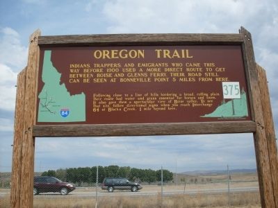
Oregon Trail
Following close to a line of hills bordering a broad, rolling plain, their route had water and grass essential for horses and oxen. It also gave them a spectacular view of Boise valley. To see that site, follow directional signs when you reach Interchange 64 at Black's Creek, 1 mile beyond here.
Erected by Idaho Historical Society. (Marker Number 375.)
Topics and series. This historical marker is listed in this topic list: Settlements & Settlers. In addition, it is included in the Idaho State Historical Society, and the Oregon Trail series lists. A significant historical year for this entry is 1900.
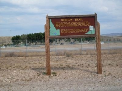
Location. 43° 28.669′ N, 116° 6.44′ W. Marker is near Boise, Idaho, in Ada County. Marker is on Interstate 84, one mile north of Black's Creek Road, on the right when traveling south. Located at a rest area between Boise and Mountain Home. Touch for map. Marker is in this post office area: Boise ID 83716, United States of America. Touch for directions.
Other nearby markers. At least 8 other markers are within 4 miles of this marker, measured as the crow flies. Basque Country (about 600 feet away, measured in a direct line); The Shoshone and Northern Paiute (approx. 3˝ miles away); The Hunt Expedition (approx. 3˝ miles away); The Fur Trade and the Tide of Emigration (approx. 3˝ miles away); Bonneville Point (approx. 3˝ miles away); Captain Bonneville (approx. 3˝ miles away); The Foote Legacy in Idaho (approx. 3.9 miles away); Site 10 ★ Blacks Creek Road Crossing (approx. 4 miles away). Touch for a list and map of all markers in Boise.
Additional keywords. Oregon Trail
Credits. This page was last revised on June 16, 2016. It was originally submitted on September 5, 2009, by Rebecca Maxwell of Boise, Idaho. This page has been viewed 2,454 times since then and 44 times this year. Photos: 1, 2. submitted on September 5, 2009, by Rebecca Maxwell of Boise, Idaho. • Craig Swain was the editor who published this page.

