Near Roscoe in Sullivan County, New York — The American Northeast (Mid-Atlantic)
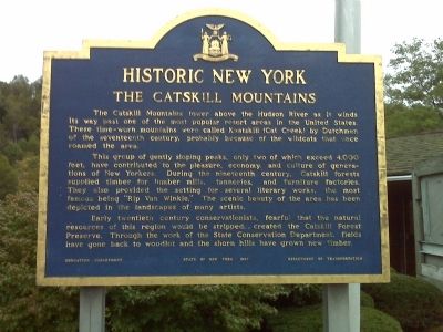
The Catskill Mountains
Historic New York
This group of gently sloping peaks, only two of which exceed 4,000 feet, have contributed to the pleasure, economy, and culture of generations of New Yorkers. During the nineteenth century, Catskill forests supplied timber for lumber mills, tanneries, and furniture factories. They also provided the setting for several literary works, the most famous being Rip Van Winkle. The scenic beauty of the area has been depicted in the landscapes of many artists.
Early twentieth century conservationists, fearful that the natural resources of this region would be stripped, created the Catskill Forest Preserve. Through the work of this State agency, fields have gone back to woodlot and the shorn hills have grown new timber.
Erected 1967 by Education Department, State of NY, Department of Transportation.
Topics and series. This historical marker is listed in these topic lists: Horticulture & Forestry • Natural Resources . In addition, it is included in the Historic New York State series list.
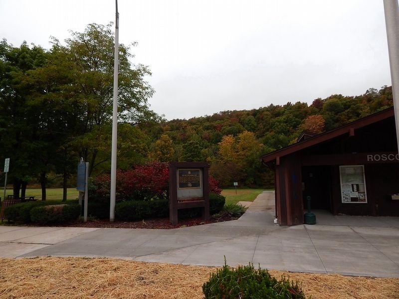
Location. 41° 55.561′ N, 74° 51.853′ W. Marker is near Roscoe, New York, in Sullivan County. Marker is on the Route 17 Quickway at the Roscoe Rest Area,, 2.8 miles east of Exit 94 (Old Route 17), on the right when traveling east. Marker is in front of the comfort station. Touch for map. Marker is in this post office area: Roscoe NY 12776, United States of America. Touch for directions.
Other nearby markers. At least 8 other markers are within 3 miles of this marker, measured as the crow flies. “They Came to the Mountains by Rail” (here, next to this marker); Livingston Manor Covered Bridge (approx. 1.8 miles away); Westfield Flats Cemetery (approx. 2˝ miles away); Presbyterian Church (approx. 2˝ miles away); John R. Mott (approx. 2˝ miles away); Devastating Fire (approx. 2.6 miles away); Risen from the Ashes (approx. 2.6 miles away); Rediscover Sherwood Island (approx. 2.6 miles away). Touch for a list and map of all markers in Roscoe.
More about this marker. In the coming months Route 17 also known as the "Quickway" will be converted to Interstate 86.
Credits. This page was last revised on October 4, 2016. It was originally submitted on September 13, 2009, by Mary Ellen Coghlan of Warwick, New York. This page has been viewed 843 times since then and 15 times this year. Photos: 1. submitted on September 13, 2009, by Mary Ellen Coghlan of Warwick, New York. 2. submitted on October 2, 2016, by Scott J. Payne of Deposit, New York. • Kevin W. was the editor who published this page.

