Marker Logo HMdb.org THE HISTORICAL
MARKER DATABASE
“Bite-Size Bits of Local, National, and Global History”
Summerville in Dorchester County, South Carolina — The American South (South Atlantic)
 

Fort Dorchester


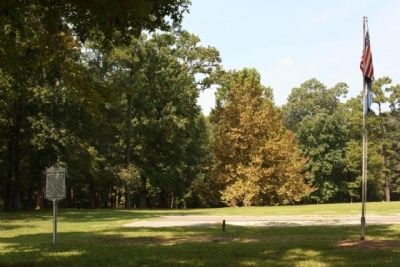
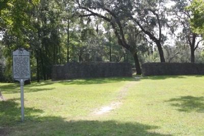
Fort Dorchester Marker image. Click for full size.
Photographed By Mike Stroud, September 13, 2009
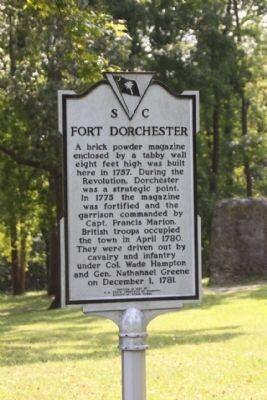
1. Fort Dorchester Marker
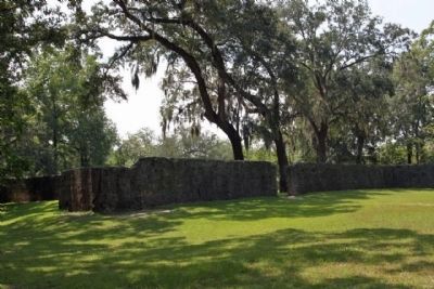
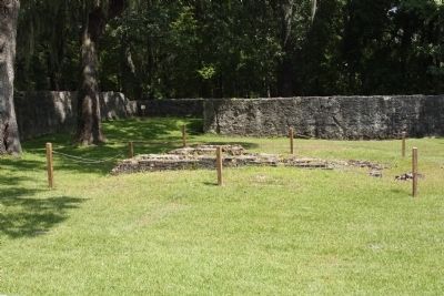
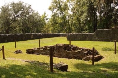
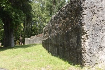
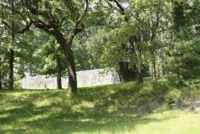
Inscription. A brick powder magazine enclosed by a tabby wall eight feet high was built here in 1757. During the Revolution, Dorchester was a strategic point. In 1775 the magazine was fortified and the garrison commanded by Capt. Francis Marion. British troops occupied the town in April 1780. They were driven out by cavalry and infantry under Col. Wade Hampton and Gen. Nathanael Greene on December 1, 1781.
 
Erected 1963 by S.C. State Commission of Forestry, Division of State Parks. (Marker Number 18-3.)
 
Topics. This historical marker is listed in these topic lists: Forts and CastlesWar, US Revolutionary. A significant historical month for this entry is April 1780.
 
Location. 32° 56.853′ N, 80° 10.206′ W. Marker is in Summerville, South Carolina, in Dorchester County. Marker can be reached from State Park Road. Located in Old Dorchester Historic Site, .6 miles south of Dorchester Road ( State Road 642 ). Touch for map. Marker is in this post office area: Summerville SC 29485, United States of America. Touch for directions.
 
Other nearby markers. At least 8 other markers are within walking distance of this marker. Colonial Dorchester (within shouting distance of this marker); a different marker also named Colonial Dorchester (within shouting distance of this marker); a different marker also named Colonial Dorchester (about 300 feet away, measured in a direct line);
Paid Advertisement
Click on the ad for more information.
Please report objectionable advertising to the Editor.
Click or scan to see
this page online
a different marker also named Colonial Dorchester (about 300 feet away); Linking Places and People (about 300 feet away); Dorchester Free School (about 500 feet away); The Bell Tower of St. George's (about 500 feet away); Parish Church of St. George, Dorchester (about 600 feet away). Touch for a list and map of all markers in Summerville.
 
Regarding Fort Dorchester. The town gradually declined after the Revolution. It was abandoned by 1788. Listed in the National Register December 2, 1969, Site - #69000165 • Historic Significance: Information Potential •
Area of Significance: Religion, Social History, Historic - Non-Aboriginal, Military, Politics/Government, Commerce •
Cultural Affiliation: American Revolution, Early American Village •
Period of Significance: 1650-1699, 1700-1749, 1750-1799 •
Owner: State •
Historic Function: Domestic •
Historic Sub-function: Village Site •
Current Function: Landscape •
Current Sub-function: Park •
 
Fort Dorchester Marker, with "Tabby" Fort ruins image. Click for full size.
Photographed By Mike Stroud, September 13, 2009
2. Fort Dorchester Marker, with "Tabby" Fort ruins
Fort Dorchester Marker, located at the west end of the parking lot image. Click for full size.
Photographed By Mike Stroud, September 13, 2009
3. Fort Dorchester Marker, located at the west end of the parking lot
Fort Dorchester as seen today image. Click for full size.
Photographed By Mike Stroud, September 13, 2009
4. Fort Dorchester as seen today
Fort Dorchester , site of the powder magazine image. Click for full size.
Photographed By Mike Stroud, September 13, 2009
5. Fort Dorchester , site of the powder magazine
Fort Dorchester . one time powder magazine image. Click for full size.
Photographed By Mike Stroud, September 13, 2009
6. Fort Dorchester . one time powder magazine
Fort Dorchester ruins, as seen today image. Click for full size.
Photographed By Mike Stroud, September 13, 2009
7. Fort Dorchester ruins, as seen today
Fort Dorchester, as seen from the road leading from the Ashley River image. Click for full size.
Photographed By Mike Stroud, September 13, 2009
8. Fort Dorchester, as seen from the road leading from the Ashley River
Ft. Dorchester-Archaeological Dig image. Click for full size.
South Carolina Department of Archives and History, circa 1970
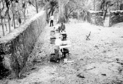
9. Ft. Dorchester-Archaeological Dig
 
 
Credits. This page was last revised on June 16, 2016. It was originally submitted on September 29, 2009, by Mike Stroud of Bluffton, South Carolina. This page has been viewed 1,596 times since then and 58 times this year. Photos:   1, 2, 3, 4, 5, 6, 7, 8, 9. submitted on September 29, 2009, by Mike Stroud of Bluffton, South Carolina. • Craig Swain was the editor who published this page.
Share this page.  
Share on Tumblr
m=22831

CeraNet Cloud Computing sponsors the Historical Marker Database.
This website earns income from purchases you make after using our links to Amazon.com. We appreciate your support.
Paid Advertisement
Apr. 26, 2024