Fayetteville in Fayette County, Georgia — The American South (South Atlantic)
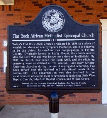
Flat Rock African Methodist Episcopal Church
Inscription.
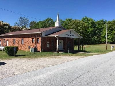
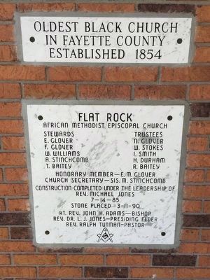
Today’s Flat Rock AME Church originated in 1854 as a place of worship for slaves on nearby Spears Plantation, and it is believed to be the oldest African-American congregation in Fayette County. Originally known as Rocky Mount, the church moved after the Civil War and was known for a time as Scufflefield. By 1898 the church, now called Flat Rock AME, and the adjoining cemetery were established at this location. Like many African-American churches during the era of segregated schooling, Flat Rock served both the spiritual and educational needs of the community. The congregation was also involved in the establishment of several local congregations including Little Vine Baptist Church, Edgefield Baptist Church, and Wilkes Grove.
Erected 2006 by Georgia Historical Society, the Fayette County Historical Society, and the Fayette Heritage Project. (Marker Number 56-4.)
Topics and series. This historical marker is listed in these topic lists: African Americans • Churches & Religion • Education. In addition, it is included in the African Methodist Episcopal (AME) Church, and the Georgia Historical Society series lists. A significant historical year for this entry is 1854.
Location. 33° 26.723′ N, 84° 31.364′ W. Marker is in Fayetteville , Georgia, in Fayette County. Marker is on Old Chapel Lane, 0 miles east of West Lanier Avenue (Georgia Route 54), on the right when traveling east. Touch for map. Marker is at or near this postal address: 148 Old Chapel Lane, Fayetteville GA 30215, United States of America. Touch for directions.
Other nearby markers. At least 8 other markers are within 4 miles of this marker, measured as the crow flies. Skirmish at Shakerag (approx. 2 miles away); Grady L. Huddleston (approx. 3.6 miles away); Fayette County Veterans Memorial (approx. 3.9 miles away); The Holliday-Dorsey-Fife House (approx. 3.9 miles away); Governor Hugh M. Dorsey (approx. 3.9 miles away); Fayette County (approx. 3.9 miles away); In Memory of the Confederate Heroes (approx. 3.9 miles away); a different marker also named Fayette County Veterans Memorial (approx. 3.9 miles away). Touch for a list and map of all markers in Fayetteville.
Credits. This page was last revised on June 16, 2016. It was originally submitted on October 4, 2009, by David Seibert of Sandy Springs, Georgia. This page has been viewed 1,493 times since then and 32 times this year. Photos: 1. submitted on October 4, 2009, by David Seibert of Sandy Springs, Georgia. 2, 3. submitted on April 7, 2016, by J. Makali Bruton of Accra, Ghana. • Kevin W. was the editor who published this page.


