Pineville in Berkeley County, South Carolina — The American South (South Atlantic)
Village of Pineville
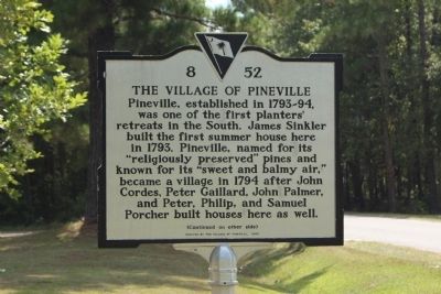
Pineville, established in 1793-94, was one of the first planters' retreats in the South. James Sinkler built the first summer house here in 1793. Pineville, named for its "religiously preserved" pines and known for its "sweet and balmy air," became a village in 1794 after John Cordes, Peter Gaillard, John Palmer and Peter, Philip, and Samuel Porcher built houses here as well.
(Rear text)
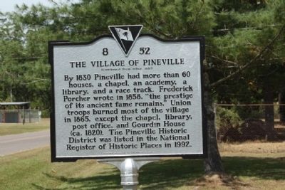
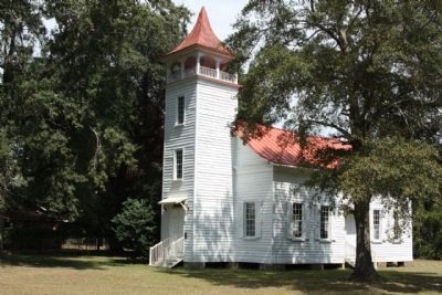
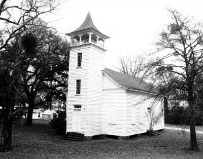
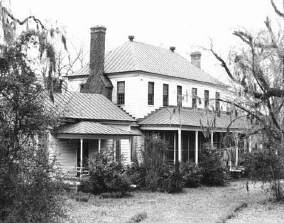
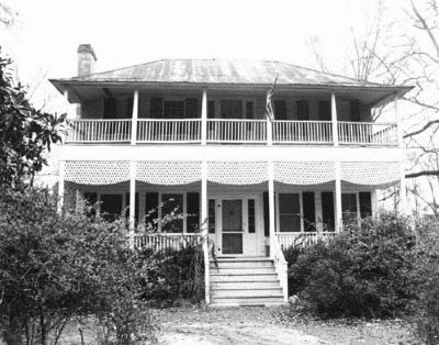
By 1830 Pineville had more than 60 houses, a chapel, an academy, a library, and a race track. Federick Porcher wrote in 1858, "the prestige of its ancient fame remains." Union troops burned most of the village in 1865, except the chapel, library, post office and Gourdin House (ca. 1820). The Pineview Historic District was listed in the National Register of Historic Places in 1992.
Erected 2008 by The Village of Pineville. (Marker Number 8-52.)
Topics. This historical marker is listed in this topic list: Settlements & Settlers. A significant historical year for this entry is 1793.
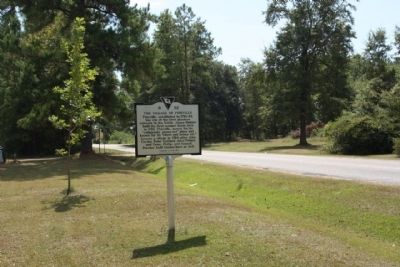
Location. 33° 25.616′ N, 80° 1.744′ W. Marker is in Pineville, South Carolina, in Berkeley County. Marker is at the intersection of Matilda Circle Road (State Highway 8-204) and Walnut Way, on the left when traveling south on Matilda Circle Road. Located approx. 500 feet south of State Road 45. Touch for map. Marker is in this post office area: Pineville SC 29468, United States of America. Touch for directions.
Other nearby markers. At least 8 other markers are within 5 miles of this marker, measured as the crow flies. Maham Plantation (approx. ¾ mile away); Thomas Walter (approx. 2.7 miles away); Francis Marion / Francis Marion's Grave (approx. 3.8 miles away); The Elusive Francis Marion: The Stuff of Legend (approx. 3.8 miles away); The Elusive Francis Marion: Guerrilla Commander (approx. 3.8 miles away); Francis Marion’s Grave (approx. 3.8 miles away); DeWitt Williams Bridge (approx. 4.3 miles away); Village of Eadytown (approx. 4.8 miles away). Touch for a list and map of all markers in Pineville.
Regarding Village of Pineville. The Pineville Historic District illustrates Pineville’s original role as a nineteenth century pineland village as well as its gradual transformation to agricultural land and to a year-round community in the late-nineteenth and early twentieth centuries. Berkeley County’s wealthy planter class, wishing to avoid the fevers associated with their low lying plantations during the summer months, established inland settlements, particularly in areas wooded with pine trees, beginning in the late eighteenth century. The Pineville Historic District is composed of four principal buildings, three residential buildings and one Episcopal church, ranging in date from ca.1810 through 1925. In the mid to late nineteenth century, Pineville was a densely-settled village that included as many as one hundred buildings, including an academy, racetrack, library, churches, and residences. Much of the town was burned by Union troops at the close of the Civil War in April 1865. In the years following the war, much of the land that made up the village was converted for use as farmland. Since that time, Pineville has remained a small community of less than twenty structures surrounded by open farm and hunting lands. Listed in the National Register February 10, 1992.(South Carolina Department of Archives and History)
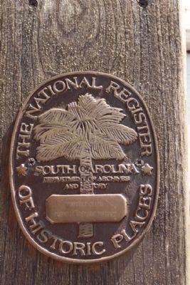
Photographed By Mike Stroud, September 15, 2009
5. "Pineville Chapel and Pineville Historic District National Register of Historic Places"
Pineville Historic District (added 1992 - District - #92000024) •
Rd. S-8-204 S of jct. with SC 45, Pineville •
Historic Significance: Event, Architecture/Engineering •
Architect, builder, or engineer: Unknown •
Architectural Style: Federal, Bungalow/Craftsman, Greek Revival •
Area of Significance: Architecture, Social History •
Period of Significance: 1800-1824, 1825-1849, 1850-1874, 1875-1899, 1900-1924, 1925-1949 •
Owner: Private •
Historic Function: Domestic, Religion •
Historic Sub-function: Religious Structure, Single Dwelling •
Current Function: Domestic, Religion •
Current Sub-function: Religious Structure, Single Dwelling •
Credits. This page was last revised on December 31, 2019. It was originally submitted on October 12, 2009, by Mike Stroud of Bluffton, South Carolina. This page has been viewed 3,160 times since then and 281 times this year. Photos: 1, 2, 3, 4, 5, 6, 7, 8. submitted on October 12, 2009, by Mike Stroud of Bluffton, South Carolina. • Craig Swain was the editor who published this page.
