Marker Logo HMdb.org THE HISTORICAL
MARKER DATABASE
“Bite-Size Bits of Local, National, and Global History”
Townshend in Windham County, Vermont — The American Northeast (New England)
 

Scott Bridge

Longest Wooden Span in Vermont


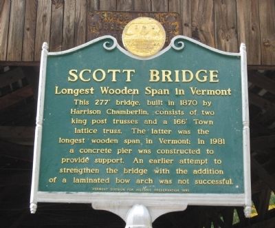
Scott Bridge Marker image. Click for full size.
Photographed By Michael Herrick, October 5, 2009
1. Scott Bridge Marker
Inscription. This 277’ bridge, built in 1870 by Harrison Chamberlain, consists of two king post trusses and a 166’ Town lattice truss. The latter was the longest wooden span in Vermont. In 1981 a concrete pier was constructed to provide support. An earlier attempt to strengthen the bridge with the addition of a laminated bow arch was not successful.

 
Erected 1990 by Vermont Division for Historic Preservation.
 
Topics. This historical marker is listed in this topic list: Bridges & Viaducts. A significant historical year for this entry is 1870.
 
Location. 43° 2.922′ N, 72° 41.768′ W. Marker is in Townshend, Vermont, in Windham County. Marker is on Vermont Route 30, half a mile south of Dam Road, on the right when traveling south. Touch for map. Marker is in this post office area: Townshend VT 05353, United States of America. Touch for directions.
 
Other nearby markers. At least 8 other markers are within 5 miles of this marker, measured as the crow flies. Simpsonville Stone Arch Bridge (approx. 2.6 miles away); Taft Homestead Site (approx. 2.6 miles away); Clarina Howard Nichols (approx. 2.6 miles away); West River Railroad (approx. 4.8 miles away); Newfane Honor Roll (approx. 4.8 miles away); Newfane World War II Monument (approx. 4.8 miles away); Newfane Civil War Monument (approx. 4.8 miles away); In Memory of Jonathan Park (approx. 4.8 miles away).
Paid Advertisement
Click on the ad for more information.
Please report objectionable advertising to the Editor.
Click or scan to see
this page online

 
Regarding Scott Bridge. The bridge carried Back Side Road over the West River, about ½ mile south of Townshend Dam. Only pedestrian traffic is permitted.
 
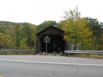
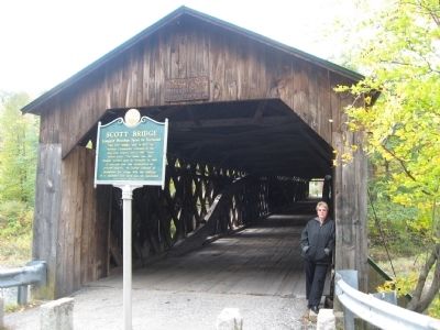
Scott Bridge and Marker image. Click for full size.
Photographed By Michael Herrick, October 5, 2009
2. Scott Bridge and Marker
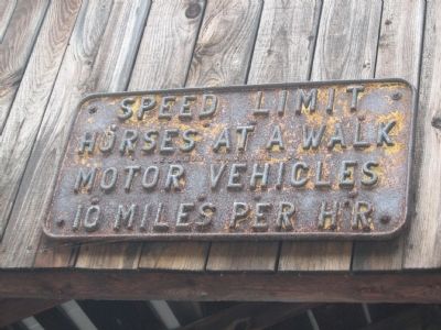
Sign Over the Portal image. Click for full size.
Photographed By Michael Herrick, October 5, 2009
3. Sign Over the Portal
Speed Limit
Horses at a Walk
Motor Vehicles
10 Miles Per Hr
Scott Bridge and Marker image. Click for full size.
Photographed By Michael Herrick, October 5, 2009
4. Scott Bridge and Marker
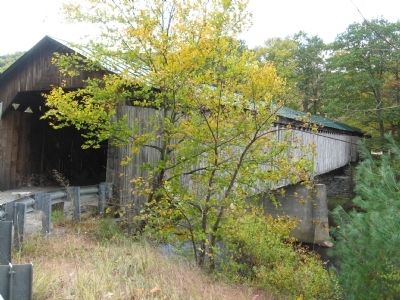
Scott Bridge - north side image. Click for full size.
Photographed By Michael Herrick, October 5, 2009
5. Scott Bridge - north side
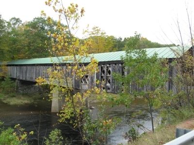
Scott Bridge - south side image. Click for full size.
Photographed By Michael Herrick, October 5, 2009
6. Scott Bridge - south side
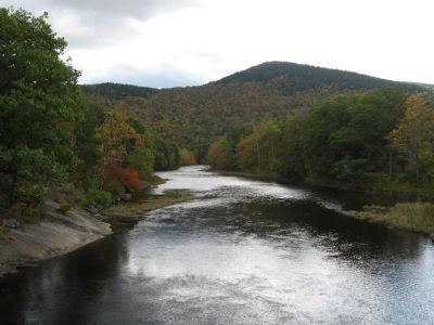
View of the West River to the south from Scott Bridge. image. Click for full size.
Photographed By Michael Herrick, October 5, 2009
7. View of the West River to the south from Scott Bridge.
 
 
Credits. This page was last revised on June 16, 2016. It was originally submitted on October 15, 2009, by Michael Herrick of Southbury, Connecticut. This page has been viewed 1,171 times since then and 22 times this year. Photos:   1, 2, 3, 4, 5, 6, 7. submitted on October 15, 2009, by Michael Herrick of Southbury, Connecticut. • Bill Pfingsten was the editor who published this page.
Share this page.  
Share on Tumblr
m=23330

CeraNet Cloud Computing sponsors the Historical Marker Database.
This website earns income from purchases you make after using our links to Amazon.com. We appreciate your support.
Paid Advertisement
Apr. 26, 2024