Santa Clara in Santa Clara County, California — The American West (Pacific Coastal)
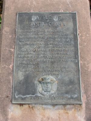
Battle of Santa Clara
Erected 1978 by Mountain Charlie Chapter No. 1850, E Clampus Vitus.
Topics and series. This historical marker is listed in this topic list: War, Mexican-American. In addition, it is included in the E Clampus Vitus series list. A significant historical month for this entry is January 1832.
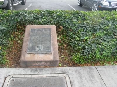
Location. 37° 21.136′ N, 121° 58.428′ W. Marker is in Santa Clara, California, in Santa Clara County. Marker is on El Camino Real (State Highway 82) near Bowe Avenue, on the right when traveling south. Marker is located at the sidewalk in front of the Moonlight Shopping Center. Touch for map. Marker is at or near this postal address: 2734 El Camino Real, Santa Clara CA 95051, United States of America. Touch for directions.
Other nearby markers. At least 8 other markers are within one mile of this marker, measured as the crow flies. John Fatjo House (approx. one mile away); Austen D. Warburton (approx. one mile away); Headen-Inman House (approx. one mile away); Saint Clare (approx. 1.1 miles away); Armistice Oak Tree Site (approx. 1.1 miles away); a different marker also named The Battle of Santa Clara (approx. 1.1 miles away); Jamison-Brown House (approx. 1.1 miles away); Santa Clara Campaign Treaty Site (approx. 1.1 miles away). Touch for a list and map of all markers in Santa Clara.
Regarding Battle of Santa Clara. See "Nearby Marker" Battle of Santa Clara for additional information.
Credits. This page was last revised on June 16, 2016. It was originally submitted on November 10, 2009, by Syd Whittle of Mesa, Arizona. This page has been viewed 1,409 times since then and 22 times this year. Photos: 1, 2. submitted on November 10, 2009, by Syd Whittle of Mesa, Arizona.

