Over-The-Rhine in Cincinnati in Hamilton County, Ohio — The American Midwest (Great Lakes)
Cincinnati Breweries / Remaining Brewery Structures
Side A: Cincinnati Breweries
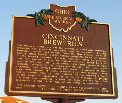
The Brewery District contains the majority of Cincinnati's remaining breweries and associated structures such as icehouses, bottling buildings, offices, and stables. With the first brewery north of Liberty Street founded in 1829, German immigrants fueled the growth of the brewing industry; by 1891, Cincinnati breweries produced over four barrels of beer per resident annually, almost twice as much as any other city in the nation. The brick breweries were typically designed in the Romanesque Revival style, and larger complexes often covered multiple city blocks. To produce the lager style beer common by 1860, typically very deep basements were dug or tunnels were cut into hillsides for the lagering process. At the height of production, 18 of the 36 breweries in greater Cincinnati were operating in Over-the-Rhine and the West End. Prohibition in 1919 closed most of the breweries permanently.
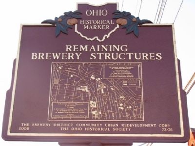
Side B: Remaining Brewery Structures
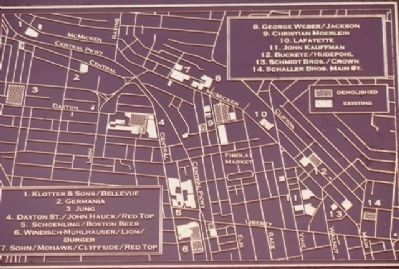
[A map shows locations for:]
1. Klotter & Sons/Bellevue
2. Germania
3. Jung
4. Dayton St./John Hauck/Red Top
5. Schoenling/Boston Beer
6. Windisch-Muhlhausen/Lion/Burger
7. Sohn/Mohawk/Clyffside/Red Top
8. George Weber/Jackson
9. Christian Moerlein
10. Lafayette
11. John Kauffman
12. Buckeye/Hudepohl
13. Schmidt Bros./Crown
13. Schaller Bros. Main St.
Erected 2008 by The Brewery District Community Urban Redevelopment Corp and The Ohio Historical Society. (Marker Number 72-31.)
Topics and series. This historical marker is listed in these topic lists: Industry & Commerce • Notable Buildings. In addition, it is included in the Ohio Historical Society / The Ohio History Connection series list. A significant historical year for this entry is 1829.
Location. 39° 7.167′ N, 84° 31.341′ W. Marker is in Cincinnati, Ohio, in Hamilton County. It is in Over-The-Rhine. Marker is on McMicken Avenue, 0 miles west of Dunlap Street, on the left when traveling west. Marker is on the north side of Hanna Playground. Touch for map. Marker is at or near this postal address: 244 W McMicken Avenue, Cincinnati OH 45214, United States of America. Touch for directions.
Other nearby markers. At least 8 other markers are within walking distance of this marker. Mohawk Honor Roll (approx. ¼ mile away); Cincinnati Public Markets / The Northern Liberties (approx. 0.3 miles away); Anti-German Hysteria (approx. 0.3 miles away); Findlay Market Opening Day Parade (approx. 0.3 miles away); Camp Joy (approx. 0.4 miles away); Hudepohl Brewing Co. (approx. 0.4 miles away); Keeping Beer Flowing into Glasses and Growlers
(approx. half a mile away); The Kroger Co. / Over-The-Rhine (approx. 0.7 miles away). Touch for a list and map of all markers in Cincinnati.
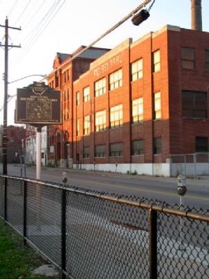
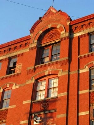
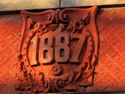
Regarding Cincinnati Breweries / Remaining Brewery Structures. The Clyffside Lofts are being developed at 244 W. McMicken Avenue, in the building that formerly housed, beginning in 1887, the William S. Sohn Brewing Company, the Mohawk Brewing Company, the Clyffside Brewing Company and the Red Top Brewing Company.
Also see . . . Cincinnati’s Historic Breweries. The Gnarly Gnome website entry (Submitted on November 24, 2022, by Larry Gertner of New York, New York.)
Credits. This page was last revised on February 4, 2023. It was originally submitted on November 26, 2009, by William Fischer, Jr. of Scranton, Pennsylvania. This page has been viewed 3,372 times since then and 109 times this year. Photos: 1, 2, 3, 4, 5, 6, 7, 8, 9. submitted on November 26, 2009, by William Fischer, Jr. of Scranton, Pennsylvania.
