Amherst Junction in Portage County, Wisconsin — The American Midwest (Great Lakes)
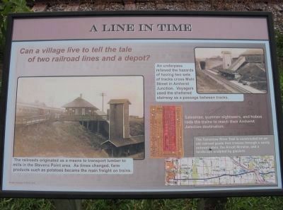
A Line in Time
The railroads originated as a means to transport lumber to mills in the Stevens Point area. As times changed, farm products such as potatoes became the main freight on trains.
An underpass relieved the hazards of having two sets of tracks cross Main Street in Amherst Junction. Voyagers used the sheltered stairway as a passage between tracks.
Salesmen, summer sightseers, and hobos rode the trains to reach their Amherst Junction destination.
The Tomorrow River Trail is constructed on an old railroad grade that crosses through a sandy outwash plain, the Arnott Moraine, and a landscape sculpted by glaciers.
Photos courtesy of Scott Janz.
Topics. This historical marker is listed in this topic list: Railroads & Streetcars.
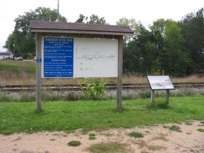
Location. 44° 28.173′ N, 89° 18.776′ W. Marker is in Amherst Junction, Wisconsin, in Portage County. Marker is at the intersection of 2nd Street and West Street, on the left when traveling north on 2nd Street. The marker is along the Tomorrow River (bike/horseback riding) Trail. Touch for map. Marker is in this post office area: Amherst Junction WI 54407, United States of America. Touch for directions.
Other nearby markers. At least 8 other markers are within 10 miles of this marker, measured as the crow flies. Amherst Fire District (approx. 2 miles away); South New Hope Lutheran Church (approx. 3.9 miles away); Iola Winter Sports Club (approx. 7 miles away); Norwegian Evangelical Lutheran Church of Our Redeemer (approx. 7.8 miles away); Jorgens Park Preserve / A Tribute (approx. 8.7 miles away); Riverside Cemetery (approx. 8.8 miles away); School House Ski Hill (approx. 9.1 miles away); Helvetia Town Hall (approx. 9.2 miles away).
Regarding A Line in Time. The marker states that the railroad tracks cross Main Street, but they actually cross 2nd Street.
Credits. This page was last revised on March 9, 2022. It was originally submitted on January 2, 2010, by Keith L of Wisconsin Rapids, Wisconsin. This page has been viewed 762 times since then and 25 times this year. Photos: 1, 2. submitted on January 2, 2010, by Keith L of Wisconsin Rapids, Wisconsin. • Craig Swain was the editor who published this page.

