Cameron in Calhoun County, South Carolina — The American South (South Atlantic)
Shady Grove Church
Inscription.
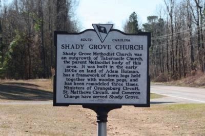
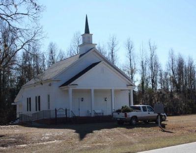
Shady Grove Methodist Church was an outgrowth of Tabernacle Church, the parent Methodist body of this area. It was built in the early 1800s on land of Adam Holman, has a framework of hewn logs held together with wooden pegs, and has been remodeled three times. Ministers of Orangeburg Circuit, St. Matthews Circuit, and Cameron Charge have served Shady Grove.
Erected 1970 by Calhoun County Historical Commission. (Marker Number 9-6.)
Topics and series. This historical marker is listed in this topic list: Churches & Religion. In addition, it is included in the South Carolina, Calhoun County Historical Commission/Society series list.
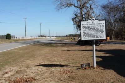
Location. 33° 35.361′ N, 80° 40.582′ W. Marker is in Cameron, South Carolina, in Calhoun County. Marker is on Cameron Road (State Highway 33) near Nate's Store Road (State Highway 9-27), on the right when traveling east. Touch for map. Marker is in this post office area: Cameron SC 29030, United States of America. Touch for directions.
Other nearby markers. At least 10 other markers are within 6 miles of this marker, measured as the crow flies. St. Matthew's Lutheran Church (approx. 2 miles away); Honoring a Pioneer Woman (approx. 3.7 miles away); First Land Granted in Calhoun County Area (approx. 3.7 miles away); Mt. Lebanon Cemetery (approx. 3.9 miles away); John Adam Treutlen (approx. 4 miles away); Jericho Methodist Church (approx. 4.1 miles away); Santee~Cemetery (approx. 4.9 miles away); Pine Grove Evangelical Lutheran Church (approx. 5.4 miles away); Tabernacle Cemetery (approx. 5˝ miles away); Good Hope Picnic (approx. 5.7 miles away). Touch for a list and map of all markers in Cameron.
Credits. This page was last revised on June 16, 2016. It was originally submitted on January 4, 2010, by Mike Stroud of Bluffton, South Carolina. This page has been viewed 1,282 times since then and 57 times this year. Photos: 1, 2, 3. submitted on January 4, 2010, by Mike Stroud of Bluffton, South Carolina. • Craig Swain was the editor who published this page.


