Downtown West in Minneapolis in Hennepin County, Minnesota — The American Midwest (Upper Plains)
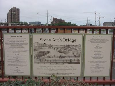
Stone Arch Bridge
Inscription.
—Daily Minnesota Tribune, November 23, 1883
St. Anthony Falls Historic District, National Historic Register of Historic Places, 1971 National Historic Civil Engineering Landmark, 1975
Construction 1882-1883
The Stone Arch Bridge was constructed as a railroad bridge by
James J. Hill and the Minneapolis Union Railway Company.
Designed by Colonel Charles C. Smith, the bridge cut diagonally
across the Mississippi River with a 6° curve at the west end.
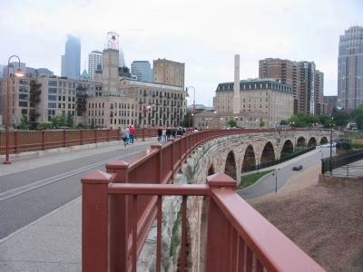
It was 2,100 feet long, 76 feet high, with 23 arches.
The bridge was built of 100,000 tons of stone, granite from Sauk Rapids,
Minnesota, and limestone quarried from nearby Mississippi River bluffs and
from Mankate, Minnesota; Stone City, Iowa; and Bridgeport, Wisconsin.
Construction took twenty-two months,
from January 16, 1882 to November 22, 1883.
600 men worked day and night, winter and summer.
Heavy labor was provided by men and by horses harnessed to windlasses.
Steam-powered pumps removed water during construction of pier foundations.
Trains provided the means to haul the stone from distant quarries.
Three men lost their lives.
1907-1910
Arches were reinforced, crown to crown, to carry heavier loads.
1925
Tracks were widened and parapet walls cut back to accommodate the increased size of trains.
1948
82 passenger trains crossed daily in the heyday of the bridge.
1961-1963
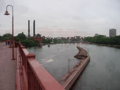
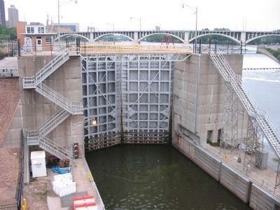
St. Anthony Falls Upper Lock, constructed by the U. S. Army Corps
of Engineers, required removal of arches 13 and 14 and Pier 14
and installation of a 200-foot Warren truss.
1965
Record-breaking spring floods caused major damage to pier 7
and arches 6 and 7. Repairs were made by the owner of the owner of the bridge,
the Great Northern Railway Company.
1978
The last passenger train crossed the bridge.
1989
Hennepin County Regional Railroad Authority
purchased the bridge.
1992
Ownership was transferred to the Minnesota
Department of Transportation.
Renovation 1993-1994
The Stone Arch Bridge was rehabilitated
to become a pedestrian and bicycle trail, a key link in the
St. Anthony Falls Heritage Trail and other riverfront trail systems.
Project of the St. Anthony Falls Heritage Board and
the Minnesota Department of Transportation.
Owner:
Minnesota Department of Transportation
Contractor:
Johnson Bros. Corporation
Litchfield, Minnesota
Partners:
Conceived, designed, and implemented by
partners in cooperation:
St. Anthony Falls Heritage Board:
State of Minnesota
Minnesota Historical Society
Mayor, City of Minneapolis
Minneapolis City Council
Minneapolis Park and Recreation Board
Minneapolis Heritage Preservation Commission
Hennepin County Board of Commissioners
Hennepin History Meusem
State Historic Preservation Office
Minnesota Department of Transportation
A. G. Lichtenstein & Associates, Inc, Fair Lawn, New Jersey
Johnson Bros. Corporation, Litchfield, Minnesota
Operation:
Minneapolis Parks & Recreation Board
Funding:
Federal: Transporation Enhancement Program,
Intermodal Surface Transportation Efficiency
Act of 1901, (ISTEA)
Local: St. Anthony Falls Heritage Board,
combining funds of the State of Minnesota,
the City of Minneapolis, and the
Minneapolis Parks & Recreation Board.
Topics and series. This historical marker is listed in this topic list: Bridges & Viaducts. In addition, it is included in the ASCE Civil Engineering Landmarks, and the Minnesota Historical Society series lists. A significant historical month for this entry is January 1839.
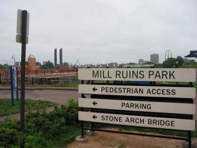
Location. 44° 58.852′ N, 93° 15.524′ W. Marker is in Minneapolis, Minnesota, in Hennepin County. It is in Downtown West. Marker can be reached from West River Parkway west of Portland Avenue South. Marker is at the west end of the Stone Arch Bridge. Touch for map. Marker is at or near this postal address: 1 Portland Avenue South, Minneapolis MN 55401, United States of America. Touch for directions.
Other nearby markers. At least 8 other markers are within walking distance of this marker. Giants in the Land: The Power of Minneapolis Mills and Millers (within shouting distance of this marker); Historic Milling District (within shouting distance of this marker); Mills and Millraces (within shouting distance of this marker); New Uses for Old Mills (within shouting distance of this marker); The Falls of St. Anthony (about 300 feet away, measured in a direct line); Water: The waterpower harnessed from St. Anthony Falls gave life to the milling industry (about 300 feet away); Bricks and Mortar
(about 300 feet away); A Changing Landscape (about 400 feet away). Touch for a list and map of all markers in Minneapolis.
Also see . . .
1. Stone Arch Bridge (Minneapolis). Wikipedia entry. (Submitted on January 31, 2010.)
2. I-35W Mississippi River Bridge. Wikipedia entry about the bridge that collapsed in 2007. (Submitted on January 31, 2010.)
Additional keywords. St. Paul, Minneapolis, and Manitoba Railway bridge
Credits. This page was last revised on April 24, 2024. It was originally submitted on January 31, 2010, by Keith L of Wisconsin Rapids, Wisconsin. This page has been viewed 1,946 times since then and 39 times this year. Photos: 1, 2, 3, 4, 5, 6. submitted on January 31, 2010, by Keith L of Wisconsin Rapids, Wisconsin. • Bill Pfingsten was the editor who published this page.
