Near Douglas in Cochise County, Arizona — The American Mountains (Southwest)
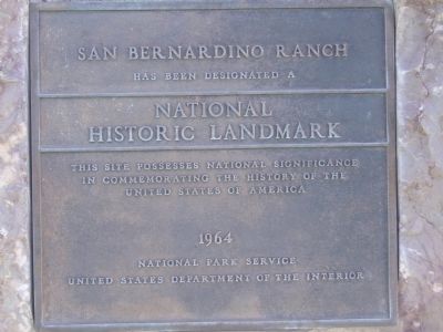
San Bernardino Ranch
National
Historic Landmark
This site possesses National significance
in commemorating the history of the
United States of America
1964
Erected 1964.
Topics and series. This historical marker is listed in this topic list: Notable Places. In addition, it is included in the National Historic Landmarks series list. A significant historical year for this entry is 1964.
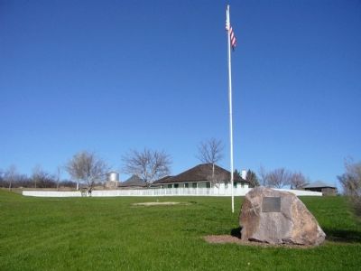
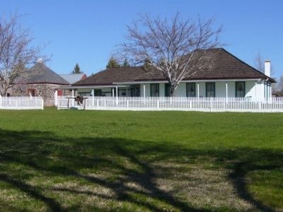
Location. 31° 20.169′ N, 109° 16.752′ W. Marker is near Douglas, Arizona, in Cochise County. Marker can be reached from the intersection of East San Bernardino Road and Slaughter Ranch Road, on the right. Marker is located in front of the ranch house. Travel east on 15th Street from Douglas. At Airport Road the road changes names to Geronimo Trail. The marker is 16 miles east at the San Bernardino Ranch. Touch for map. Marker is at or near this postal address: 6153 Geronimo Trail, Douglas AZ 85607, United States of America. Touch for directions.
Other nearby markers. At least 2 other markers are within 2 miles of this marker, measured as the crow flies. Mormon Battalion (approx. 0.6 miles away); a different marker also named Mormon Battalion (approx. 1.9 miles away).
Regarding San Bernardino Ranch. This site was designated as a National Historic Landmark on July 19, 1964:
Statement of Significance:
The center of a cattle ranching empire that straddled the U.S.-Mexico border, this ranch illustrates the continuity of Spanish and American cattle ranching in the Southwest. Until late in the 19th century, the San Bernardino Valley, a well-watered area occupying southern Arizona and northern Mexico, was not successfull occupied by Europeans due to the threat of Apache attack; in 1884, however, John H. Slaughter, a Texas cattle rancher, leased a portion of the Mexican land grant and began the development of a ranch that would span up to 100,000 acres, supplying beef, fruits, and vegetables to the surrounding settlements and military posts.
Credits. This page was last revised on June 14, 2020. It was originally submitted on March 7, 2010, by Bill Kirchner of Tucson, Arizona. This page has been viewed 1,334 times since then and 21 times this year. Photos: 1, 2, 3. submitted on March 7, 2010, by Bill Kirchner of Tucson, Arizona. • Syd Whittle was the editor who published this page.


