Central Berkeley in Alameda County, California — The American West (Pacific Coastal)
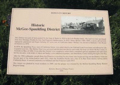
Historic McGee-Spaulding District
Berkeley History

Photographed By Andrew Ruppenstein, March 7, 2010
1. Historic McGee-Spaulding District Marker
{In the upper right hand of the marker is a photo of a locomotive and building, with the caption "A steam locomotive laying track in 1911 at this site next to the site of the electric lineman's headquarters."}
In 1876, the Spaulding Tract, west of California Street, was subdivided by the Oakland Land Association and offered for sale in quarter-acre lots. The McGee Tract was surveyed and divided into blocks and roads; The map was filed with the County of Alameda in May 1886. Even after the District was completely subdivided it remained sparsely populated and semi-rural for two decades, with fields of wheat and barley, cows tethered at pasture, and Strawberry Creek running through to the Bay.
After the 1906 Earthquake, people from San Francisco searching for new home sites began moving into the District. It did not become part of the urban pattern until 1912, when the Southern Pacific ran a line of its Red Train electric railway down California Street. It served commuters to Oakland and San Francisco until 1933.
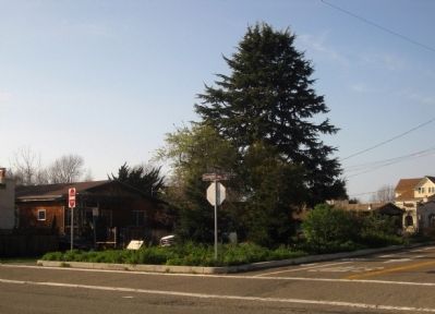
This island was planted by local residents in 2005, and the plaque was donated by the McGee-Spaulding-Hardy Historic Interest Group.
2008
Erected 2008 by Berkeley Historical Plaque Project.
Topics. This historical marker is listed in this topic list: Settlements & Settlers. A significant historical month for this entry is May 1886.
Location. 37° 51.756′ N, 122° 16.732′ W. Marker is in Berkeley, California, in Alameda County. It is in Central Berkeley. Marker is at the intersection of Dwight Way and California Street on Dwight Way. Touch for map. Marker is in this post office area: Berkeley CA 94703, United States of America. Touch for directions.
Other nearby markers. At least 8 other markers are within walking distance of this marker. Becky Temko Tot Park (approx. 0.2 miles away); Longfellow School (approx. ¼ mile away); Garden History (approx. 0.4 miles away); Site of Presentation High School and Convent (approx. half a mile away); City Hall Annex (approx. half a mile away); Berkeley High School Industrial Arts and Science (G and H Buildings) (approx. half a mile away); Berkeley High School Alumni: Bobby Seale, Jean Yonemura Wing, Billy Martin (approx. half a mile away); Berkeley Veterans Memorial Grove (approx. half a mile away). Touch for a list and map of all markers in Berkeley.
More about this marker. The marker is located in a landscaped traffic island at the intersection of the 1600 block of Dwight Way and the 2500
block of California Street.
Also see . . . Historic McGee-Spaulding District. Historic Information regarding the District with added vintage photos. (Submitted on July 3, 2011, by Patricia Edwards of Berkeley, California.)
Credits. This page was last revised on February 7, 2023. It was originally submitted on March 24, 2010, by Andrew Ruppenstein of Lamorinda, California. This page has been viewed 1,698 times since then and 18 times this year. Photos: 1, 2. submitted on March 24, 2010, by Andrew Ruppenstein of Lamorinda, California. • Syd Whittle was the editor who published this page.
